
Tropical Storm “Franklin” about to hit Yucatan peninsula, Mexico
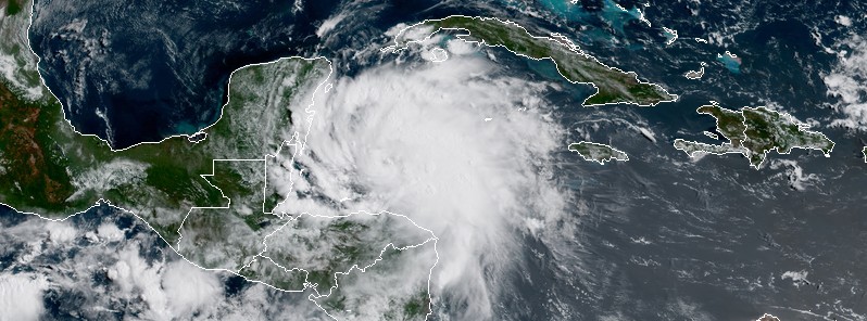
Featured image: Tropical Storm "Franklin" at 15:00 UTC on August 7, 2017. Credit: NOAA/GOES-16 (preliminary and non-operational)
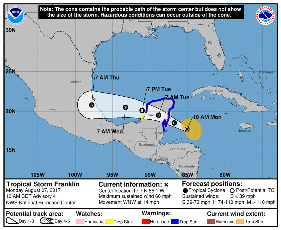
Tropical Storm "Franklin" formed 03:00 UTC on August 7, 2017 over the northwestern Caribbean as the sixth named storm of the 2017 Atlantic hurricane season. Franklin is strengthening and moving toward the Yucatan peninsula where it is expected to make landfall later today, move over it and make a second landfall over the Mexican state of Veracruz on Tuesday, August 8. Heavy rain brought by this cyclone could produce life-threatening flash floods. A dangerous storm surge will raise water levels by as much as 60 to 120 cm (2 to 4 feet) above normal tide levels.
At 15:00 UTC on August 7, Franklin's center was located 330 km (205 miles) E of Belize City, Belize and about 350 km (215 miles) ESE of Chetumal, Mexico. Its maximum sustained winds are 95 km/h (60 mph). The system is moving WNW at 22 km/h (14 mph) with the minimum estimated central pressure of 999 hPa.
A Hurricane Watch is in effect for the coast of Mexico from Chetumal to Punta Allen. A Tropical Storm Warning is in effect for Belize City northward to the border of Mexico and the coast of Mexico from Chetumal to Campeche. A Tropical Storm Watch is in effect for the coast of Mexico from Campeche to Sabancuy.
On the current forecast track, the center of Franklin will be near the east coast of Yucatan peninsula by this evening (CDT). The system is expected to move across the peninsula tonight and on Tuesday.
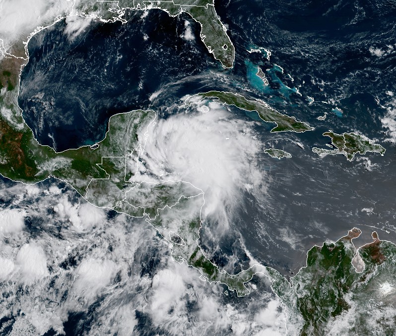
Tropical Storm "Franklin" at 15:00 UTC on August 7, 2017. Credit: NOAA/GOES-16 (preliminary and non-operational)
Strengthening is forecast until the center reaches the east coast of the Yucatan peninsula, and Franklin could be near hurricane strength by the time it makes landfall, somewhere near El Placer. Some weakening is likely while the system moves across the peninsula on Tuesday and exits somewhere near Campeche.
Rainfall amounts of 76 to 152 mm (3 to 6 inches), with isolated amounts of around 304 mm (12 inches), are possible across the Yucatan Peninsula of Mexico and Belize through Wednesday, with the highest amounts over the Mexican state of Quintana Roo. These rains could produce life-threatening flash floods.
A dangerous storm surge will raise water levels by as much as 60 to 120 cm (2 to 4 feet) above normal tide levels along the immediate coast near and to the north of where the center makes landfall. Near the coast, the surge will be accompanied by large and destructive waves.
I'm a dedicated researcher, journalist, and editor at The Watchers. With over 20 years of experience in the media industry, I specialize in hard science news, focusing on extreme weather, seismic and volcanic activity, space weather, and astronomy, including near-Earth objects and planetary defense strategies. You can reach me at teo /at/ watchers.news.
Commenting rules and guidelines
We value the thoughts and opinions of our readers and welcome healthy discussions on our website. In order to maintain a respectful and positive community, we ask that all commenters follow these rules.