
Major storm approaching Southern California
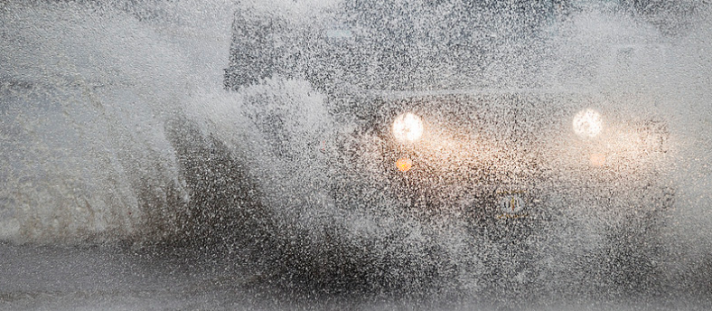
Featured image: A driver plows through a flooded street in Los Angeles during the second day of consecutive winter storms, January 6, 2016. Credit: Scot L (CC - Flickr)
Meteorologists are warning Southern California is about to get hit with what could be the biggest rainmaker in six years. Urban flooding, mudslides, strong winds and heavy snowfall are expected as two successive storms hit the region Thursday and Friday, February 17, 2017. On Friday, there could be rainfall rates of 25.4 mm (1 inch) per hour. Another storm will approach the West Coast for early next week, followed by another trough possibly for midweek next week, NWS warned. Stay away from canyons, burn areas, streams, washes, rivers, and dry river beds.
The first storm should reach Los Angeles after 18:00 local time Thursday, followed Friday morning with a 'very dynamic storm,' said National Weather Service meteorologist Curt Kaplan.
The storms, accompanied by some disturbances, originated in the Gulf of Alaska and have been sucking up volumes of warm moisture from a so-call atmospheric river, said Kaplan, adding that Friday’s storm will be the biggest so far of the season.
Early estimates are that the region will receive 50.8 to 101.6 mm (2 – 4 inches) of rain in coastal and valley areas but between 101.6 and 203.2 mm (4 and 8 inches) in the mountains and foothills.
Latest rainfall estimate graphic for powerful winter storm to affect SW Calif. Fri-early Sat. #CAflood #CAstorm #LArain pic.twitter.com/kYkMZbfhTK
— NWS Los Angeles (@NWSLosAngeles) February 16, 2017
Heavy rain expected along the west coast into the weekend pic.twitter.com/ANizdf8KBZ
— NWS WPC (@NWSWPC) February 16, 2017
Another big storm is headed our way. Concerned about flooding? @LAFD has sandbags & sand at local stations! #LArain https://t.co/0J5voeNllZ pic.twitter.com/VGsF6cjyz9
— LA EMD (@ReadyLA) February 15, 2017
"Possible impacts due to potentially widespread heavy rain include flooding for urban areas and small streams, flash flooding with mud and debris flows, especially near and below recent burn areas, and rockslides along canyon walls," NWS warned in a statement.
Travel delays are also likely due to reduced visibility and slick roads with water ponding on some roadways. Winter driving conditions are possible down to 1 830 m (6 000 feet) late Friday into Saturday. Additionally, strong and potentially damaging southerly winds with this storm system may lead to downed trees and power lines.
Kaplan said there could be rainfall rates of 25.4 mm (1 inch) an hour on Friday. "Stay away from canyons, burn areas, streams, washes, rivers, and dry river beds,” he warned.
But all this drenching is also having a salutary impact, putting a dent in the drought and doing so in dramatic fashion.
Normally, downtown L.A. would have received 227.6 mm (8.96 inches) of rain by this time of the year in the season that runs from October to April, but it already has had 412.7 mm (16.25 inches), Kaplan said, "and there’s a whole lot more coming."
If forecast hold, some daily rain records will likely be set Friday, NWS Los Angeles said.
Read more: Massive storm slams California, breaks records (Friday, February 17, 2017)
After a brief respite late Sunday, February 19, another storm system will approach the West Coast for early next week, followed by another trough possibly for midweek next week, NWS warned.
The Watchers team and our contributors bring the latest on extreme weather, earthquakes, volcanic eruptions, space weather, and all things science. We're all about making sense of the natural world and keeping you informed on what’s happening. Got a tip or a question? Hit us up using the form at newstips!
Awesome Noah
I still taking reservations for my ark.