
Tropical Cyclone “Dineo” about to hit Mozambique
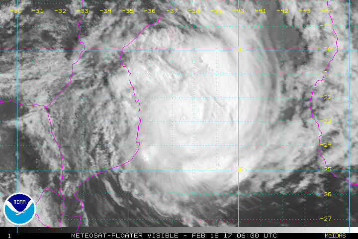
Featured image: Tropical Cyclone "Dineo" at 06:00 UTC on February 15, 2017. Credit: METEOSAT, NOAA
Tropical Cyclone "Dineo" is still intensifying and is forecast to make landfall over the coast of southern Mozambique just after UTC midnight on February 16, 2017. Dineo is the fifth tropical cyclone of the 2016/17 Southern hemisphere tropical cyclone season.
At 03:00 UTC on February 15, Tropical Cyclone "Dineo" was located approximately 251 km (156 miles) WSW of Europa Island, and has tracked WSW at 11 km/h (6.9 mph). Animated enhanced infrared satellite imagery showed a compact system with deep convective banding wrapping tighter into and obscuring the low level circulation.
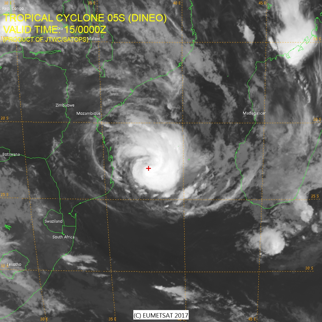
Tropical Cyclone "Dineo" on February 15, 2017. Credit: EUMETSAT, JTWC/SATOPS
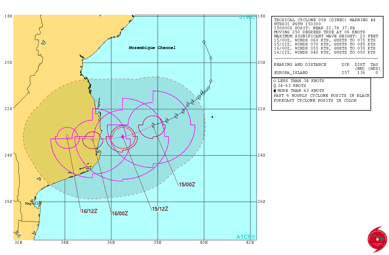
Tropical Cyclone "Dineo" forecast track by JTWC on February 15, 2017
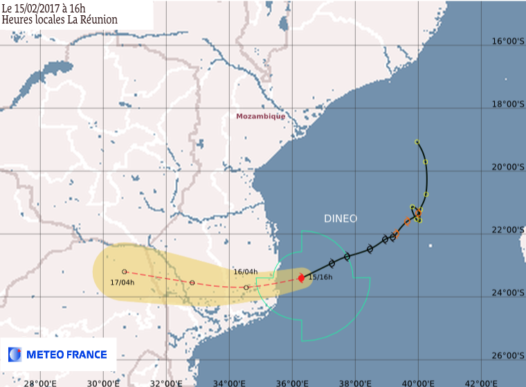
Tropical Cyclone "Dineo" forecast track by RSMC La Reunion on February 15, 2017
At the time, Dineo's maximum sustained winds were reaching 111 km/h (69 mph) and the system was still intensifying, expected to reach 129 km/h (80 mph) before landfall. By early UTC afternoon, Dineo developed an eye.
Cyclone #Dineo strengthens & develops an eye just prior to making landfall later today near & north of Inhambane, #Mozambique. pic.twitter.com/U2vd8B4VQN
— UW-Madison CIMSS (@UWCIMSS) February 15, 2017
Landfall is expected over the coast of Inhambane, southern Mozambique just after midnight UTC on February 16. It is possible Dineo's center will pass right over the city of Massinga. After that, the system will rapidly weaken and dissipate.
Update:
Dineo hits Mozambique, leaves a trail of destruction and 4 dead
The Watchers team and our contributors bring the latest on extreme weather, earthquakes, volcanic eruptions, space weather, and all things science. We're all about making sense of the natural world and keeping you informed on what’s happening. Got a tip or a question? Hit us up using the form at newstips!
Is this storm strong enough to ruin all Limpopo n mpumalanga province ?will it kill people? This is bad really bad guys