
Haima (Lawin) reached super typhoon status, near Philippines
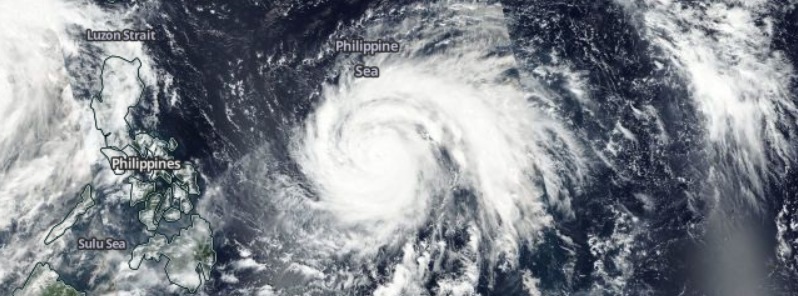
Featured image: Typhoon "Haima" approaching the Philippines, October 17, 2016. Image credit: NASA/Suomi NPP/VIIRS
Typhoon "Haima" is expected to become a powerful Category 5 hurricane over the next two days and reach the Philippines by the mid-week. Residents should prepare for violent typhoon conditions and closely follow further development. Floods from storm surges are expected in the low-lying regions, and intense winds will be a major challenge fro the infrastructure already affected by the previous storm.
Haima, known in the Philippines as Lawin, developed as a tropical storm on October 15, 2016, along Typhoon "Sarika", as the second tropical system in the northwestern Pacific and rapidly intensified into a major Category 4 system, only a few days later.
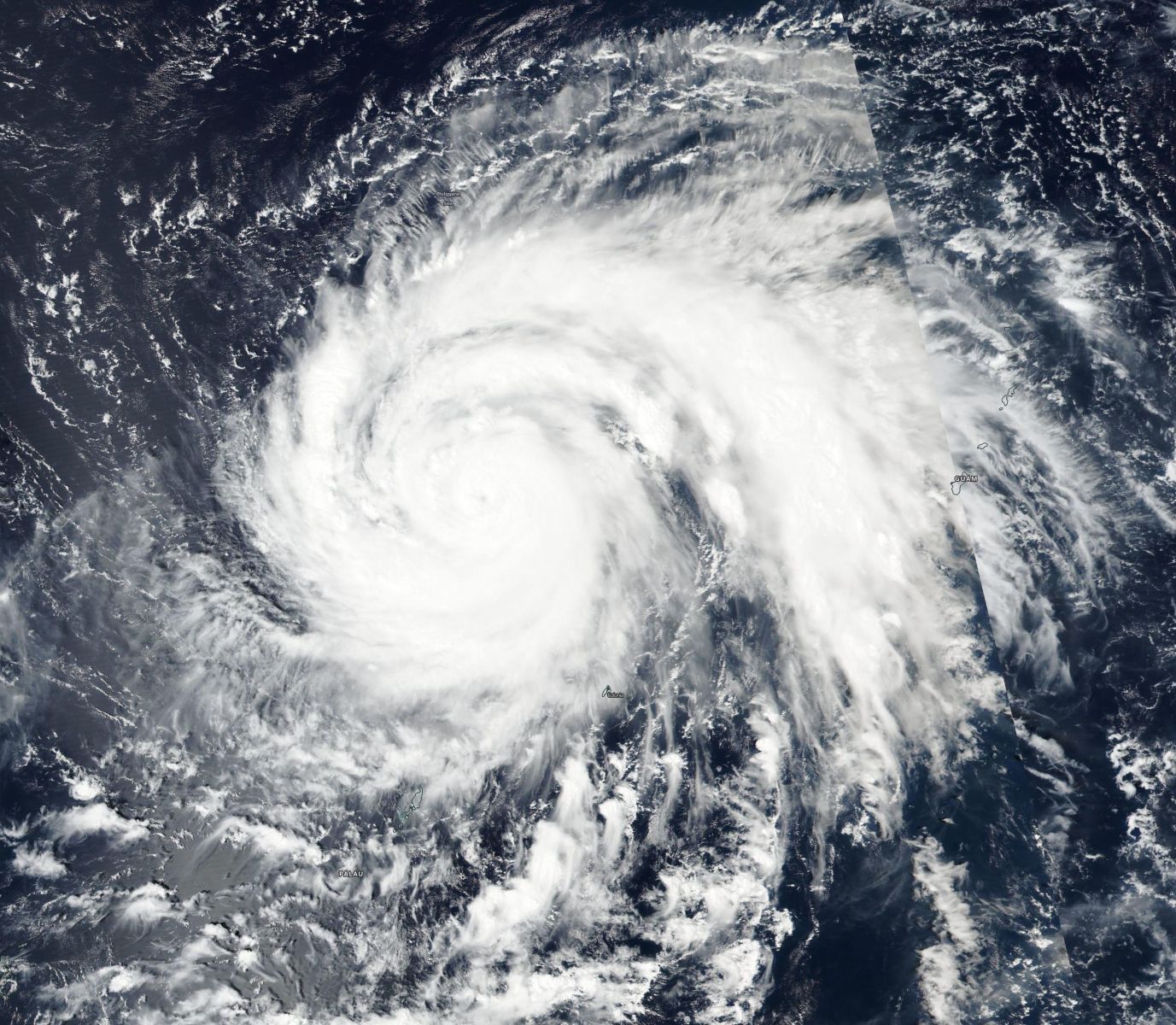
Typhoon "Haima", October 17, 2016. Image credit: NOAA/NASA/DoD Suomi NPP/VIIRS
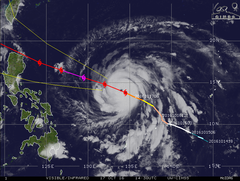
Typhoon "Haima" approaching the Philippines, October 17, 2016, 14:30 UTC. Image credit: UW-CIMSS
Typhoon "Haima" was located approximately 1 457.5 km (905.6 miles) east of Manila, the Philippines, and tracking west-northwestward at 20.4 km/h (12.7 mph), on October 17, at 15:00 UTC, according to the Joint Typhoon Center (JTWC). The system was packing maximum sustained winds of 212.9 km/h (132.3 mph) with gusts up to 259.3 km/h (161.1 mph).
Haima is expected to strengthen further over the next 48 hours and become a super typhoon. Its maximum sustained winds are expected to climb to 259.3 km/h (161.1 mph) with gusts reaching 314.8 km/h (195.6 mph), making it a dangerous Category 5 system.
Haima is expected to reach the Philippines over the next three days, and some weakening will likely occur beforehand.
Video credit: Westpacwx
According to Robert Speta, a meteorologist from Westpacwx, Haima will likely take a "Megi 2010" like track into northeastern Luzon. The typhoon already brought winds of tropical storm intensity to the Yap island, southwest of Guam, where high wind warnings have been put in effect on the morning of October 17 (local time).
Over the next two days, the conditions over Luzon will worsen. Residents are urged to prepare for violent typhoon conditions by the morning of October 19 (local time), and coastal evacuations should take place at the north side of the system's center line.
Typhoon "Haima" – 5-day forecast track. Image credit: JTWC
The region from Cagayan south into Isabela is very familiar with dealing with typhoons. However, a second one in a time span less than one week may put a lot of stress on the already affected infrastructure.
Storm surge is expected to flood low-lying areas ahead of the typhoon, and strong winds will represent a major issue, as the buildings and infrastructure have likely already sustained damage from the previous storm. Caution and close monitoring are advised.
Update – Haima becomes a super typhoon
09:20 UTC, October 18, 2016
Haima (Lawin) has reached super typhoon status with maximum sustained winds over 240 km/h (150 mph).
At 09:00 UTC, it was located approximately 1 033 km (642 miles) E of Manila, Philippines, and has tracked WNW at 27.8 km/h (17.2 mph) over the past six hours. Haima now has tight spiral banding wrapping into a well-defined 24 km (15 miles) diameter eye.
The system is expected to further intensify over the next 12 hours and peak near 250 km/h (155 mph) over the next 24 hours.
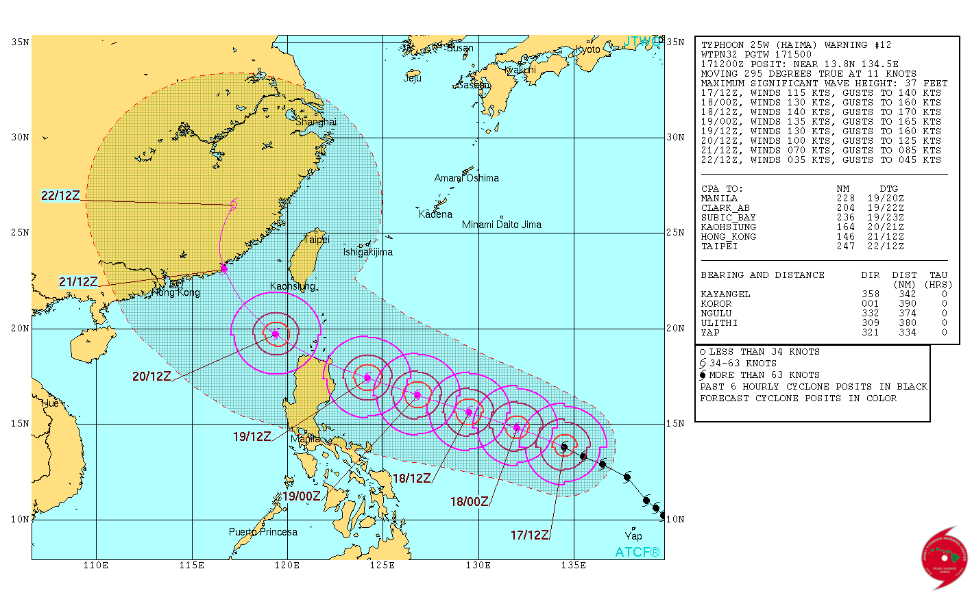
Haima is expected to cross over the northern tip of Luzon, with land interaction leading to additional weakening before emerging into the South China Sea.
Continued weakening is expected as the system travels through the South China Sea.
After 48 hours, Haima is expected to take a more northerly direction before making landfall east of Hong Kong.
Dissipation is expected on October 23, near Shanghai.
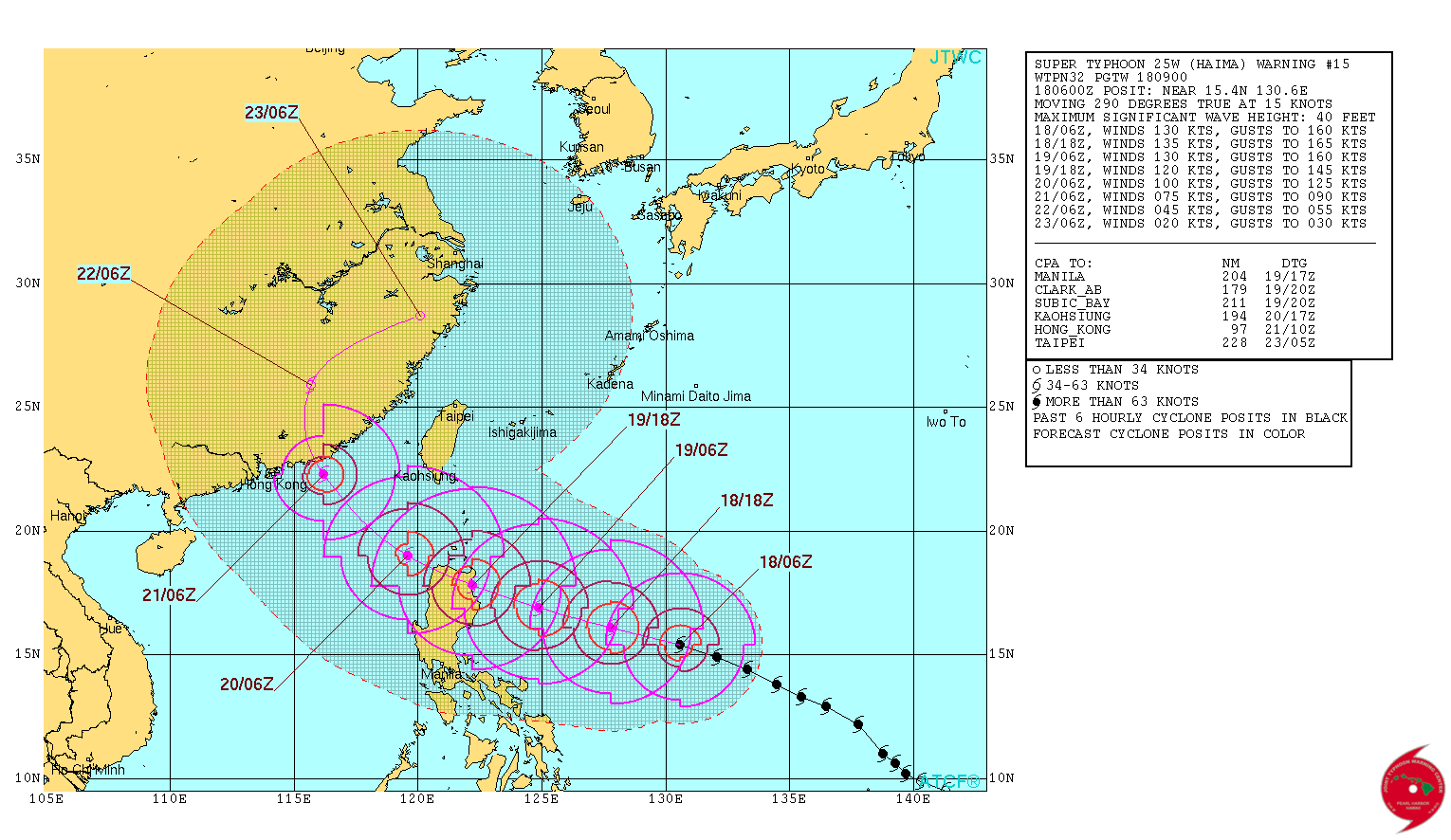
Typhoon "Haima" forecast track by JTWC at 09:00 UTC on October 18, 2016
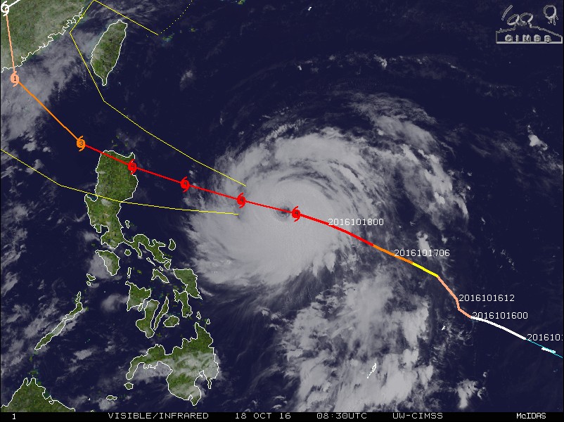
Typhoon "Haima" at 08:30 UTC on October 18, 2016
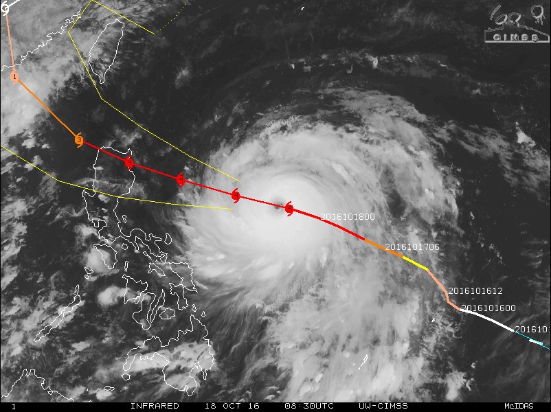
Typhoon "Haima" at 08:30 UTC on October 18, 2016
Commenting rules and guidelines
We value the thoughts and opinions of our readers and welcome healthy discussions on our website. In order to maintain a respectful and positive community, we ask that all commenters follow these rules.