
Winter returns to New Zealand, arctic blast to reach the country Wednesday
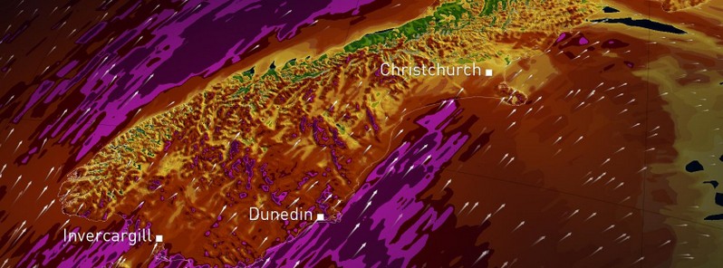
Image credit: NIWA
Starting Wednesday, September 7, 2016, winter is set to return to New Zealand. Despite it being spring according to the calendar, one more big winter push is on the way late this week, bringing everything from cold temperatures and gusty winds to even low elevation snow, NIWA forecasters warned.
As a pattern shift brings potent cold air out of the Southern Ocean and into New Zealand for the second half of the week, the effects will first be felt in the South Island on Wednesday as winds quickly shift to the south and cold air pours in. Rain will move up the West Coast during the day, while the island’s ski fields will get a nice late-season infusion of fresh powder.
However, in cities such as Dunedin and Christchurch the temperature may actually begin to fall on September 6. Strong and possibly damaging southerly gusts exceeding 100 km/h (62.1 mph) at the coasts will make it feel downright bitter.
In the North Island, showers and gusty winds will begin to arrive on Wednesday afternoon, making it an unpleasant commute in spots between Wellington and Hamilton.
September's big freeze: A July-like chill on track to return to NZ from Wednesday–> winds blow from Southern Ocean. pic.twitter.com/r8ltVUqNvX
— Niwa Weather (@NiwaWeather) September 4, 2016
"A major theme associated with this cold outbreak is the threat for near sea-level snowfall for several locations around New Zealand," NIWA said. With temperatures plummeting on Wednesday evening in the South Island, light accumulations will be possible by Thursday morning in the hills around Dunedin, with even the possibility of minor accumulation in the city itself. This could cause travel issues on Thursday morning.
Farther north, a Thursday morning dusting will be possible in Christchurch and its northern suburbs. However, the snow may not be confined to the South Island on Thursday, as the Wellington area could see light accumulations also. Here, the best chance for snow will be in the morning in the higher elevation suburbs such as Brooklyn, Karori, and Johnsonville. It’s possible the city center will see snowflakes flying as well, but accumulation is not expected at sea level in Wellington.
An area of high seas, with wave height possibly over 6 m (19.7 feet), is forecast to affect the Cook Strait by Thursday afternoon. Crashing waves and winds along the east and south of both Islands could cause damage.
Overall, Thursday will feature miserable weather for most of the country. In addition to the snow threat, temperatures will be bitter, with main centers such as Dunedin, Christchurch, Wellington, and Auckland seeing some of their coldest September maximum temperatures on record.
Furthermore, potent southerly wind gusts will batter the eastern South Island and most of the North Island, causing the wind chill to drop below zero in places. Temperatures will be more like mid-July than September across the whole of New Zealand, with 6 to 12 °C (10.8 to 21.6 °F) below average on Thursday and Friday.
A gradual improvement is expected starting Friday, September 9 as the storm begins to move away. However, cold rain showers will continue to pelt the North Island, with gusty winds again making it feel like the middle of winter. Conditions will be much-improved in the South Island, where sunshine could be plentiful for the West Coast and areas south of Christchurch.
"Temperatures will truly begin to rebound this weekend as high pressure arrives over the country. Any remaining showers will taper off in the North Island on Saturday with dry conditions expected for Sunday. Meanwhile, very pleasant weather will be on the cards in the South Island on Saturday. By Sunday afternoon showers will return to Fiordland, but dry weather will persist elsewhere," NIWA said.
The Watchers team and our contributors bring the latest on extreme weather, earthquakes, volcanic eruptions, space weather, and all things science. We're all about making sense of the natural world and keeping you informed on what’s happening. Got a tip or a question? Hit us up using the form at newstips!
Commenting rules and guidelines
We value the thoughts and opinions of our readers and welcome healthy discussions on our website. In order to maintain a respectful and positive community, we ask that all commenters follow these rules.