
Tropical Storm “Chanthu” approaching Japan with heavy rain and strong winds
Featured image: Tropical Storm "Chanthu" on August 15, 2016. Credit: UW-CIMSS
Tropical Depression 09W formed on August 13 in the northwest Pacific Ocean and strengthened into a tropical storm named Chanthu by the end of the UTC day. Chanthu is now approaching Japan with heavy rain and strong winds and is expected to skirt the northeastern coast of the big island, then make landfall on August 17 in south-central Hokkaido, Japan's northernmost island.
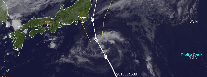
At 21:00 UTC on August 15, the center of Tropical Storm "Chanthu" was located approximately 635 km (394 miles) south-southeast of Yokosuka, Japan, according to the JTWC. The system is moving to the north-northwest at 24 km/h (15 mph), with maximum sustained winds of 65 km/h (40 mph) and gusts to 83 km/h (52 mph).
Credit: UW-CIMSS
Satellite imagery depicts a broad circulation nearly completely devoid of deep convection. Only a small area of flaring convection persists near the low-level circulation center. Although sea surface temperatures are warm and vertical wind shear remains low, restricted outflow and dry air entrainment to the west and south is suppressing the maintenance of deep convection.
The strongest thunderstorms on August 15 appeared in a band north and northwest of the center of circulation. Fragmented bands of thunderstorms were wrapped into the low-level center from the south and east.
Chanthu is expected to continue on its north-northwest track but future intensification is no longer likely. After 21:00 UTC on August 16, vertical wind shear is forecast to increase while the system merges with a mid-latitude trough and subsequently completes extratropical transition.
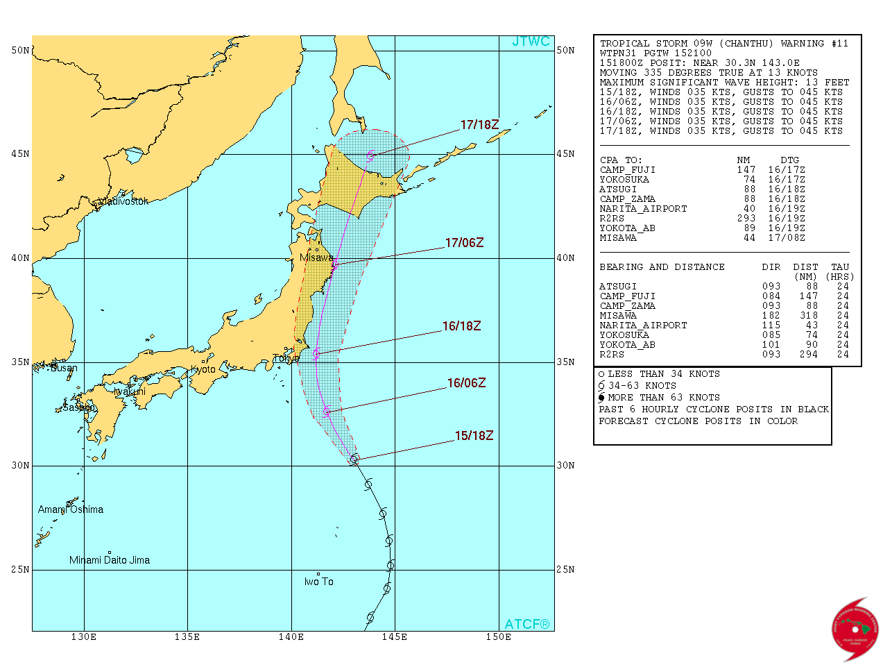
Tropical Storm "Chanthu" forecast track by JTWC on August 15, 2016
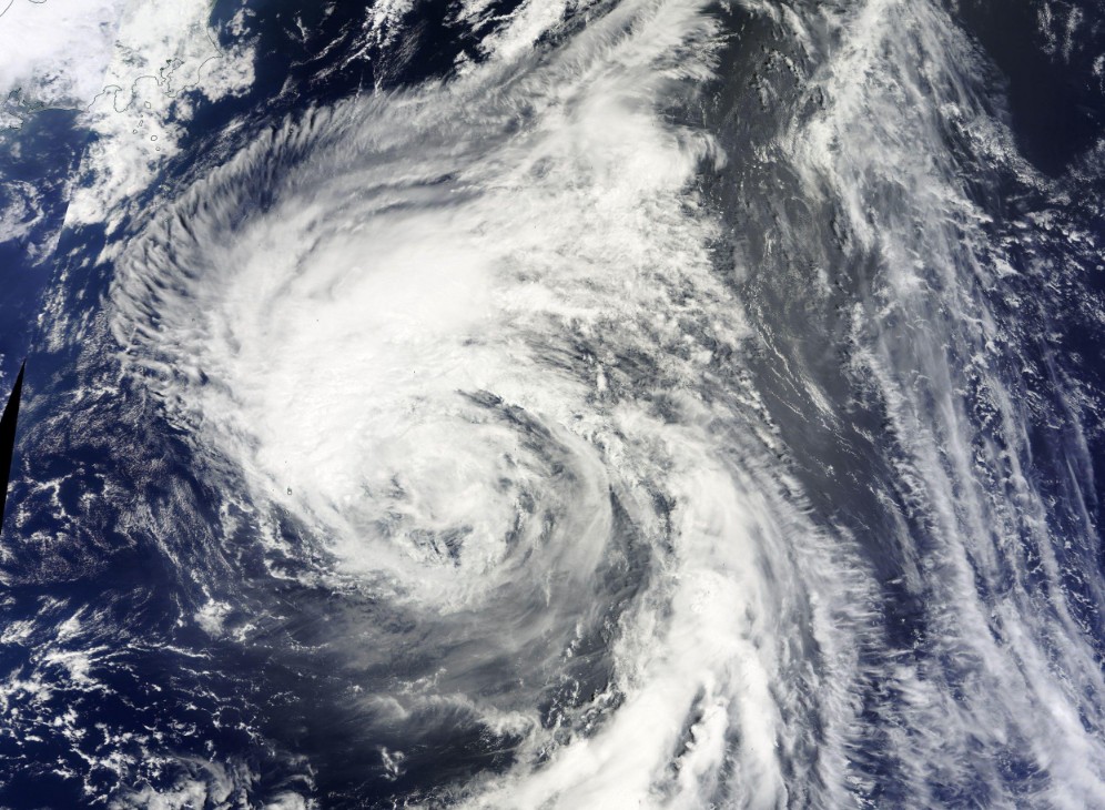
Tropical Storm "Chanthu" on August 15, 2016. Credit: NASA Terra/MODIS
Chanthu is expected to skirt the northeastern coast of the big island, then make landfall on August 17 south-central Hokkaido, Japan's northernmost island.
The Watchers team and our contributors bring the latest on extreme weather, earthquakes, volcanic eruptions, space weather, and all things science. We're all about making sense of the natural world and keeping you informed on what’s happening. Got a tip or a question? Hit us up using the form at newstips!
Commenting rules and guidelines
We value the thoughts and opinions of our readers and welcome healthy discussions on our website. In order to maintain a respectful and positive community, we ask that all commenters follow these rules.