
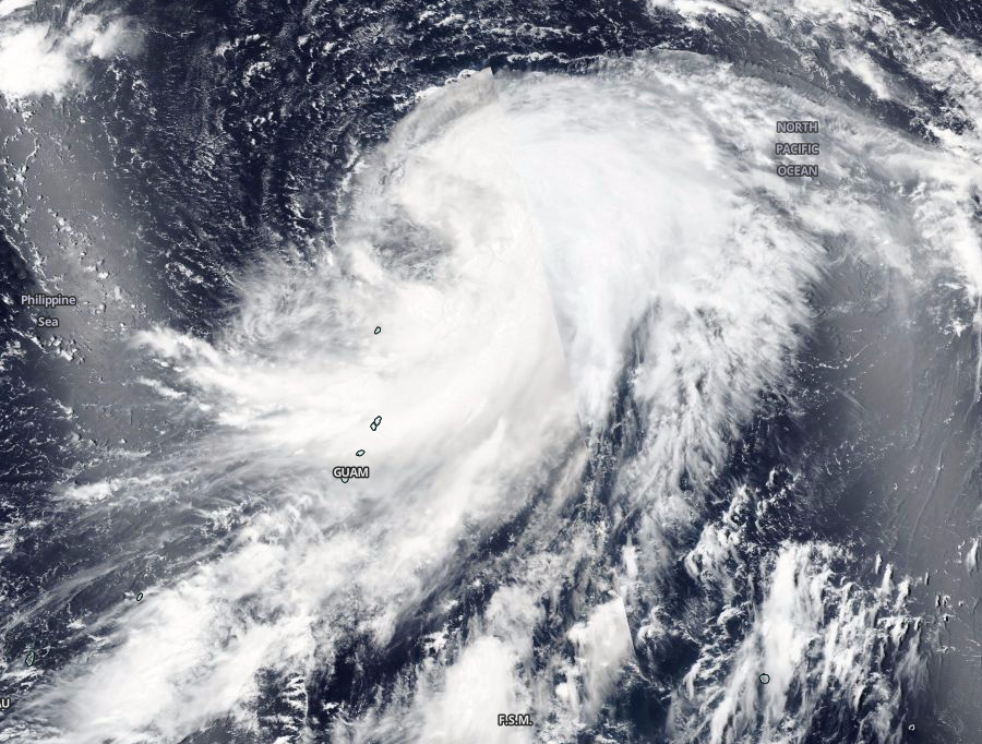
Tropical Storm “Omais” to become a typhoon and affect Japan with high waves
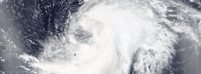
Featured image: Tropical Storm "Omais", August 5, 2016. Image credit: NASA/Suomi NPP/VIIRS
Omais, the seventh tropical cyclone of the 2016 Pacific typhoon season, developed on August 4, 2016. The system will intensify and become a typhoon over the next 48 hours, and begin to weaken afterward. No watches or warnings have been issued. The storm may bring high coastal waves to portions of the Japan mainland early next week.
Tropical Storm "Omais" was located approximately 679.7 km (422.3 miles) east-southeast of the Iwo To Island, Japan, and moving north-northeastward at 24 km/h (14.9 mph) on August 5, at 15:00 UTC, according to the Joint Typhoon Warning Center (JTWC). The system was packing maximum sustained winds of 92.6 km/h (57.5 mph) and gusts of 120.4 km//h (74.8 mph) while its central pressure was estimated at 985 hPa.
Tropical Storm "Omais", August 5, 2016. Image credit: NASA/Suomi NPP/VIIRS
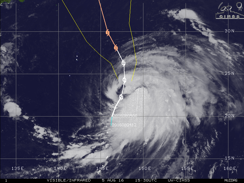
Tropical Storm "Omais", August 5, 2016, 15:30 UTC. Image credit: UW-CIMSS
Environmental conditions currently support the system's intensification, with low vertical wind shear, and warm sea surface temperatures, between 30 and 31 °C (86 and 87.8 °F). The storm is tracking poleward along the western periphery of the near-equatorial ridge.
Omais is expected to intensify into a typhoon, equivalent to a Category 1 hurricane on the Saffir-Simpson hurricane wind scale, over the next two days. The maximum sustained winds are forecast to reach 129.6 km/h (80.5 mph) with gusts up to 157.4 km/h (97.8 mph).
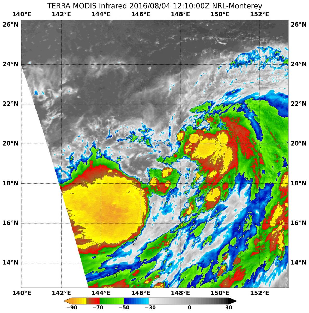
NASA's Aqua satellite showed cloud top temperatures of strong thunderstorms around the center of circulation as cold as -62.2 °C (80 °F) around Tropical Storm "Omais" on August 4. Image credit: NASA/NRL
After the next 72 hours, the system will continue moving on a more north-northwestward track. Because of the large expanse of gale-force winds and tight sea level pressure gradient along its western periphery, the system's 63 km/h (39 miles) radii have been extended over land, just east of Tokyo, according to the JTWC. Following the 72-hour period, Omais will begin to interact with a midlatitude shortwave trough, and become extratropical over the next five days. Further weakening due to increasing vertical wind shear and cooler sea surface temperatures has been forecast.
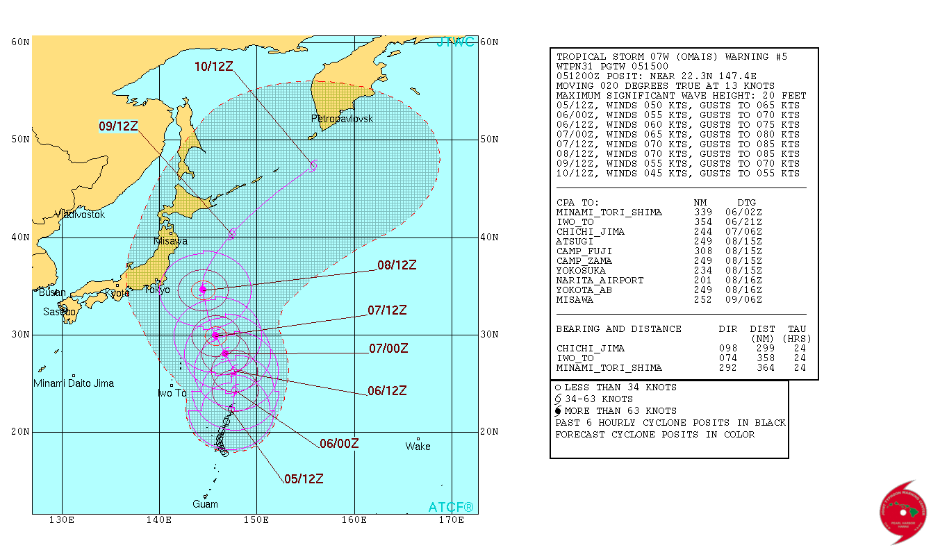
Tropical Storm "Omais" 5-day forecast track. Image credit: JTWC
According to Robert Speta, a Westpacwx meteorologist, the storm will eventually move north while staying east of the Honshu and Izu islands into early next week, and it may stir high waves for the coastal areas of mainland Japan.
Commenting rules and guidelines
We value the thoughts and opinions of our readers and welcome healthy discussions on our website. In order to maintain a respectful and positive community, we ask that all commenters follow these rules.