
Tropical Storm “Dolly” makes landfall in Veracruz, Mexico
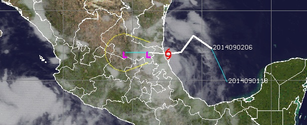
Image credit: UW-CIMSS
Tropical Storm "Dolly" developed from low pressure area on September 2, 2014, near Mexico's Yucatan Peninsula. At 12:00 UTC on September 2 the center was located about 145 miles (230 km) east-southeast of La Pesca, Mexico, moving west-northwest near 12 mph (20 km/h).
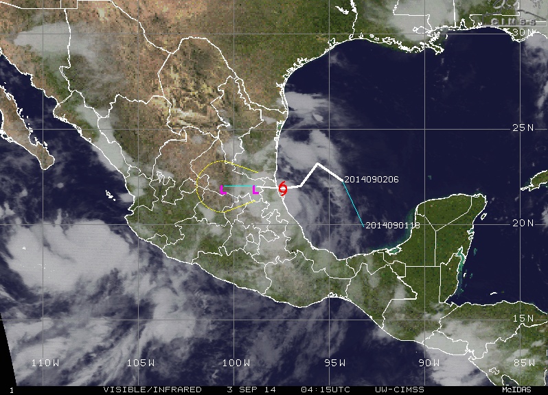
Dolly hit northern Tamiahua Lagoon, Veracruz, at 02:30 UTC on September 3 (21:30 local time on September 2) with winds of 46 mph (75 km/h) and gusts of 59 mph (95 km/h) generating severe weather and torrential rains which soaked Mexico's Gulf coast.
Authorities issued warnings of life-threatening flash floods and mud slides in mountainous areas.
Wednesday school classes were suspended in several municipalities along the Gulf coast.
At 03:00 UTC today, the center of Tropical Storm "Dolly" was moving over the coast of Mexico at 08 knots (9.2 mph/14.8 km/h). Minimum central pressure was 1002 mb.
Dolly is expected to produce rainfall amounts of 5 – 10 inches (127 – 254 mm) with isolated maximum amounts of 15 inches (381 mm) across much of Tamaulipas and Nuevo Leon as well as northern Veracruz and eastern San Luis Potosi through Wednesday evening.
Authorities warned rain will continue in the coming days and encouraged people to stay informed of notices issued by Civil Protection and the state and municipal authorities.
Tropical Storm "Dolly" forecast track on September 3, 2014. Image credit: UW-CIMSS

On September 1 at 17:45 UTC NASA's Terra satellite caught this image of the low pressure area that would become Tropical Storm Dolly, while it was moving over the Yucatan Peninsula. Image credit: NASA Goddard's MODIS Rapid Response Team
This animation from NOAA's GOES-East satellite from August 31 – September 2 shows the movement of a low pressure area from the western Caribbean Sea over the Yucatan Peninsula as it becomes Tropical Storm Dolly.
Courtesy of NASA/NOAA GOES Project
Tropical Storm "Norbert"
Meanwhile, Tropical Storm "Norbert" formed in the Pacific Ocean. Norbert also formed on September 2 and at 03:30 UTC on September 3 it was located approximately 114 miles (185 km) southwest of Cabo Corrientes, Jalisco, and 320 miles (515 km) southeast of Cabo San Lucas, Baja California.
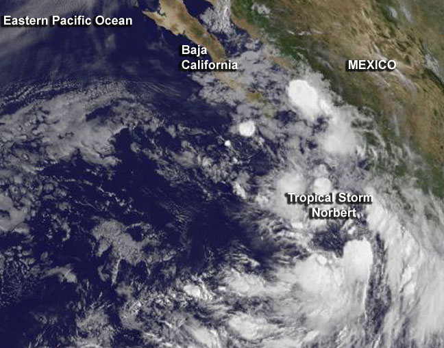
This GOES-West satellite image of Tropical Storm Norbert was taken at 12:00 UTC on September 2 and showed some bands of thunderstorms had formed south of the center of circulation, and around the center. Image credit: NASA/NOAA GOES Project
Maximum recorded winds were 46.6 mph (75 km/h), wind gusts 59 mph (95 km/h). Norbert is moving north-northwest at 9.32 mph (15 km/h) and generating intense rainfall (2.9 – 5.9 inches/75 – 150 mm) in Baja California Sur, Sinaloa, Nayarit, Jalisco, Colima, Michoacan and Guerrero. Very strong rain (1.9 – 2.9 inches/50 – 75 mm) is generated over villages of Guanajuato and strong (0.9 – 1.9 inches/25 – 50 mm) over Zacatecas and Aquascalientes.
6.5 – 13 feet (2 – 4 meters) high waves and wind gusts of up to 31 mph (50 km/h) are generated along the coast of Michoacan, Colima and Jalisco.
Norbert is expected to move away from the southwestern coast of Mexico early Wednesday, and approach the southern tip of the Baja Peninsula on Thursday.
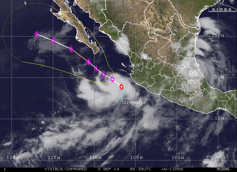
Tropical Storm "Norbert" forecast track on September 3, 2014. Image credit: UW-CIMSS
I'm a dedicated researcher, journalist, and editor at The Watchers. With over 20 years of experience in the media industry, I specialize in hard science news, focusing on extreme weather, seismic and volcanic activity, space weather, and astronomy, including near-Earth objects and planetary defense strategies. You can reach me at teo /at/ watchers.news.
Commenting rules and guidelines
We value the thoughts and opinions of our readers and welcome healthy discussions on our website. In order to maintain a respectful and positive community, we ask that all commenters follow these rules.