
Tropical Storm “Dolly” forms off the coast of northeastern U.S. as the second-earliest fourth named storm on record
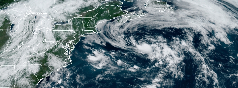
Image credit: NOAA/GOES-East/RAMMB/CIRA. Acquired 14:10 UTC on June 23, 2020.
Subtropical Depression Four has developed offshore of the northeastern U.S. late Monday afternoon, June 22, 2020, and intensified into Tropical Storm "Dolly" at 17:00 UTC on June 23 — the fourth named storm of the 2020 Atlantic hurricane season and the second-earliest fourth named storm on record. The storm is expected to become post-tropical on June 24.
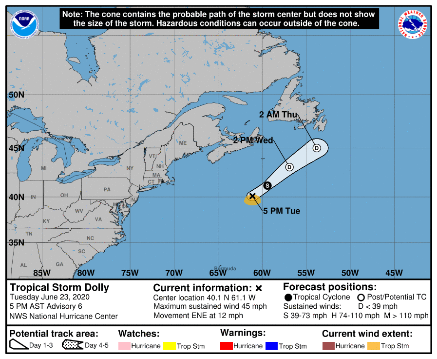
At 17:00 UTC on June 23, the center of Tropical Storm "Dolly" was located 600 km (370 miles) SSE of Halifax, Nova Scotia, and 1 070 km (665 miles) SW of Cape Race, Newfoundland, Canada.
Its maximum sustained wind speed was 75 km/h (45 mph). The system is moving ENE at 20 km/h (13 mph) with minimum central pressure of 1 002 hPa.
A turn toward the northeast with an increase in forward speed is expected tonight and on June 24.
Weakening is forecast during the next day or so as Dolly moves over colder waters and becomes post-tropical.
The system, which is not expected to directly impact land, is forecast to pick up steam as it moves along the Gulf Stream, well off the coast of the U.S.' Eastern Seaboard.
Dolly's formation is far earlier than usual as the fourth named storm of the season usually does not take place until August 23.
Visible satellite imagery shows what the National Hurricane Center has classified as Subtropical Depression 4 spinning well offshore. This system will race to the northeast away from our area with no major impacts expected. #MEwx #NHwx pic.twitter.com/ZXA1YiLtb3
— NWS Gray (@NWSGray) June 23, 2020
Steady and deep convection continues over Subtropical Depression #Four, however the system is unlikely to become a named storm per the latest NHC forecast. Still though, the chance is there, albeit lower than yesterday. By the end of today, development chances will likely end. pic.twitter.com/BjlTi1IybS
— Frank's Weather (@TheWeatherMastr) June 23, 2020
Records from the NHC show that June has only produced two other D-named storms, which were Debby from 2012 and Danielle from 2016.
"The depression stayed well east of New England on Monday night and will pass south and east of Nova Scotia Tuesday afternoon and night," said AccuWeather hurricane expert Dan Kottlowski.
However, it could result in rough seas and cause disruptions in shipping. "Once over much colder water starting later Tuesday, the depression will lose any tropical characteristics and once again become a non-tropical system."
In case you missed it yesterday afternoon, Subtropical Depression 4 was designated over the N Atlantic by @NHC_Atlantic! It is forecast to remain weak as it meanders off to the northeast over the next couple days. pic.twitter.com/Ajp7DhVsMd
— NWS Columbia (@NWSColumbia) June 23, 2020
Barely a weak fish storm, which shouldn’t even be named and wouldn’t have been named a few decades back. Now they just want to boost the number of storms.