
Rapid intensification of 2020 tropical cyclones

Image credit: NOAA/GOES-East, RAMMB/CIRA, TW
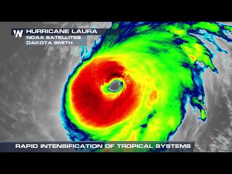
The 2020 Atlantic hurricane season has so far produced a record-tying 10 tropical systems that have undergone rapid intensification, including Iota — the strongest tropical cyclone of the season.
Iota strengthened into a Category 5 hurricane with maximum sustained winds of 260 km/h (160 mph) — making it the strongest tropical cyclone of the 2020 Atlantic season and the second-most intense November hurricane in the Atlantic ocean on record — as its center moved over the Colombian archipelago of San Andrés, Providencia and Santa Catalina, causing unprecedented damage. This marked the first time a Category 5 hurricane directly struck Colombia.
The storm made landfall near the town of Haulover, Nicaragua, on November 17 — just 25 km (15 miles) south of where Eta made landfall on November 3 — as a Category 4 hurricane with maximum sustained winds just 2 km/h below Category 5, making it the strongest November hurricane to hit the Central American country on record. Iota surpassed the previous November landfall record set by Eta at 230 km/h (140 mph) on November 3, 2020.
Iota explosively intensified before landfall, 61 hPa in 24 hours (71 hPa in 36 hours) — which is far beyond the rapid deepening threshold. There are only 3 Atlantic hurricanes on record that have deepened more than 61 hPa in 24 hours — Gilbert in 1988, and Rita and Vilma in 2005. Iota is the only one in November.
The 2020 Atlantic hurricane season is now tied with 1995 for the highest number of rapidly-intensifying cyclones in a single year since 1979.
8 of them occurred in the Gulf of Mexico and the Caribbean, and 2 in the central Atlantic. Six of these 10 rapidly-intensifying storms have occurred since early October.
WeatherNation's Meteorologist Steve Glazier spoke with several scientists about the phenomenon and why it can be so concerning:

Teo Blašković founded The Watchers in 2011 and edited it until 2026, covering seismic and volcanic activity, extreme weather, space weather and near-Earth objects. Articles on this page are his archive.
Published in the last 24 hours
- High Risk of excessive rainfall covers Florida’s Space Coast as St. Johns River near Cocoa reaches 5.67 m
- Asteroid 2026 WJ to pass Earth at 1.7 lunar distances at 04:20 UTC on November 22, with 2026 WD following at 4.4 lunar distances on November 23
- Cyclone Akvan crossed the north Andhra Pradesh and south Odisha coasts close to Gopalpur on November 20 with 70-80 km/h winds gusting to 90, and has weakened into a deep depression
- A broad low over southeastern Florida and the northwestern Bahamas has a 30 percent chance of subtropical or tropical development within 48 hours and a 50 percent chance within 7 days, the National Hurricane Center says
