
Typhoon “Halong” approaching mainland Japan
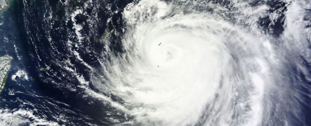
Featured image: Typhoon "Halong" on August 7, 2014. Image credit: NASA Terra/MODIS
Typhoon "Halong", which recently became the third Super Typhoon of 2014 in the Western Pacific basin, has lost its strength and is now the equivalent of a Category 1 hurricane on Saffir–Simpson Hurricane Wind Scale. However, it will gain additional strength on its track toward mainland Japan.
It is expected to make landfall on Saturday, August 9, with maximum sustained winds near 85 knots (97 mph/157 km/h – equivalent of a Category 2 hurricane).
Halong passed directly over the remote Japanese subtropical island of Minami-Daitojima today with maximum sustained surface winds of approximately 65 knots (74 mph/120 km/h). The islands also reported a minimum central pressure of 954.3 millibars.
Halong will continue moving north-northeast and will pass east of Ryukyu Islands before it hits land and significantly weakens due to rough terrain over western Japan. As the system emerges over the Sea of Japan, it will continue to weaken.
The Japan Meteorological Agency has issued high wave warnings for Okinawa and nearby islands, along with less serious advisories for storm surge, gale-force winds and thunderstorms.
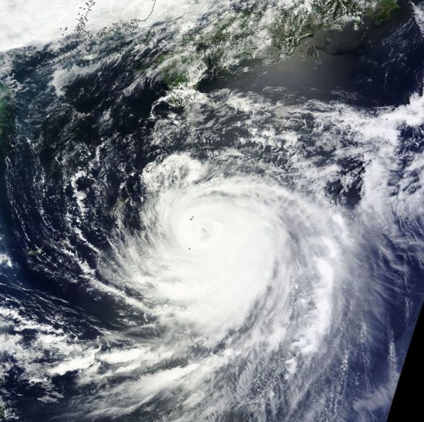
Typhoon "Halong" on August 7, 2014. Image credit: NASA Terra/MODIS
According to JTWC warning issued 15:00 UTC today, Typhoon "Halong" was located approximately 480 nautical miles (552 miles/888 km) south of Iwakuni, Japan, and has tracked northward at 5 knots (5.7 mph/9.2 km/h) over the past six hours. Maximum significant wave height at 12:00 UTC today was 38 feet (11.5 meters). At the same time its wind speed was 75 knots (86.3 mph/138.9 km/h), wind gusts were 90 knots (103.5 mph/166 km/h).
Animated enhanced infrared satellite imagery indicates little change in structure over the past six hours. Halong maintained a large 35 nautical miles (40 miles/64.8 km) eye with the bulk of the deep convection over the southern semi-circle.
Officials urged local people to guard against the wind and possible landslides.
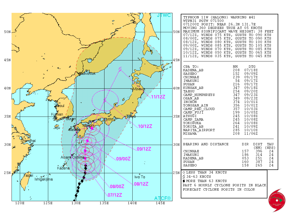
Typhoon "Halong" forecast track by JTWC on August 7, 2014.
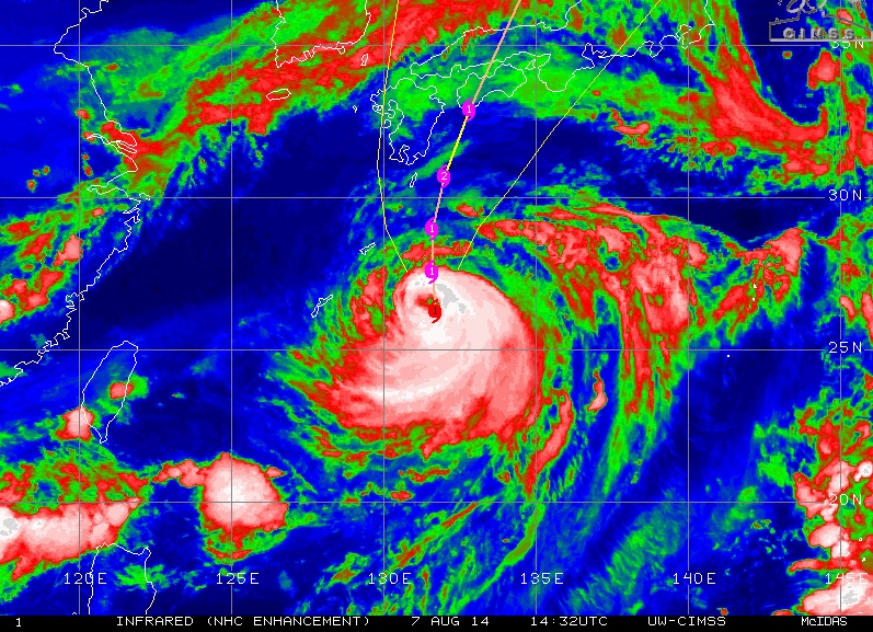
Typhoon "Halong" infrared image on August 7, 2014. Image credit: UW-CIMSS
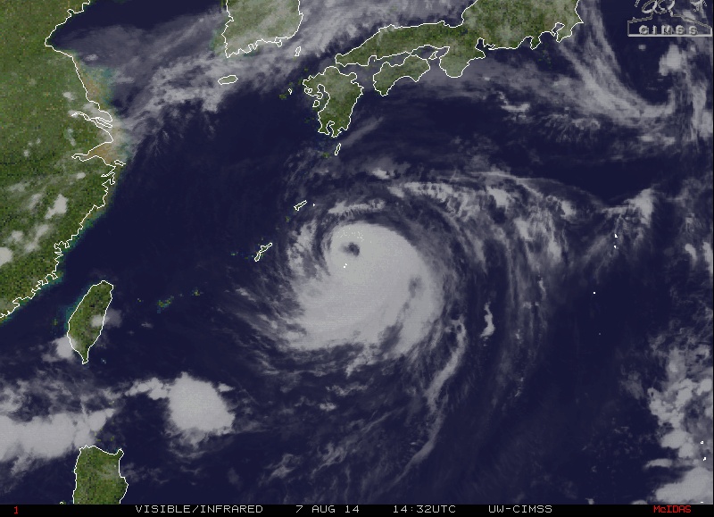
Typhoon "Halong" infrared/visible image on August 7, 2014. Image credit: UW-CIMSS
I'm a dedicated researcher, journalist, and editor at The Watchers. With over 20 years of experience in the media industry, I specialize in hard science news, focusing on extreme weather, seismic and volcanic activity, space weather, and astronomy, including near-Earth objects and planetary defense strategies. You can reach me at teo /at/ watchers.news.
Commenting rules and guidelines
We value the thoughts and opinions of our readers and welcome healthy discussions on our website. In order to maintain a respectful and positive community, we ask that all commenters follow these rules.