
Tropical Cyclone Imelda gaining strength in Indian Ocean
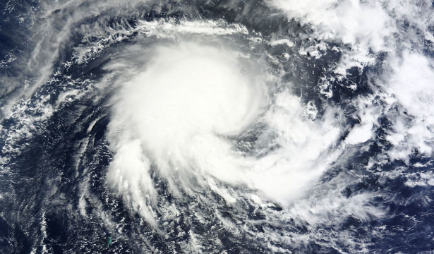
Image credit: The Moderate Resolution Imaging Spectroradiometer (MODIS) on NASA’s Terra satellite captured this natural-color image on April 8, 2013. Imelda lacked a distinct eye characteristic of strong storms, but still sported a rough apostrophe shape. (NASA image courtesy Jeff Schmaltz, LANCE/EOSDIS MODIS Rapid Response Team at NASA GSFC. Caption by Michon Scott)
Tropical Cyclone Imelda is spinning in the open waters of the Southern Indian Ocean moving in west-southwestern direction. According to latest report by Joint typhoon Warning Center (JTWC, Tropical Cyclone Imelda is located approximately 650 nm north-northeast of La Reunion, has tracked west-southwestward at 13 knots.
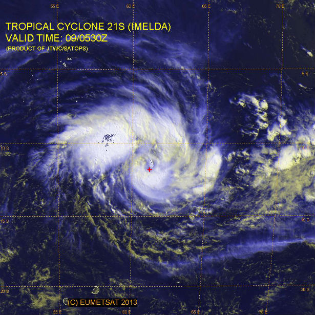 EUMRTSAT’s Multispectral satellite image of the system on April 9, 2013 (Credit: JTWC/SATOPS)
On April 5, 2013 Imelda was a low pressure area designated “93S”. By April 6, 2013, 93S consolidated and became a tropical depression that has strengthened into a tropical storm, and is expected to continue strengthening to hurricane-force system. NASA’s Tropical Rainfall Measuring Mission (TRMM) satellite revealed low-level bands of thunderstorms over the western semicircle, while northeast of the center on April 8, 2013. The bands of thunderstorms were fragmented and weak. Since then, those bands have organized and wrap tightly into the center of circulation.
 This 3-D image of tropical cyclone Imelda from TRMM PR shows that some thunderstorms west of Imelda’s center of circulation were towering to heights of above 15km (~9.3 miles). (Credit: NASA/TRMM)
On April 8, 2013 Imelda reached maximum sustained winds near 40 knots (46.0 mph/74.0 kph) and was moving to the west at 12 knots (13.8 mph/22.2 kph). JTWC forecasters expect Imelda to continue tracking west-southwestward for the next two days and strengthen. Wind speeds were forecast to reach 95 knots (175 kilometers per hour) with gusts up to 115 knots (215 kilometers per hour).
Imelda is expected to continue heading west before turning sharply to the south around April 11, 2013. The system will not make landfall in Madagascar.
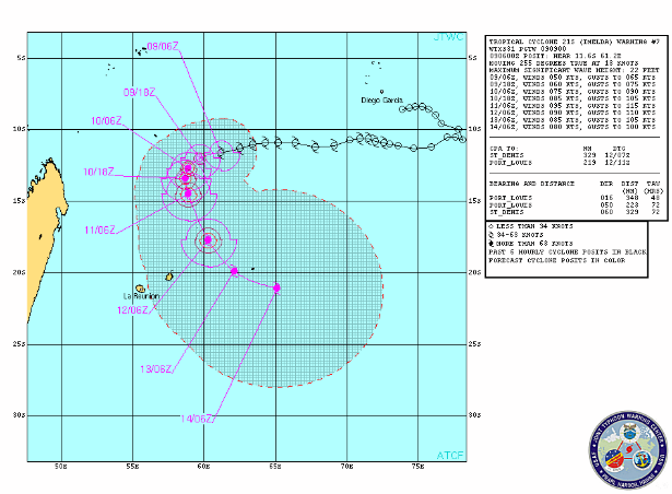 TC Imelda forecast track (Credit: JTWC)
Satellite Animations
- Storm-Centered Infrared (Meteosat 7; CIMSS)
- Storm-Centered Enhanced Infrared (Meteosat 7; CIMSS)
- Storm-Centered Water Vapor (Meteosat 7; CIMSS)
- Storm-Centered Visible (Meteosat 7; CIMSS)
- Meteosat 7 Infrared (Meteosat 7; CIMSS)
- Meteosat 7 Infrared (Color Background) (Meteosat 7; CIMSS)
- Meteosat 7 Infrared (NHC Color Enhancement) (Meteosat 7; CIMSS)
- Meteosat 7 Water Vapor (Meteosat 7; CIMSS)
- Meteosat 7 Water Vapor (Color Background) (Meteosat 7; CIMSS)
[…] https://watchers.news/2013/04/09/tropical-cyclone-imelda-gaining-strength-in-indian-ocean… […]