
M6.1 earthquake hit Santiago del Estero, Argentina
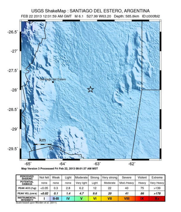
Image credit: USGS Shake Map
Strong and deep earthquake registered as M6.1 (USGS/EMSC) hit Santiago del Estero region in Argentina on February 22, 2013 at 12:02 UTC.
The epicenter was located 28 km (17 miles) E of Suncho Corral, Argentina at coordinates 27.993°S, 63.195°W. Measured depth was 585.8 km (364.0 miles).
Considering the depth, this quake was not so dangerous. There were no reports of major damage or casualties.
| Magnitude | 6.1 |
|---|---|
| Date-Time |
|
| Location | 27.993°S, 63.195°W |
| Depth | 585.8 km (364.0 miles) |
| Region | SANTIAGO DEL ESTERO, ARGENTINA |
| Distances | 28 km (17 miles) E of Suncho Corral, Argentina 66 km (41 miles) NNW of Anatuya, Argentina 78 km (48 miles) WSW of Quimili, Argentina 111 km (68 miles) E of Santiago del Estero, Argentina |
| Location Uncertainty | horizontal +/- 12.9 km (8.0 miles); depth +/- 5.8 km (3.6 miles) |
| Parameters | NST=585, Nph=700, Dmin=610 km, Rmss=0.89 sec, Gp= 22°, M-type=(unknown type), Version=8 |
| Source |
|
| Event ID | usc000fbl2 |
Shake intensity map (Credit: USGS)
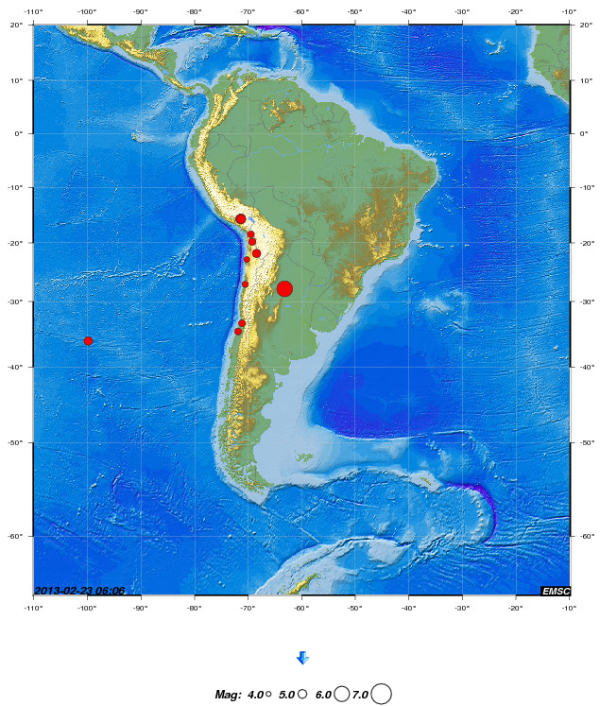
Map of earthquakes in region on February 22, 2013 (Credit: EMSC)
Commenting rules and guidelines
We value the thoughts and opinions of our readers and welcome healthy discussions on our website. In order to maintain a respectful and positive community, we ask that all commenters follow these rules.