
Magnitude 6.4 (6.8) earthquake struck Kuril Islands, Russia
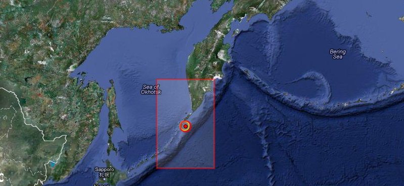
Image credit: EMSC + Google Earth
Strong earthquake, initially registered as M 6.8 but later revised to M 6.4 struck Kuril Islands, Russia at 18:12:42 UTC on November 16, 2012 according to USGS. The epicenter was located 162 km (101 miles) SSW (198°) from Severo-Kuril’sk, Kuril Islands, Russia (49.200°N, 155.700°E) at depth of 4.9 km (3.0 miles) which was later changed to 29.1 km (18.1 miles). EMSC registered M 6.0, changed to M 6.4 and revised finally to M 6.6 at the depth of 60 km (37.3 miles) which was also changed to 5 km.
Lots of revision in magnitudes and depth but generally we can agree that the magnitude ranged between 6.4 and 6.8 at depth from 5 to 60 km.
 Recent activity map (Source: USGS)
 Intensity shaking map (Source: USGS)
| Magnitude | 6.8 |
|---|---|
| Date-Time |
|
| Location | 49.291°N, 155.445°E |
| Depth | 4.9 km (3.0 miles) (poorly constrained) |
| Region | KURIL ISLANDS |
| Distances | 162 km (100 miles) SSW of Severo-Kuril’sk, Russia 454 km (282 miles) SSW of Vilyuchinsk, Russia 474 km (294 miles) SSW of Petropavlovsk-Kamchatskiy, Russia 479 km (297 miles) SSW of Yelizovo, Russia |
| Location Uncertainty | horizontal +/- 15.1 km (9.4 miles); depth +/- 6.7 km (4.2 miles) |
| Parameters | NST=328, Nph=334, Dmin=454.2 km, Rmss=0.92 sec, Gp= 40°, M-type=regional moment magnitude (Mw), Version=7 |
| Source |
|
| Event ID | usc000dtr7 |
The epicenter is far out of the coast in a sparsely populated to unpopulated area. There are no tsunami warnings issued at the moment.
 Earthquake map (Source: Pacific Tsunami Warning Center)
TSUNAMI BULLETIN NUMBER 001

PACIFIC TSUNAMI WARNING CENTER/NOAA/NWS

ISSUED AT 1821Z 16 NOV 2012


AN EARTHQUAKE HAS OCCURRED WITH THESE PRELIMINARY PARAMETERS


 ORIGIN TIME -  1813Z 16 NOV 2012

 COORDINATES -  49.2 NORTH  155.7 EAST

 DEPTH       -   60 KM

 LOCATION    -  KURIL ISLANDS

 MAGNITUDE   -  6.8


EVALUATION


 NO DESTRUCTIVE WIDESPREAD TSUNAMI THREAT EXISTS BASED ON

 HISTORICAL EARTHQUAKE AND TSUNAMI DATA.


 HOWEVER - EARTHQUAKES OF THIS SIZE SOMETIMES GENERATE LOCAL

 TSUNAMIS THAT CAN BE DESTRUCTIVE ALONG COASTS LOCATED WITHIN

 A HUNDRED KILOMETERS OF THE EARTHQUAKE EPICENTER. AUTHORITIES

 IN THE REGION OF THE EPICENTER SHOULD BE AWARE OF THIS

 POSSIBILITY AND TAKE APPROPRIATE ACTION.


THIS WILL BE THE ONLY BULLETIN ISSUED FOR THIS EVENT UNLESS

ADDITIONAL INFORMATION BECOMES AVAILABLE.


THE JAPAN METEOROLOGICAL AGENCY MAY ALSO ISSUE TSUNAMI MESSAGES

FOR THIS EVENT TO COUNTRIES IN THE NORTHWEST PACIFIC AND SOUTH

CHINA SEA REGION.  IN CASE OF CONFLICTING INFORMATION... THE

MORE CONSERVATIVE INFORMATION SHOULD BE USED FOR SAFETY.


THE WEST COAST/ALASKA TSUNAMI WARNING CENTER WILL ISSUE PRODUCTS

FOR ALASKA...BRITISH COLUMBIA...WASHINGTON...OREGON...CALIFORNIA.
All magnitudes estimations :
mb6.5 (BEO) Mw7.2 (BGSG) ML2.9 (GFU) M 6.5 (GFZ) Mb6.5 (GSRC) Mw6.8 (JMA) MB6.7 (LDG) MB6.7 (LED) MB6.7 (MAD) Mb6.3 (MSO) Mw6.8 (NEIC) Mb5.1 (NEWS) Mb5.1 (NEWS) Mb4.8 (NEWS) Mw6.8 (PTWC) Mw6.8 (PTWC) Mb6.7 (ZAMG)
UPDATE 1 (18:40 UTC, November 16,2012)
EMSC revised preliminary magnitude 6.0 to 6.4, and the depth was changed to 2 km.
UPDATE 2 (19:00 UTC, November 16, 2012)
EMSC revised magnitude to 6.6 and the depth was changed to 5 km.
Commenting rules and guidelines
We value the thoughts and opinions of our readers and welcome healthy discussions on our website. In order to maintain a respectful and positive community, we ask that all commenters follow these rules.