
Typhoon Sanvu is the first typhoon this year
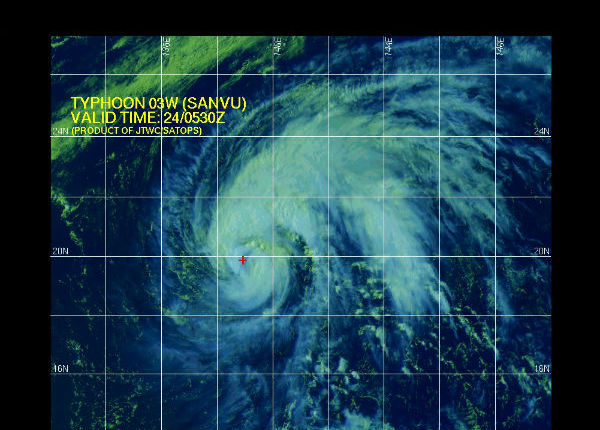
Image credit: TW
Typhoon Sanvu has become the year’s first typhoon. It is the first such storm since early October 2011. Sanvu is only the second named western north Pacific storm thus far in 2012. Fortunately, no major land masses are under threat from Sanvu, which will track near a few small remote islands later in the week.

According to latest warning issued by Joint Typhoon Weather Center (JTWC) Typhoon Sanvu (TY 03W) was located 310 nm south-southwest of Iwo To, Japan and was moving north-northwestward at speed of 8 knots. Maximum significant wave height is 8.3 meters (27 feet).
Sanvu is forecast to hold typhoon status through Friday, when its center will approach Iwo To, according to the JTWC. Typhoon Sanvu is expected to veer northeast to the open Pacific Ocean after weakening to a tropical storm.

Satellite Animations
- Storm-Centered Infrared (MTSAT2; NOAA/SSD)
- Storm-Centered Infrared (Aviation Color Enhancement) (MTSAT2; NOAA/SSD)
- Storm-Centered Water Vapor (MTSAT2; NOAA/SSD)
- Storm-Centered Visible (MTSAT2; NOAA/SSD)
- Storm-Centered Visible (Colorized) (MTSAT2; NOAA/SSD)
- Tropical West Pacific Infrared (MTSAT2; NOAA)
- Tropical West Pacific Enhanced Infrared (MTSAT2; NOAA)
- Tropical West Pacific Water Vapor (MTSAT2; NOAA)
- Tropical West Pacific Visible (MTSAT2; NOAA)

Commenting rules and guidelines
We value the thoughts and opinions of our readers and welcome healthy discussions on our website. In order to maintain a respectful and positive community, we ask that all commenters follow these rules.