
Magnitude 6.1 – Off east coast of the North Island, New Zealand
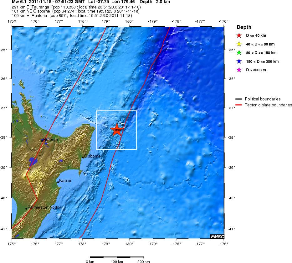
Image credit: TW
Magnitude 6.1 struck near >North Island, New Zealand at 07:51UTC and was located 158 km (98 miles) NE of Gisborne, 269 km (167 miles) ENE of Rotorua, 405 km (251 miles) ESE of Auckland, New Zealand (37.608°S, 179.243°E). According to NZ GEONET the depth was at 40km (24.8 miles), while USGS measured depth of 26 km (16.2 miles) and EMSC only 2km (1.2 miles).


There have been a series of sharp earthquakes in the Kermadec Trench region northeast of Napier today. A 5.8 earthquake at 5.34pm NZT was centred 292km northeast of Napier, at a depth of 33km and a magnitude 5.3 earthquake struck close by at 3.43 pm, at a depth of 12km. That quake was possibly felt in the Raukumara Peninsula.
 There was no tsunami alert issued. In July this year a tsunami alert was issued for New Zealand after a huge 7.8 magnitude earthquake in the Kermadec Islands region.
Commenting rules and guidelines
We value the thoughts and opinions of our readers and welcome healthy discussions on our website. In order to maintain a respectful and positive community, we ask that all commenters follow these rules.