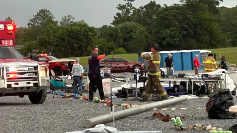
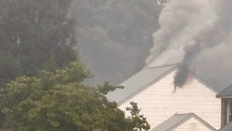
• Rare Moderate Risk (4/5) issued for Mid-Atlantic as severe thunderstorms raise threat of damaging winds and tornadoes

    A Moderate Risk (Level 4 of 5) for severe thunderstorms has been issued across parts of the Mid-Atlantic United States for Monday, March 16, 2026, as a powerful multi-hazard storm threatens over 100 million people across the U.S. Fast-moving storms capable of producing damaging winds and a few strong tornadoes are forecast to develop from the Carolinas into Virginia and Maryland during the afternoon and evening hours. A Moderate Risk is an unusually high severe weather category for the Mid-Atlantic and is not issued often for this region. The National Weather Service office serving the Washington, D.C. area described the setup as a “quite rare Day 2 Moderate Risk area” ahead of the event.

  • Winter weather impacts Appalachians and Mid-Atlantic while severe storm risk expands across parts of Oklahoma and Kansas

    A lifting frontal boundary draped from the southern Plains to the Mid-Atlantic is producing a swath of mixed winter precipitation across the Ohio and Tennessee Valleys on March 2, 2026, while setting the stage for isolated severe thunderstorms in Oklahoma and Kansas on March 3. Winter weather advisories are in effect from Indiana to Pennsylvania, with ice accretion possible across the higher terrain of the Appalachians, according to the Weather Prediction Center.

  • NWS increases confidence in heavy snow across the Carolinas and southern Virginia as Arctic air deepens

    A surge of Arctic air will spread across the central and eastern United States from Friday, January 30, 2026, bringing the longest duration of cold in several decades to parts of the region. Forecast confidence has increased for a winter storm to develop along the East Coast over the weekend, with the highest likelihood of heavy snowfall across the Carolinas and southern Virginia, and gusty coastal winds extending into the Mid-Atlantic.

  • Blizzard warnings in effect for parts of West Virginia and western Maryland

    Blizzard warning have been issued with snowfall totals of up to 30 cm (12 inches) being forecast across the high western slopes along with gusts of 80 km/h (50 mph) across multiple mountain counties. The warnings are in effect for parts of West Virginia, western Maryland, and western Virginia from 10:00 EST Wednesday, December 10, 2025 to 10:00 EST Thursday, December 11.

  • Slow-moving storm triggers flood watches from North Carolina to Pennsylvania

    Flood watches have been issued from North Carolina to Pennsylvania, including Washington, D.C., as a severe weather system brings heavy rains to the Northeast starting Tuesday, May 13, 2025. Heavy rainfall is expected to extend from the Southeast to the Great Lakes, with much of the Mid-Atlantic affected through Wednesday, May 14.

  • Virginia Beach sees heaviest snow since 1989

    Virginia Beach experienced the heaviest snowfall since 1989 as the strongest storm of the season swept through Virginia on Wednesday, February 19, 2025, dropping rare and heavy snow across the region.