
Subtropical low triggers Red Heavy Rain Warning in Northland, New Zealand
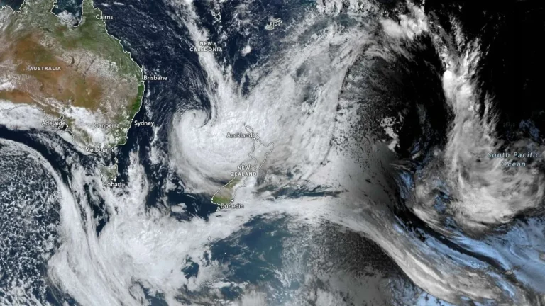
A deep subtropical low prompted a Red Heavy Rain Warning for parts of Northland, New Zealand, on March 25, 2026, with 230–280 mm (9–11 inches) of rain forecast for areas east of Kaikohe from Doubtless Bay to Whangārei through early March 27. MetService and local authorities warned of dangerous river conditions, significant flooding and slips, with some communities at risk of isolation.