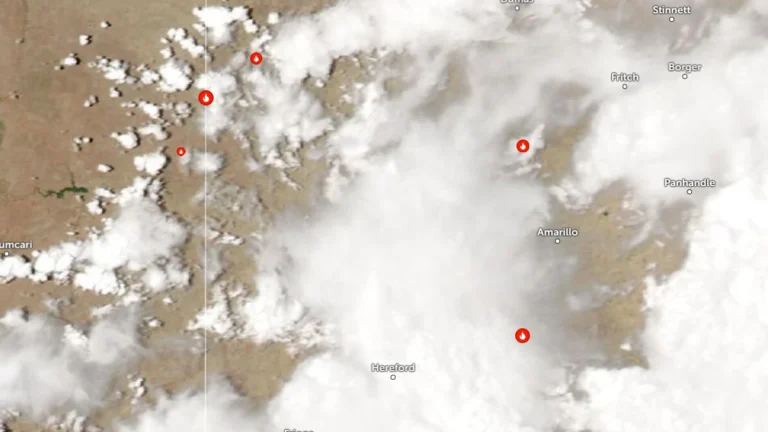
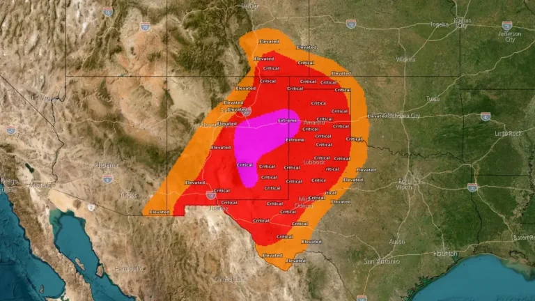
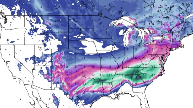
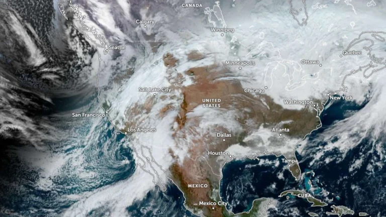
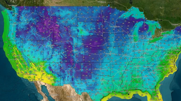
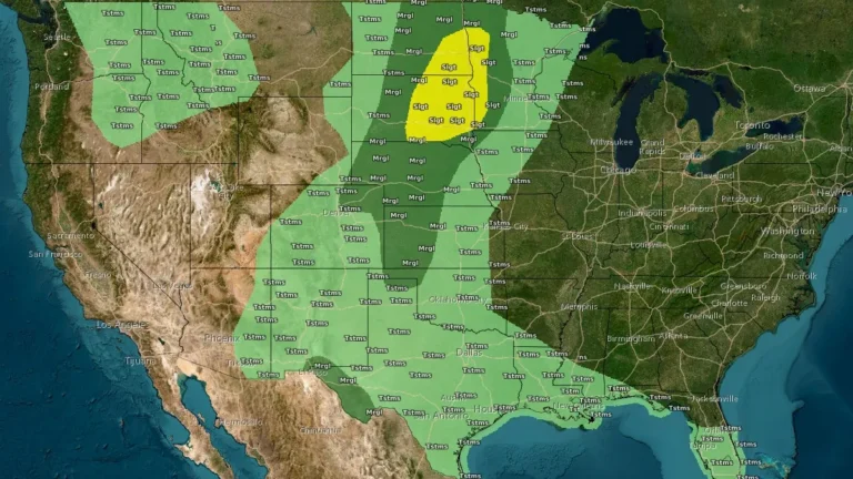
• Severe thunderstorms and flooding threat forecast across the Plains through Thursday

    Repeated rounds of severe thunderstorms are forecast to develop across parts of the northern Plains and Upper Mississippi Valley through Thursday, June 4, bringing the potential for large hail, damaging winds, isolated tornadoes, and localized flooding. The Storm Prediction Center (SPC) placed parts of the eastern Dakotas and western Minnesota under a Slight Risk (level 2 of 5) for severe thunderstorms, while excessive-rainfall outlooks from the Weather Prediction Center (WPC) target portions of the eastern Dakotas, west Texas, and New Mexico.

  • SPC issues Extremely Critical fire weather outlook for eastern New Mexico and far western Texas Panhandle

    The Storm Prediction Center issued an Extremely Critical Fire Weather Area for portions of eastern New Mexico into the far western Texas Panhandle on Sunday, April 26, 2026. Red Flag Warnings cover much of the southern High Plains as southwest winds of 40-55 km/h (25-35 mph), localized gusts of 80-95 km/h (50-60 mph), and very low relative humidity create conditions where any new fire could spread rapidly.

  • Red Flag Warnings issued for parts of Texas, New Mexico, Oklahoma and Colorado as critical fire weather spreads on March 15

    Strong winds and very dry air behind a powerful storm system are creating critical fire weather across parts of Texas, New Mexico, Oklahoma, and Colorado on March 15, 2026, prompting Red Flag Warnings across multiple forecast areas. Wind gusts may reach 105 km/h (65 mph), while relative humidity is forecast to fall as low as 6 to 15 percent in some areas, supporting rapid fire growth and spread.

  • Winter storm watches in effect across central and southern United States

    Winter storm watches are in effect from New Mexico and Texas to Arkansas, Tennessee, and Kentucky, from Friday morning through late Saturday night, January 23–24, 2026, with some extending into Sunday afternoon, January 25. Heavy snow, sleet, and ice accumulations are forecast, along with dangerously cold temperatures that will persist into Monday morning, January 26.

  • Twin cross-country storms to bring severe weather from the Cascades and Rockies to the Mississippi Valley

    A pair of cross-country storm systems will affect large parts of the United States through Friday, January 9, 2026, bringing widespread rain, mountain snow, and a risk of severe thunderstorms. Heavy snowfall is forecast for the Cascades and the southern Rockies. Flash floods and severe thunderstorms are forecast across the Lower Mississippi and Tennessee Valleys by the end of the week.

  • Early-season freeze impacts large parts of the Texas and Oklahoma Panhandles and New Mexico

    Widespread Freeze Warnings are in effect across the Texas and Oklahoma Panhandles and parts of New Mexico on Thursday, October 30, 2025, with temperatures forecast to drop to −6°C to −2°C (20°F–28°F). The event marks the first significant freeze of the season across the southern High Plains. The warnings remain valid through early Friday morning as clear skies and light winds enable rapid radiational cooling. Residents are advised to protect plants, pipes, and pets.

  • Remnants of Priscilla trigger flash floods in New Mexico, U.S.

    Remnants of post-tropical Priscilla struck the desert southwest of U.S. triggering significant floods across the region including parts of New Mexico between Friday and Saturday, October 10 and 11, 2025. Intense flooding swept away at least two vehicles and prompted rescues in the San Juan County.