
Remnants of Priscilla trigger flash floods in New Mexico, U.S.
Remnants of post-tropical Priscilla struck the desert southwest of U.S. triggering significant floods across the region including parts of New Mexico between Friday and Saturday, October 10 and 11, 2025. Intense flooding swept away at least two vehicles and prompted rescues in the San Juan County.

Floodwaters sweep away a vehicle in San Juan County, New Mexico on October 11, 2025. Credit: San Juan County Fire & Rescue
Remnant tropical moisture from former Tropical Storm Priscilla moved northward into the Desert Southwest on October 10, bringing along rain and flash floods to northwestern New Mexico, particularly in San Juan County.
According to the National Weather Service (NWS) Albuquerque office, repeated rounds of tropical rain developed over western and central New Mexico through the weekend, with Flash Flood Warnings issued for several counties. The agency noted that intense bursts of rainfall over arid terrain led to rapid runoff, flooding normally dry washes and low crossings.
While the rainfall totals were not significant, the low infiltration capacity of desert soil can cause quick run off and flash floods. The Navajo Dam recorded 32 mm (1.26 inches) of rainfall between October 10 and 11. Aztec 24 mm (0.95 inches), Farmington sites 18–22 mm (0.70–0.88 inches), and Bloomfield 20 mm (0.80 inches).
San Juan County Fire and Rescue reported multiple incidents in which at least two vehicles were swept away, and crews assisted drivers who escaped or were rescued from arroyo flows.
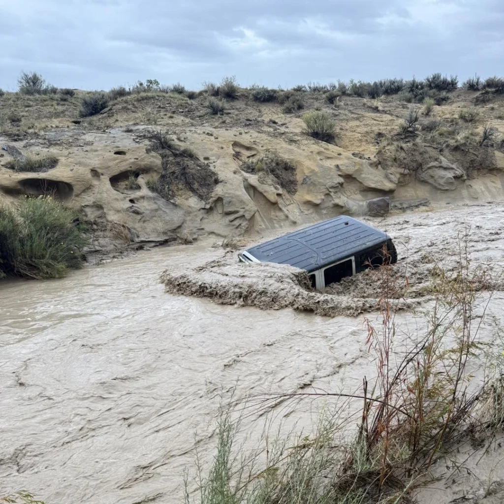
 A jeep getting swep away by flood waters in New Mexico on October 11, 2025. Credit: San Juan County Fire & Rescue
- A jeep getting swep away by flood waters in New Mexico on October 11, 2025. Credit: San Juan County Fire & Rescue


Satellite and radar imagery from the National Hurricane Center (NHC) and NOAA showed the remnants of Priscilla transporting deep tropical moisture into the region from the eastern Pacific.
The system dissipated off the coast of Mexico earlier in the week but continued to funnel humid air northward, interacting with a stalled frontal boundary over the Four Corners region.
The moisture plume extended across Arizona, southern Utah, and western Colorado, where additional flash flooding and localized river rises were reported.
The NWS said the Animas and San Juan rivers reached near action stages in parts of the Four Corners region, with several flood advisories issued downstream in Colorado.
Regional forecasts indicate that residual tropical moisture will continue to affect parts of the Southwest into early next week, though rainfall intensity is expected to decrease as the air mass dries.
References:
1 Public Information Statement –NWS – October 11, 2025

I am an Assistant Editor and Severe Weather & Science Journalist at The Watchers, specializing in real-time severe weather coverage, geophysical event reporting, and research-driven scientific analysis. You can reach me at rishav(at)watchers(.)news.
Commenting rules and guidelines
We value the thoughts and opinions of our readers and welcome healthy discussions on our website. In order to maintain a respectful and positive community, we ask that all commenters follow these rules.