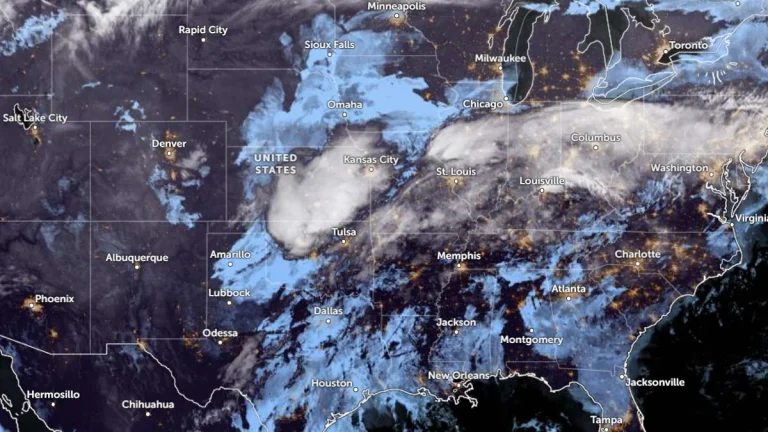
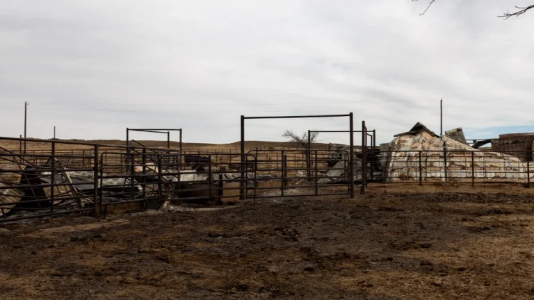
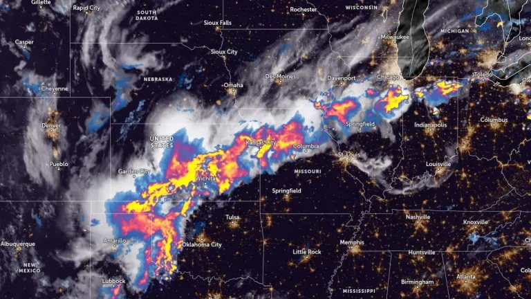
• NWS confirms EF-2 tornado hit Ottawa, Kansas, injuring 3 on April 13

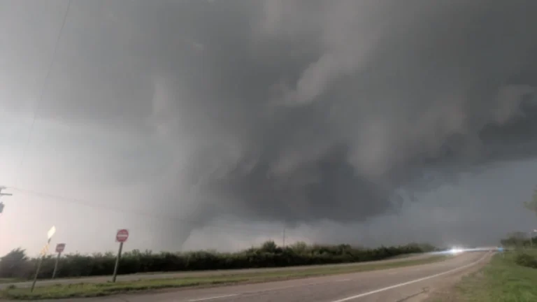
    An EF-2 tornado struck Ottawa in Franklin County, Kansas, between 19:23 and 19:48 CDT on April 13, 2026, damaging homes, businesses, and power infrastructure while injuring three people. The National Weather Service estimated peak winds of 201 km/h (125 mph), with a damage path of 11.75 km (7.3 miles) and a maximum width of 91 m (100 yards).

  • Multiple tornadoes hit Kansas, Minnesota, Iowa and Wisconsin during April 13 severe weather outbreak

    A severe weather outbreak on April 13, 2026, produced at least 14 preliminary tornado reports across Kansas, Minnesota, Iowa, and Wisconsin, with the most serious reported damage in and near Ottawa. No fatalities were immediately reported, but storm surveys were still underway as forecasters warned of additional rounds of severe weather through at least April 16.

  • Red Flag Warnings issued from the Plains to the Southeast under critical fire weather conditions

    Red Flag Warnings are in effect across the Central Plains and Southeast United States on March 28, 2026, as the National Weather Service (NWS) warns of critical fire weather conditions driven by strong winds, low relative humidity, and dry fuels. Wind gusts up to 80 km/h (50 mph) and humidity levels as low as 10–20% are expected to promote rapid fire ignition and spread. Outdoor burning is strongly discouraged across all warned regions.

  • Multiple tornadoes reported across Kansas, Oklahoma, and Texas as severe storms impact southern Plains

    Multiple tornadoes were reported across parts of Kansas, Oklahoma, and Texas on March 5, 2026, as severe thunderstorms moved across the southern Plains. The Storm Prediction Center (SPC) received at least seven tornado reports during the event, with storms causing localized damage and leaving more than 11 000 customers without power as of March 6, according to PowerOutage.US.

  • SPC issues Enhanced Risk for severe storms with large hail and tornado potential across Texas-Oklahoma-Kansas

    Severe thunderstorms capable of producing very large hail, damaging winds, and a few tornadoes are forecast to develop across the Texas Panhandle, western Oklahoma, and southern Kansas late on March 5, 2026. The National Weather Service (NWS) Storm Prediction Center (SPC) has issued an Enhanced Risk for the region as atmospheric conditions become favorable for supercell development along a dryline during the late afternoon and evening.

  • Ranger Road Fire doubles in size in one day, reaching over 114 650 ha (283 000 acres) in Kansas-Oklahoma

    The Ranger Road Fire nearly doubled in size from 58 700 ha (145 000 acres) to over 114 650 ha (283 000 acres) within roughly 24 hours after ignition at 11:40 LT on February 17, 2026, when it crossed the Kansas–Oklahoma border. As of February 18, containment stood at 15% following rapid expansion driven by dry fuels and high winds. Authorities closed sections of Kansas highways 283, 160, and 183.

  • Red Flag Warning and High Wind Watches issued across central U.S. as strong northwesterly winds develop

    Strong northwesterly winds and very low humidity will bring critical fire weather conditions across eastern Colorado and western Kansas on Thursday, January 15, 2026, prompting the National Weather Service in Goodland to issue a Red Flag Warning and Fire Weather Watch. At the same time, high wind watches have been issued across the northern and central Great Plains, with gusts up to 120 km/h (75 mph) expected Thursday through Friday, January 16.