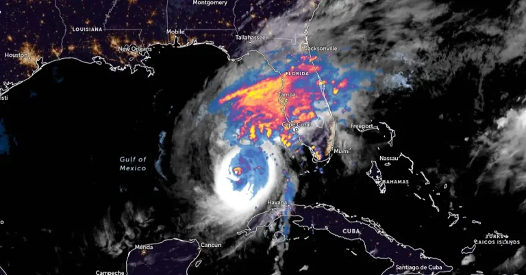
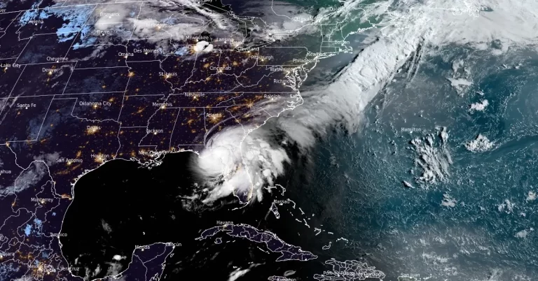
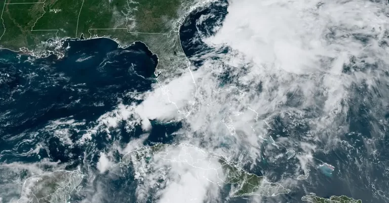
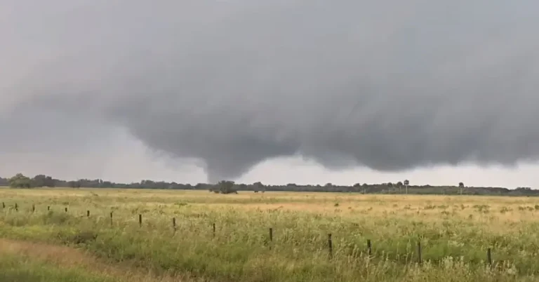
• 7th confirmed tornado of the day hits Florida as Milton’s storm surge begins

    Meteorologists at the National Weather Service in Miami have confirmed the 7th tornado linked to Hurricane “Milton” just hours before its expected landfall in Florida. As of 14:40 LT, 39 Tornado Warnings have been issued, with more tornadoes possible through the night. Tropical-storm-force winds have begun impacting Florida’s west coast, while rising water levels at the Naples Pier indicate the start of Milton’s storm surge across southwestern coastal areas. Multiple warnings remain in effect across the Florida peninsula.

  • Large area of destructive storm surge forecast as extremely dangerous Hurricane “Milton” hits Florida

    Category 5 Hurricane “Milton” is moving NE toward Florida, U.S. at 22 km/h (14 mph) with maximum sustained winds of 260 km/h (160 mph). Milton is forecast to make landfall late tonight or early Thursday along the Florida Gulf Coast, threatening large area with severe storm surges, destructive winds, and heavy rainfall.

  • Up to 75% of homes in Keaton Beach, Florida destroyed by Hurricane “Helene”

    Category 4 Hurricane “Helene” made landfall near Perry in the Taylor County, Big Bend region of Florida on September 28, 2024, bringing a destructive storm surge and powerful winds. Keaton Beach, a Taylor County seaside village, that has had three storms in the last 13 months, has been devastated by Helene, with 60% to 75% of dwellings destroyed.

  • Category 4 Hurricane “Helene” slams Florida with destructive storm surge, leaves over 240 dead in U.S.

    Hurricane “Helene” made landfall near Perry in the Big Bend region of Florida at 23:10 local time (LT) on Thursday, September 26, 2024, as a Category 4 hurricane with record-breaking winds of 220 km/h (140 mph). It created massive life-threatening storm surges of up to 6.1 m (20 feet). Multiple extreme wind warnings have been issued across several counties in the Big Bend region before the arrival of the eye of the storm.

  • Hurricane “Helene” expected to bring catastrophic and deadly storm surge to Florida Big Bend, U.S.

    Hurricane “Helene” is expected to rapidly intensify to a Category 4 major hurricane before making landfall on Florida’s Big Bend coast on Thursday, September 26, 2024. Catastrophic storm surge, potentially reaching 6 m (20 feet) above ground, along with destructive winds and life-threatening flash flooding, pose serious risks to the region. Residents in affected areas are urged to follow evacuation orders and complete preparations immediately.

  • Hurricane “Debby” makes landfall in Florida, historic rains expected in parts of Georgia and the Carolinas

    Hurricane “Debby” made landfall near Steinhatchee in Florida’s Big Bend at 11:00 UTC on Monday, August 5, 2024. Debby had minimum central pressure of 979 hPa and maximum sustained winds of 130 km/h (80 mph) at the time of landfall, making it a Category 1 hurricane on the Saffir-Simpson scale. It was moving NNE at 17 km/h (10 mph).

  • Widespread floods in South Florida, authorities urge citizens to refrain from travel

    As the long low pressure region near the coast of Florida continues to produce a wide area of disorganized showers and thunderstorms, SE Broward and NE Miami-Dade including Hallandale, Hollywood, NMB, Dania, and Aventura witness life-threatening flooding and widespread road closures with detrimental impact on homes and businesses across the region.

  • Sarasota hit by record-breaking 1-hour rainfall, all of South Florida under Flood Watch

    Disorganized showers and thunderstorms produced by a broad and elongated area of low pressure are affecting parts of Florida. On Tuesday, June 11, 2024, this low pressure dropped record-breaking rainfall over Sarasota, causing significant flash flooding. Heavy rain is expected to continue in the days ahead and the flood threat will remain through the end of the work-week.