
Tropical Storm “Milton” forms, forecast to strike Florida as a hurricane
Tropical Storm “Milton” formed in the Gulf of Mexico at 17:25 UTC on October 5, 2024, as the 13th named storm of the 2024 Atlantic hurricane season. The current forecast track takes it right toward Florida, strengthening into a hurricane before making landfall.

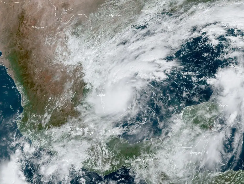
Satellite image of Tropical Storm "Milton" at 16:50 UTC on October 5, 2024. Credit: NOAA/GOES-East, RAMMB/CIRA, The Watchers
At the time of formation, the center of Milton was located approximately 355 km (220 miles) north-northeast of Veracruz, Mexico, and 590 km (365 miles) west-northwest of Progreso, Mexico.
The system had maximum sustained winds of 65 km/h (40 mph), with higher gusts, and was moving slowly north-northeast at 6 km/h (3 mph). The storm’s minimum central pressure was estimated at 1 006 hPa.
The current forecast calls for strengthening in the coming days and Milton is expected to reach hurricane strength before striking central Florida’s west coast next week.
Areas of heavy rainfall will also impact portions of Florida on Sunday and Monday, October 5 and 6, well ahead of the tropical system, with heavy rainfall more directly related to the system expected by later Tuesday through Wednesday, October 9.
This rainfall brings the risk of flash, urban, and areal flooding, along with minor to isolated moderate river flooding.
Residents in the affected areas are advised to monitor updates and prepare for severe weather conditions.

Milton is expected to produce 50 to 100 mm (2 to 4 inches) of rainfall across parts of the northern Yucatan Peninsula and western Cuba.
Swells generated by the system will begin affecting the coast of the southwestern Gulf of Mexico today. These swells are expected to extend northward and eastward along much of the Gulf Coast by early next week, creating life-threatening surf and rip current conditions.
References:
1 Tropical Storm Milton Tropical Cyclone Update – NWS/NHC -October 5, 2024
2 Tropical Depression Fourteen Advisory Number 1 – NWS/NHC – October 5, 2024

Teo Blašković founded The Watchers in 2011 and edited it until 2026, covering seismic and volcanic activity, extreme weather, space weather and near-Earth objects. Articles on this page are his archive.
Published in the last 24 hours
- High Risk of excessive rainfall covers Florida’s Space Coast as St. Johns River near Cocoa reaches 5.67 m
- Cyclone Akvan weakens after landfall near Gopalpur; more than 300 000 evacuated in Odisha, India
- In January 1862, California’s new governor took a rowboat to his own inauguration, after 45 days of storms had turned the Central Valley into a lake up to 300 miles long Epicenter
- People who stayed put through the 2017 hurricanes were more often the ones with flood insurance, a survey of 2,557 Gulf Coast residents found, and the authors suggest the policy may have made the storm feel less dangerous Epicenter
