
Seismic imaging reveals fault-controlled volcanic plumbing beneath Lipari, Italy
New seismic imaging has resolved a system of structures extending to about 10 km (6.2 miles) beneath Lipari in Italy’s Aeolian Islands, with the deepest reflectors aligned with the Tindari–Letojanni fault system. The results indicate that the fault system may control part of the island’s volcanic plumbing architecture, while a strong reflector beneath the San Calogero hydrothermal field may mark a boundary between the shallow hydrothermal system and deeper intrusive rocks.
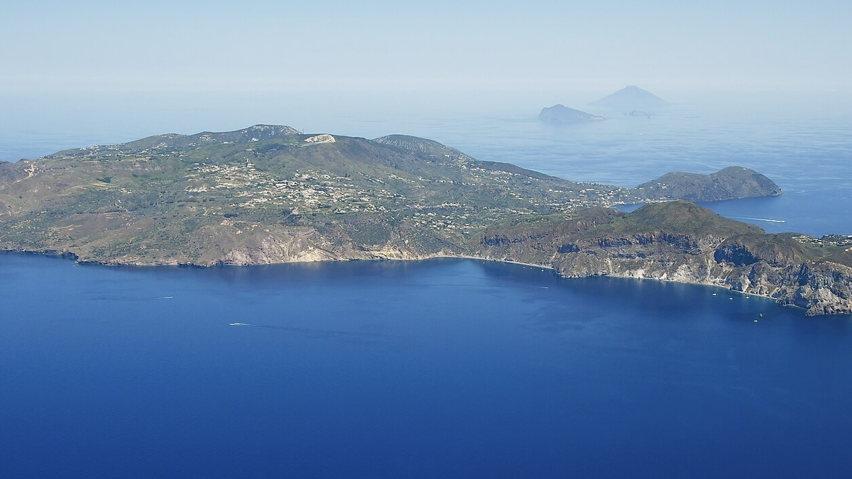
Aerial image of Lipari (view from the southwest). Credit: Carsten Steger
Earlier ambient-noise tomography using data from the same 2018 experiment produced a three-dimensional velocity model to a depth of about 2.5 km (1.6 miles). The new matrix-imaging analysis extends the imaged relative-reflectivity structure to approximately 10 km (6.2 miles) and identifies specific structures as priority targets for future seismic, deformation, gas, and electrical monitoring.
Wei, Liu and Chen (2026), writing in Geophysical Research Letters, used passive seismic matrix imaging to reanalyze data recorded across Lipari in 2018.
The deepest coherent structures form steep reflector bands between approximately 3 and 10 km (1.9–6.2 miles) beneath the central-western and southern parts of the island. Their geometry aligns with the Tindari–Letojanni fault corridor.
A reflector is not a photograph of magma. It marks a location where seismic waves encounter a sufficiently strong change in physical properties to send energy back toward the surface.
In volcanic crust, such contrasts can arise from fractured rock, lithological boundaries, cooled intrusions, fluids, or zones containing melt. The imaging therefore reveals the geometry of subsurface contrasts but does not uniquely determine what material produces them.
The researchers interpret the fault-aligned pattern as evidence for a long-lived structural corridor that may have provided favorable pathways for magma-fluid transfer.
That distinction is important. The study identifies an architecture capable of organizing subsurface movement over geological time; it does not show magma currently rising through the fault.
A second major feature lies beneath the San Calogero hydrothermal field.
There, the researchers resolved a laterally continuous reflector at approximately 1–2 km (0.6–1.2 miles) depth. Combined with earlier seismic-velocity results, the structure is consistent with a candidate boundary between an altered shallow cap and a more competent intrusive complex below.
Physically, such a boundary could matter because differences in permeability and rock properties can influence where hydrothermal fluids accumulate or move.
The authors propose that the San Calogero reflector could therefore become a specific monitoring target. Changes in deformation, gas flux, temperature, or electrical properties around the structure could help test whether it behaves as a hydraulic boundary within the hydrothermal system.
The deeper imaging became possible because matrix imaging approaches the volcanic wavefield differently from conventional tomography.
The 2018 experiment deployed 48 seismic nodes across Lipari, with 46 recording continuously for approximately 30 days. The researchers used vertical-component inter-station cross-correlations between 1 and 10 Hz and assembled them into a reflection matrix.
Adaptive wavefield-aberration correction was then used to compensate for distortions caused by the strongly heterogeneous volcanic crust. The procedure strengthens coherent reflected and singly scattered energy relative to the incoherent, multiply scattered background.
Earlier ambient-noise tomography from the same field experiment produced a three-dimensional velocity model to approximately 2.5 km (1.6 miles) depth. The new matrix-imaging volume resolves recognizable relative-reflectivity structures approaching 10 km (6.2 miles).
Sensitivity tests showed that the main reflector domains remained recognizable when acquisition effects, propagation heterogeneity, noise, and changes in the reference velocity model were considered. However, local reflector amplitudes, boundaries, widths, and absolute positions varied, meaning the images are more robust for identifying broad structural domains than for fixing every reflector boundary precisely.
The result does not reveal one continuous magma reservoir or a single open conduit from depth to the surface.
Reflectors vary along the fault system, and some shallow structures are not visibly connected to deeper ones. The authors interpret that segmentation as compatible with a vertically extensive but laterally partitioned transfer-and-storage architecture.
That interpretation remains non-unique because seismic reflectivity constrains structural contrasts much better than composition or present activity.
As of September 17, Italy’s Department of Civil Protection states that formal volcanic alert levels have not been defined for Lipari. The 2026 study reports subsurface structure, not an escalation in volcanic activity, and its images cannot by themselves establish that magma is currently ascending or that an eruption is approaching.
The strongest immediate value of the work is therefore in defining targets for future observation and monitoring.
Wei et al. identify the Tindari–Letojanni corridor, the San Calogero reflector and shallow eastern structures as priority targets for combined seismic, geodetic, gas, electrical and marine observations.
Relocating local earthquakes could test whether seismicity concentrates along the deep reflector system. Deformation, gas, temperature and electrical measurements at San Calogero could determine whether the shallow reflector behaves as a barrier or pathway for hydrothermal fluids.
Offshore extensions of the structure remain less constrained because the experiment was primarily land-based. Marine seismic surveys and ocean-bottom instruments could test whether the fault-controlled architecture continues beyond Lipari’s coastline.
The unresolved question is therefore not whether the seismic structures exist, but what they contain and whether any are active pathways today. Answering that will require combining the new geometry with earthquake locations, attenuation imaging, magnetotellurics, gravity, geochemistry, and time-dependent deformation.
References:
1 Wei, J., Liu, Q., & Chen, L. (2026). Fault-controlled plumbing system beneath Lipari Volcanic Island revealed by seismic matrix imaging. Geophysical Research Letters, 53(17), e2026GL122836. https://doi.org/10.1029/2026GL122836
2 Calò, M., Di Luccio, F., Persaud, P., & Ventura, G. (2023). Ambient noise tomography of the Lipari volcanic island (Southern Italy) from a dense nodal array. Geophysical Research Letters, 50(4), e2022GL101022. https://doi.org/10.1029/2022GL101022

I’m a science journalist and researcher at The Watchers, contributing to the Epicenter edition, where I cover peer-reviewed scientific research and emerging discoveries across Earth and space sciences. With a background in astronomy and a passion for environmental science, I’ve worked in shark and coral conservation in Fiji, conducting reef and shark-behavior research, contributing to mangrove restoration, and earning PADI Open Water and Coral Reef Certifications. I bring a blend of scientific rigor and storytelling to illuminate the discoveries shaping our planet and beyond.
Published in the last 24 hours
- A fireball over northern China on 6 November 2026 punched a crater into a wheat field at Beigucheng village in Hebei; the Institute of Geochemistry has now classified the fallen stones as L6 ordinary chondrites. Epicenter
- Weather radar tracked meteorites falling into Cape Cod Bay after a 1.1-kiloton fireball over Massachusetts on 30 May 2026; researchers have now traced its orbit almost out to Jupiter. Epicenter
- 10 named storms, one hurricane for the first time since 1925: Why has the Atlantic been so quiet in 2026 Epicenter
- Bay of Bengal system to become Cyclone Akvan, landfall forecast between Nellore and Tuni on November 20, India
