
Magnetic anomalies detected by Swarm satellites days before Myanmar’s M7.7 quake
Researchers have identified satellite-detected magnetic anomalies up to eight days before the M7.7 earthquake that struck Myanmar on March 28, 2025, according to a study published in Scientific Reports on October 22, 2025.
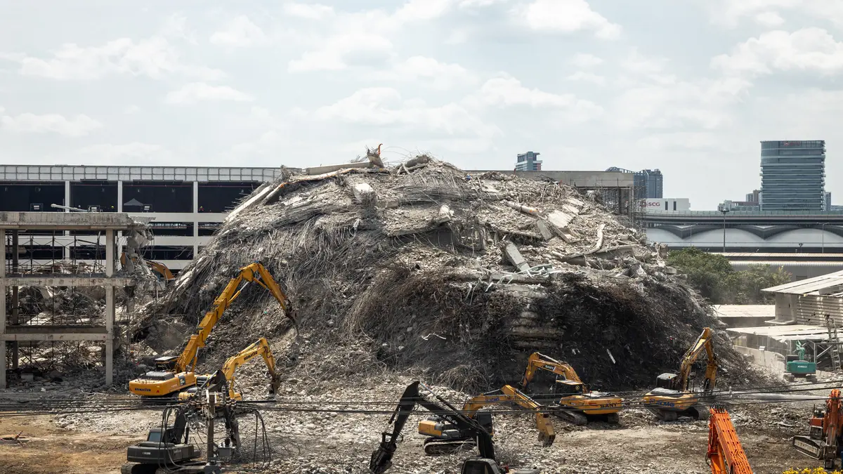
Collapse of New Headquarters of the State Audit Office (Thailand) after the 2025 Myanmar earthquake, pictured from JJ Mall, Bangkok. Credit: Supanut Arunoprayote
In late March 2025, an M7.7 earthquake ripped through Myanmar’s Sagaing region, one of Southeast Asia’s most active tectonic zones. Now, satellite data reveal that the planet’s magnetic field may have signaled the coming disaster days before it happened.
Researchers analyzed 10 days of vector magnetic field data recorded by the European Space Agency’s Swarm satellites before the earthquake. They found unusual variations in the Y component of the magnetic field, a parameter particularly sensitive to lateral crustal stress. These disturbances appeared in 22 out of 85 orbital passes and were detected as early as eight days before the mainshock.
One of the clearest signals came from Swarm Alpha’s orbit 63 682, which crossed only about 50 km (31 miles) from the eventual epicenter four days before the earthquake. The anomaly lasted roughly 135 seconds as the satellite moved southward across the region.
The same pattern was later confirmed in orbits from Swarm Bravo and Charlie at distances of about 97 km (60 miles) and 407 km (253 miles), respectively. All were recorded under geomagnetically quiet conditions, ruling out external space weather influences.
When researchers compared the satellite paths to the U.S. Geological Survey intensity map, they found a striking overlap between the magnetic anomaly and the zone of maximum ground shaking. This alignment supports the idea that the detected signal originated from the same crustal stresses that triggered the earthquake.
Measuring the invisible
Swarm satellites orbit Earth at altitudes between 430–510 km (270–317 miles) and carry high-precision vector magnetometers that measure tiny fluctuations in Earth’s magnetic field. The Myanmar study used cubic-spline filtering to remove long-term trends, isolating the short-term residuals that could indicate pre-seismic activity.
The analysis covered 85 half-orbits above the “Dobrovolsky region,” a theoretical circular area around the expected epicenter where pre-seismic signals might occur. Researchers extracted the X, Y, and Z magnetic components for each orbit and identified 22 with anomalies exceeding background noise. These signals were clustered close to the Sagaing Fault, a strike-slip boundary known for producing destructive earthquakes.
For each detected anomaly, the team measured its amplitude, duration, and distance from the epicenter. Using these parameters, they applied four previously developed empirical equations designed to estimate earthquake magnitude from satellite data. The model that included satellite-to-epicenter distance produced the most accurate results, predicting a magnitude of about M7.2—close to the actual M7.7 event.
The analysis also revealed an intriguing pattern: the “energy” values of the anomalies, a measure combining amplitude and duration, consistently fell within a narrow range between 570 and 577.
Although the authors note that this index is not measured in standard physical units, the consistency across multiple passes suggests it may represent a characteristic signature of earthquake-related magnetic disturbances.
 Building collapsed in Myanmar after M7.7 earthquake on March 28, 2025. Image credit: SmuitHansd
- A temple destroyed by the M7.7 earthquake in Myanmar on March 28, 2025. Image credit: amithype


How atmosphere and ground talk to each other
The possible link between magnetic anomalies and earthquakes lies in a process known as Lithosphere–Atmosphere–Ionosphere Coupling, or LAIC. When tectonic stress builds in the crust, microcracks can open, releasing gases such as radon. These gases ionize the surrounding air and alter its electrical conductivity, potentially disturbing the local electric and magnetic environment.
The disturbances can then propagate upward, affecting the ionosphere hundreds of kilometers above. Satellites such as Swarm can detect these perturbations as subtle fluctuations in magnetic field components. This idea is not new—the earlier DEMETER mission (2004–2010) observed similar pre-seismic electromagnetic effects—but Swarm provides better global coverage and higher measurement precision.
Still, not all anomalies are created equal. Solar storms, cosmic radiation, and even instrument drift can produce signals that resemble seismic precursors. To separate true pre-seismic patterns from unrelated disturbances, scientists cross-check satellite readings with geomagnetic indices such as Dst and Kp, which describe the overall quietness of Earth’s magnetosphere.
During the Myanmar events, both indices remained low, increasing confidence that the anomalies were of lithospheric origin.
Toward real short-term earthquake forecasting
The Myanmar findings add to a growing body of evidence that magnetic and ionospheric signals may precede large earthquakes. If confirmed through repeated observation, such data could become part of a multi-parameter earthquake monitoring system that integrates magnetic, ionospheric, and thermal indicators.
Researchers emphasize that this method is still in an experimental stage. The reliability of magnetic precursors varies across regions and depends on factors such as crustal composition, satellite geometry, and ambient geomagnetic conditions.
To move toward operational forecasting, scientists will need much larger datasets spanning different tectonic environments.
Future research will test the same empirical equations on other large earthquakes and explore additional parameters like plasma density and electron temperature. Machine-learning approaches may also help distinguish genuine seismic precursors from natural background variations.
Although predicting the exact time and place of an earthquake remains beyond current capability, this study suggests that we may be getting closer to identifying when the Earth is under unusual magnetic stress. In a region as seismically active as Myanmar, even a few days of advance warning could make a difference.
Context and significance
Myanmar sits at the intersection of four tectonic plates, where the Indian, Eurasian, Sunda, and Burma plates interact along complex boundaries. The Sagaing Fault, which runs north to south through central Myanmar, has generated some of the region’s largest and most destructive earthquakes. Historical records show multiple events exceeding magnitude 7 since the 20th century.
The 2025 earthquake caused severe shaking across the Sagaing and Mandalay regions and affected neighboring countries. Reported fatalities exceeded 5 000, with extensive infrastructure damage. The event renewed interest in short-term earthquake forecasting methods, particularly those that could provide days or even hours of notice.
The Swarm results suggest that satellites could complement ground-based seismometers by observing electromagnetic changes over wide areas. If the observed Y-component anomalies prove to be a recurring feature before large earthquakes, space-based magnetic monitoring could become an important part of future early-warning frameworks.
This discovery also illustrates how Earth-observation satellites originally designed for geophysics can yield unexpected insights into seismic hazards. By tracking small, consistent disturbances in the magnetic field, scientists are beginning to read subtle signals that may precede the planet’s most destructive natural events.
References:
1 Detection of pre-seismic magnetic field anomalies using Swarm satellite data: a case study of the 2025 Mw7.7 Myanmar earthquake – Homayoon Alimoradi et al. – Nature: Scientific Reports – October 22, 2025 – https://doi.org/10.1038/s41598-025-20901-1 – OPEN ACCESS

I’m a science journalist and researcher at The Watchers, contributing to the Epicenter edition, where I cover peer-reviewed scientific research and emerging discoveries across Earth and space sciences. With a background in astronomy and a passion for environmental science, I’ve worked in shark and coral conservation in Fiji, conducting reef and shark-behavior research, contributing to mangrove restoration, and earning PADI Open Water and Coral Reef Certifications. I bring a blend of scientific rigor and storytelling to illuminate the discoveries shaping our planet and beyond.
Interesting, but I wonder how manmade processes especially industrial and/or agricultural emissions can affect ionization as well, potentially introducing more noise. As well as natural radon variability itself in various different types of rock and strata.