
After five years of monitoring, scientists map Popocatépetl’s interior in 3D
Before dawn, while most of central Mexico sleeps, a small group of scientists climbs the dark slopes of Popocatépetl, one of the country’s most active volcanoes. Their goal is to recover seismic instruments that, after five years of continuous monitoring, have allowed researchers to construct the first complete three-dimensional image of the volcano’s interior. The model reveals multiple zones where magma accumulates beneath the crater, extending to depths of about 18 km (11 miles), and offers new insight into how Popocatépetl functions and how its eruptions may develop.
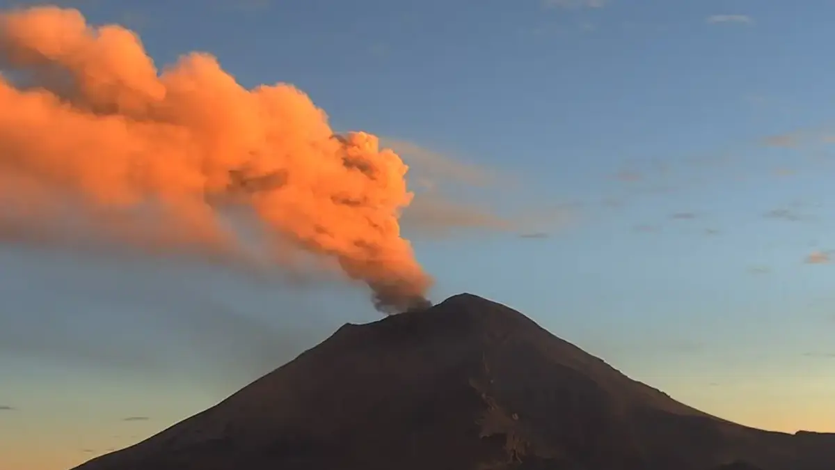
Popocatepetl volcano on December 17, 2024. Credit: CENAPRED
Before dawn, while most of central Mexico sleeps, a small group of scientists climbs the dark slopes of Popocatépetl, one of the most active volcanoes on Earth. Above them, the crater occasionally exhales gas and ash. Beneath their boots, the ground is never completely still.
Their goal is simple in principle and daunting in practice: to find out what is happening inside the volcano.
For five years, researchers from the National Autonomous University of Mexico (UNAM) have repeatedly climbed Popocatépetl carrying dozens of kilograms of instruments, batteries, computers, and sensors. They have worked through freezing nights, sudden storms, ashfall, and the constant risk that an explosion could destroy months of data in seconds.
The effort has now paid off. The team has produced the first complete three-dimensional image of the entire interior of Popocatépetl, a volcano rising 5 452 m (17 883 feet) above sea level and capable of affecting millions of people living around it. The model reveals where magma accumulates beneath the crater and provides a clearer picture of how the volcano works, information that could eventually help authorities respond more effectively to eruptions.
Marco Calò, a geophysicist at UNAM’s Geophysics Institute and leader of the project, invited The Associated Press to join the team on its most recent expedition—the last before the research is formally published.
Inside an active volcano, nothing is static. Rock deforms, magma migrates, gases escape, and aquifers shift. All of this motion produces seismic signals.
Popocatépetl is no exception, yet despite its activity and the roughly 25 million people living within 100 km (62 miles) of the crater, it long lacked a detailed internal map. Houses, schools, hospitals, and five major airports could all be affected by a significant eruption.
Earlier attempts to image the volcano’s interior, carried out about 15 years ago, produced contradictory results and lacked the resolution needed to understand how the volcanic edifice was constructed or where magma was actually stored, Calò said.
To change that, his team expanded the monitoring network from 12 seismographs operated by Mexico’s National Disaster Prevention Center to 22 instruments encircling the volcano. While only a few sensors are enough to detect an emergency, many more are needed to understand what causes those emergencies.
Each device records ground vibrations 100 times per second, generating a continuous stream of measurements. Across a network of stations, this quickly adds up to very large data volumes that must be stored, transmitted, and processed in near real time.
Karina Bernal, a 33-year-old doctoral student on the project, used artificial intelligence to process the signals, adapting algorithms originally developed for other volcanoes. She trained the system to recognize the different types of tremors generated by Popocatépetl.
“I taught the machine about the different kinds of tremors there are in El Popo,” she said, using the volcano’s popular nickname.
Gradually, patterns emerged. From those patterns, the team inferred what kinds of material lay beneath the surface, whether they were solid or molten, how hot they were, and how deep they sat. Eventually, they were able to map it all.
The resulting image looks nothing like the simple diagrams many people remember from school, with a single magma chamber feeding a straight conduit to the surface.
Instead, the three-dimensional cross-section extends 18 km (11 miles) below the crater and shows multiple pools of magma at different depths, separated by rock or partially solid material. These magma bodies are not evenly distributed. They appear more numerous beneath the southeastern side of the volcano, a detail that may help explain patterns of seismic activity observed at the surface.
Popocatépetl emerged in its current form more than 20 000 years ago, growing inside the remains of older volcanoes. It has been persistently active since 1994, releasing plumes of gas, smoke, and ash almost daily.
From time to time, its activity builds a lava dome over the main vent. Eventually, the dome collapses, triggering an eruption. The most recent such event occurred in 2023.
Calò, a 46-year-old Sicilian, spoke about the volcano with a mix of scientific precision and evident affection. He notes that Popocatépetl’s height can change after eruptions and recounts its long history with humans.
In the first century, a village called Tetimpa on the volcano’s slopes was buried by ash in what Calò describes as Popocatépetl’s own “little Pompeii.” In the early 20th century, people triggered an eruption themselves by using dynamite to extract sulfur from the crater.
Popocatépetl also emits more volcanic greenhouse gases than almost any other volcano on Earth. Even so, Calò points out, those emissions are still only a fraction of what humans produce in nearby Mexico City.
For years, Calò studied volcanoes mostly from a computer screen. Trying to understand something so physical without ever touching it left him dissatisfied. Popocatépetl changed that.
“It’s majestic,” he said.
After hours of climbing, the team pitches camp in a pine grove at about 3 800 m (12 500 feet) above sea level, a spot that appears safe from pyroclastic explosions, judging by the height of the trees that have managed to grow there.
Higher up, vegetation disappears, replaced by ash and sediment.
The scientists cross a dry lahar channel—a mixture of ash and rock that turns into a destructive mudflow during the rainy season. From there, the view opens up. To the east stands Pico de Orizaba, Mexico’s tallest mountain, alongside the dormant volcano La Malinche. To the north lies Iztaccíhuatl, the inactive peak known as “the sleeping woman.”
At night, Popocatépetl seems louder. Echoes make explosions sound as if they come from different directions, until a puff of smoke from the crater reveals the true source. When activity increases, ash can fall like rain. On the darkest nights, the rim of the crater glows orange.
Karina Rodríguez, a 26-year-old master’s student on the team, says you can sometimes hear the ground itself tremble.
At 4 200 m (13 780 feet), the backpacks feel heavier, the air is thinner, while ash, dark and still warm in places, dominates the landscape.
At one seismic station, the team digs up the equipment and cheers when it turns out to still be working. They download the data and rebury it.
Nearby, a massive “volcanic bomb”—a rock roughly 1.5 m (about 5 feet) across and weighing several tons—sits as a reminder of how eruptions begin. The summit area is officially restricted for that reason, though not everyone respects the rules. In 2022, a person was killed after being struck by a rock about 300 m (980 feet) from the crater.
A bottle of tequila tucked into a rocky hollow known as Popocatépetl’s “belly button” hints at the traditions surrounding the volcano, including an annual pilgrimage that some view as a connection to the underworld.
Not every monitoring station remains operational over time. At one site, data transmission stopped several months ago after the battery failed. Similar problems are common at remote installations: rodents sometimes damage power and data cables, while explosions in nearby areas can destroy equipment entirely. Each failure creates gaps in the long-term records that scientists depend on to track changes and assess hazards.
Even so, the project has delivered solid results. Repeating the imaging in the future will allow scientists to track changes inside the volcano and help authorities make better decisions when eruptions occur.
The work has also raised new questions. Why are tremors more frequent on the southeastern side, where more magma appears to be stored? What does that mean for future activity?
This final expedition marks the end of the fieldwork phase. Soon, years of effort will be distilled into a scientific publication. Watching Popocatépetl’s interior move in three dimensions on a computer screen makes every climb worthwhile.
“It’s what drives you to start another project,” Rodríguez said, “and keep climbing.”
References:
1 What’s inside Mexico’s Popocatépetl? Scientists obtain first 3D images of the whole volcano – AP News – December 30, 2025

I’m a science journalist and researcher at The Watchers, contributing to the Epicenter edition, where I cover peer-reviewed scientific research and emerging discoveries across Earth and space sciences. With a background in astronomy and a passion for environmental science, I’ve worked in shark and coral conservation in Fiji, conducting reef and shark-behavior research, contributing to mangrove restoration, and earning PADI Open Water and Coral Reef Certifications. I bring a blend of scientific rigor and storytelling to illuminate the discoveries shaping our planet and beyond.
Commenting rules and guidelines
We value the thoughts and opinions of our readers and welcome healthy discussions on our website. In order to maintain a respectful and positive community, we ask that all commenters follow these rules.