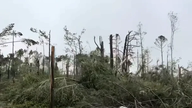
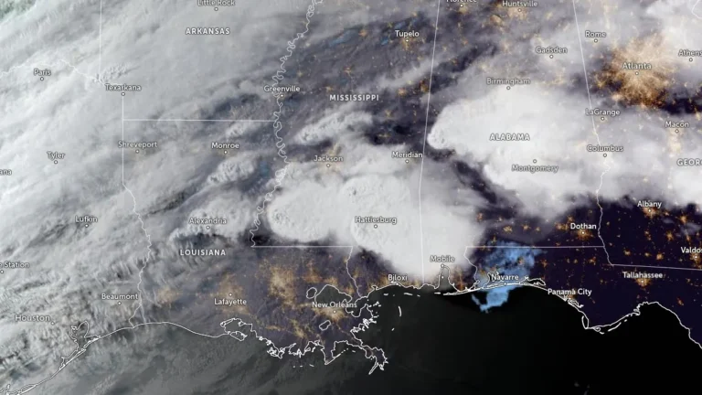
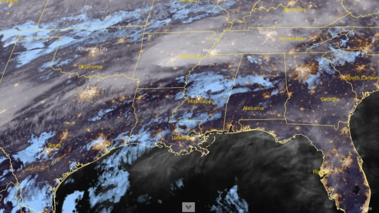
• Rare high-impact windstorm hits Zagreb, Croatia, in one of the city’s strongest wind episodes on record

    One of the strongest wind episodes on record in Zagreb, and the most intense in the modern Zagreb-Maksimir measurement record, struck the Croatian capital on March 27, 2026, with gusts exceeding 120 km/h (75 mph), causing widespread damage, major transport disruption, and multiple injuries, including two serious cases reported by authorities.

  • Damaging winds, hazardous surf and alpine snow impact south-eastern Australia

    A multi-hazard weather system began affecting south-eastern Australia on March 26, 2026, bringing severe thunderstorms to parts of New South Wales, followed by damaging winds, hazardous surf along the NSW coast, a sharp temperature drop, and snow in alpine areas. Forecasts through March 28 called for gusts up to 120 km/h (75 mph) in exposed coastal areas, offshore wave heights of several meters, and wintry conditions over higher terrain, while NSW SES reported hundreds of storm-related incidents during the initial phase of the event.

  • Freeze Warnings issued for parts of Kentucky, Indiana, Illinois and Missouri

    Freeze Warnings have been issued across Kentucky, southern Indiana, southern Illinois, and southeast Missouri, with sub-freezing temperatures forecast overnight into March 28, 2026. The warnings are in effect from late March 27 through the morning hours of March 28, with minimum temperatures expected between −4°C and −1.5°C (24–29°F). Frost and freeze conditions are expected to damage crops, sensitive vegetation, and exposed outdoor plumbing.

  • Tropical Cyclone Narelle crosses Gascoyne coast with destructive winds and flooding, Western Australia

    Severe Tropical Cyclone Narelle made landfall just south of Coral Bay, Western Australia, at approximately 09:30 AWST (01:30 UTC) on March 27, 2026, as a Category 3 system. It brought wind gusts up to 195 km/h (121 mph), intense rainfall, and a dangerous storm tide along the Gascoyne coast. Severe weather conditions are continuing inland through the day and are forecast to persist into March 28.

  • Severe Tropical Cyclone Narelle to pass close to the North West Cape, bringing destructive winds to Western Australia

    Severe Tropical Cyclone Narelle strengthened to Category 4 off the coast of Western Australia on March 26, 2026, and was forecast to pass close to the North West Cape before tracking south along the Gascoyne coast on March 27. The Bureau of Meteorology warned the system could bring very destructive wind gusts up to 275 km/h (171 mph), dangerous storm surge, and heavy rainfall capable of producing flash flooding across parts of the Pilbara and Gascoyne.

  • Tropical Cyclone Narelle strengthens off Western Australia, Category 4 intensity forecast near the coast

    Severe Tropical Cyclone Narelle re-intensified, reaching Category 3 strength off the coast of Western Australia on March 25, 2026, and is forecast to strengthen further while tracking parallel to the Pilbara coast. The system reached Category 3 intensity with sustained winds of 130 km/h (81 mph), with forecasts indicating strengthening to Category 4 as it approaches the North West Cape late March 26.

  • Subtropical low triggers Red Heavy Rain Warning in Northland, New Zealand

    A deep subtropical low prompted a Red Heavy Rain Warning for parts of Northland, New Zealand, on March 25, 2026, with 230–280 mm (9–11 inches) of rain forecast for areas east of Kaikohe from Doubtless Bay to Whangārei through early March 27. MetService and local authorities warned of dangerous river conditions, significant flooding and slips, with some communities at risk of isolation.