
Heavy, wet May snow disrupts Colorado’s Front Range
A heavy, wet late-season snowstorm affected Colorado’s Front Range, foothills, mountains, and I-25 urban corridor from Tuesday, May 5, into Wednesday, May 6, 2026, closing schools, prompting travel advisories and shelter activation, delaying flights at Denver International Airport, and causing scattered power outages. NWS Denver/Boulder forecast 13-20 cm (5-8 inches) along the I-25 corridor, with local totals up to 30 cm (12 inches) near the foothills and Palmer Divide. Heavier mountain snow was also forecast along and north of I-70, where CDOT warned of hazardous travel conditions.
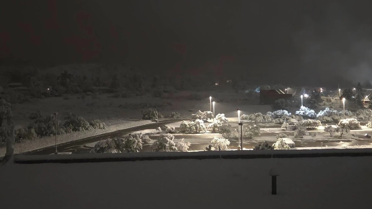
Image credit: NWS/Denver/Colorado
Winter Storm Warnings covered the I-25 corridor from Fort Collins, Boulder, and the Denver metro area to Castle Rock and Denver International Airport from 20:00 MDT Tuesday to 15:00 MDT Wednesday. The National Weather Service (NWS) warned that heavy snow accumulating on trees could break limbs, bring down power lines, and cause scattered outages, while slick and hazardous conditions remained possible for the Wednesday morning commute.
The highest totals were forecast for Rocky Mountain National Park, the Medicine Bow Range, Estes Park, Red Feather Lakes, Nederland, and the northern Front Range foothills. NWS forecast 15-41 cm (6-16 inches) for Summit County, the Mosquito Range, Indian Peaks Wilderness, and the southern Front Range foothills, with the heaviest snowfall generally along and north of I-70.
“A significant late-season winter storm is underway in the Rockies, with heavy snowfall expected to continue through tonight,” NWS forecaster Blanco-Alcala said. “Chances of at least minor impacts remain very high, at over 90%, per the latest Probabilistic Winter Storm Severity Index (WSSI-P).”
Among early NWS Local Storm Reports, a public observer measured 27 cm (10.5 inches) of snow at 2 NE Sunshine in Boulder County at 23:00 MDT on May 5.
Meteorologists at the Denver/Colorado NWS office said the midnight snowfall measurement at their office brought 14.4 cm (5.7 inches) of snow and warned that snowfall will intensify across the Denver metro again after 01:00 MDT on May 6.
The Colorado Department of Transportation (CDOT) warned that the storm’s peak impacts would affect travel during the Wednesday morning commute, when cooling temperatures were expected to produce snow-covered roads at lower elevations before conditions improved Wednesday afternoon.
About 100 CDOT plows were assigned to the Denver region during the storm, with crews prioritizing interstates and major roadways before secondary roads.
Denver7 reported Wednesday closures for multiple school districts, including Denver Public Schools, JeffCo Public Schools, Boulder Valley School District, and Adams 14. The City and County of Denver also announced a 2-hour delayed opening for government agencies on Wednesday because of inclement weather.
According to PowerOutage, 8 129 homes and businesses were without power in Colorado as of 06:32 UTC on May 6. Jefferson County had 2 081 customers without power, followed by Denver County with 1 958, Adams County with 1 481, Boulder County with 982, and Weld County with 972. Xcel Energy accounted for 7 146 tracked outages.
More than 500 delays were reported at Denver International Airport on Tuesday evening, while the Colorado Rockies postponed their Tuesday game against the New York Mets and moved Wednesday’s game later in the day.
“Snowfall is expected to remain very wet, dense, and heavy, which could lead to tree and power line damage,” Blanco-Alcala noted.
“Beginning tonight, a widespread and hard freeze is expected as the snowfall begins to wind down. Travel impacts are likely across much of the area, especially in higher elevations where snowy and slushy roads are possible. Additionally, exercise caution while shoveling; the wet, heavy nature of the snow may increase the risk of overexertion and injury.”
May snowfall is uncommon in Denver but remains within the documented seasonal range. According to NWS climate data, the average May snowfall in Denver is 4.3 cm (1.7 inches), while the snowiest May on record produced 39 cm (15.5 inches) in 1898.
References:
1 Watches, Warnings & Advisories – NWS – May 6, 2026
2 Preliminary Local Storm Report – NWS/Denver/Boulder – May 6, 2026
3 Denver’s Fall/Winter/Spring Statistics – NWS/Denver/Boulder – Accessed May 6, 2026
4 Probabilistic Heavy Snow and Ice Discussion – NWS/WPC – May 6, 2026
I'm a dedicated researcher, journalist, and editor at The Watchers. With over 20 years of experience in the media industry, I specialize in hard science news, focusing on extreme weather, seismic and volcanic activity, space weather, and astronomy, including near-Earth objects and planetary defense strategies. You can reach me at teo /at/ watchers.news.
Commenting rules and guidelines
We value the thoughts and opinions of our readers and welcome healthy discussions on our website. In order to maintain a respectful and positive community, we ask that all commenters follow these rules.