Tornado damages 28 homes in two villages of Demak Regency, Central Java, Indonesia
At least 28 homes and a vehicle were damaged after a tornado struck the Harjowinangun and Kebsonsari villages in Central Java, Indonesia, on May 2, 2026.

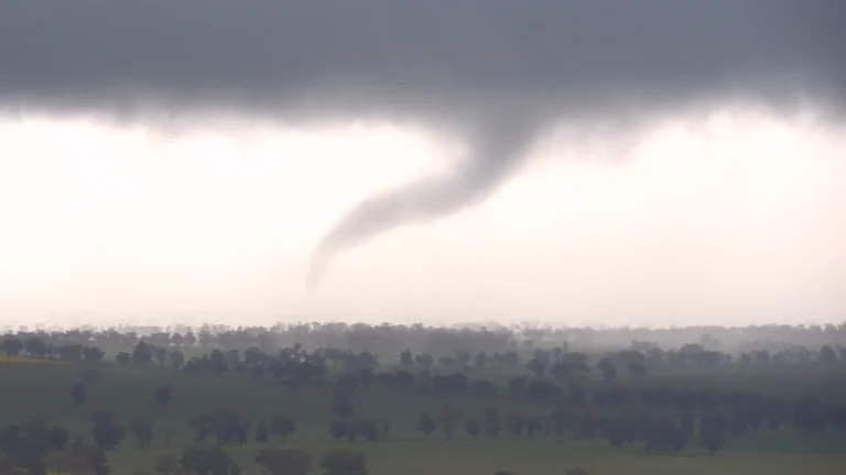
At least 28 homes and a vehicle were damaged after a tornado struck the Harjowinangun and Kebsonsari villages in Central Java, Indonesia, on May 2, 2026.
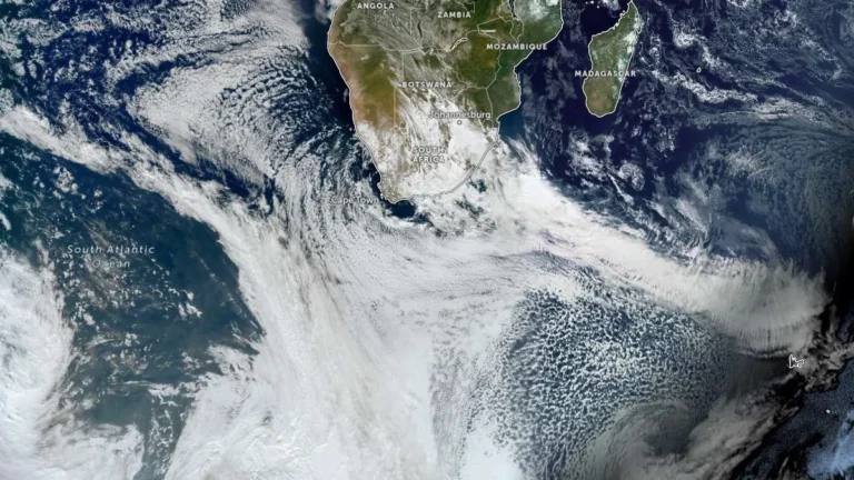
SAWS has issued Orange Level 8 warnings for disruptive rainfall in parts of the Eastern and Western Cape for May 5–7, 2026, as an intense cut-off low pressure system moves across the country, raising the risk of flooding, damaging winds, and hazardous coastal conditions.
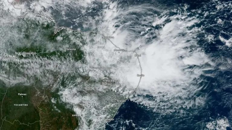
Heavy rainfall left 6 people dead and nearly 3 000 people displaced or homeless in Pernambuco, northeastern Brazil, after floods, landslides, and river overflows affected Recife, the surrounding metropolitan area, and the Zona da Mata Norte on May 1 and 2, 2026. CEMADEN kept parts of Pernambuco under moderate hydrological and geological risk on May 3 due to saturated soil, previous rainfall accumulations, and elevated river levels.
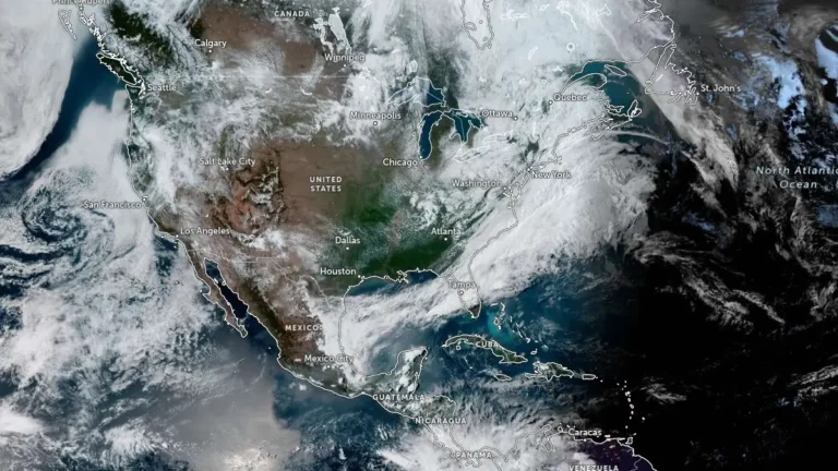
Storm-force winds and high seas are forecast over parts of the western Atlantic on Sunday, May 3, 2026, as a rapidly deepening low-pressure system moves northeast off the U.S. East Coast. The NWS Ocean Prediction Center issued storm warnings for offshore waters, with forecast winds reaching 110 km/h (70 mph) and seas building up to 7 m (23 feet).
The National Weather Service preliminarily rated the Mineral Wells tornado in Texas as EF3, with estimated peak winds of 233 km/h (145 mph), after surveying damage from the April 28, 2026, severe weather event. NWS listed 5 injuries and 0 fatalities, while Mineral Wells officials kept a curfew in place for the affected area as cleanup and damage assessment continued.
A severe thunderstorm with hail, record rain, and strong winds hit Bengaluru, Karnataka, India, on Wednesday evening, April 29, 2026, killing at least 7 people in a hospital wall collapse and 3 more in separate incidents.
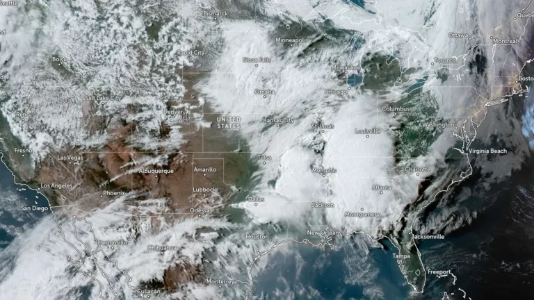
Giant hail up to 11.4 cm (4.5 inches) was reported in Johnson County, Texas, late on April 28, 2026, while a separate corridor of 7.6–10.2 cm (3–4 inches) hail caused structural and vehicle damage across southwest Missouri earlier the same day. The storms were part of a multi-state severe weather outbreak stretching from Oklahoma and Arkansas into Mississippi, producing widespread reports of large hail, damaging winds, and isolated tornadoes. Confirmed impacts included broken windows, roof damage, and an animal fatality at a zoo in Springfield, Missouri.

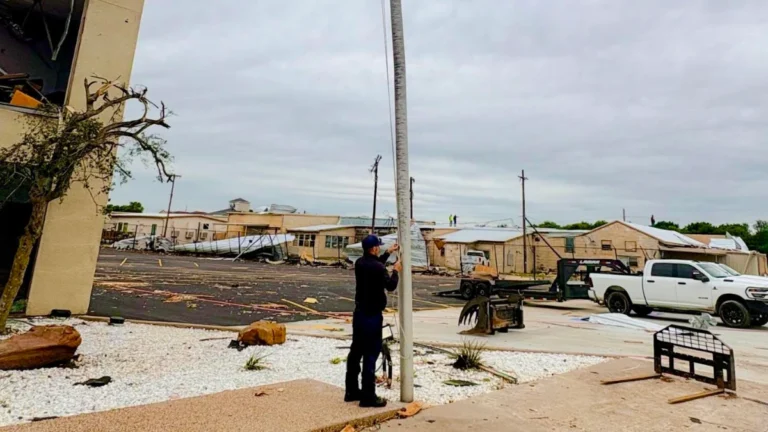
Severe thunderstorms struck Mineral Wells on April 28, 2026, injuring at least two people and causing widespread damage across the city. Emergency crews responded to damaged homes and debris-strewn areas, while local authorities declared a disaster and imposed a curfew.

A tornado was reported in Germantown, Clinton County, Illinois, on April 27, 2026, bringing down large trees and damaging homes as severe weather outbreak struck parts of the Midwest.
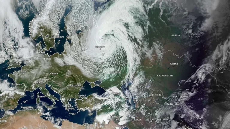
A late-season snowstorm swept across central and northwestern Russia on April 27–28, 2026, leaving three people dead and cutting electricity to more than 76 000 residents, according to regional authorities and the Russian Emergency Situations Ministry. Strong winds reaching up to 97 km/h (60 mph) combined with wet snow to damage infrastructure and disrupt transport, including in Moscow.