
I am an Assistant Editor and Severe Weather & Science Journalist at The Watchers, specializing in real-time severe weather coverage, geophysical event reporting, and research-driven scientific analysis. You can reach me at rishav(at)watchers(.)news.

  • Bavi forecast to intensify into super typhoon near Northern Mariana Islands

    Tropical Storm Bavi is forecast to undergo rapid intensification from late July 2, 2026, and become a super typhoon as it approaches the Northern Mariana Islands. The Joint Typhoon Warning Center (JTWC) forecast issued at 09:00 UTC calls for 1-minute sustained winds of 250 km/h (155 mph) near the system’s peak intensity around July 5.

  • Tropical Storm Douglas forms over the eastern Pacific, forecast to weaken into a remnant low by July 3

    Tropical Storm Douglas formed over the eastern North Pacific Ocean at 21:00 UTC on July 1, 2026, and became the fourth named storm of the 2026 eastern Pacific hurricane season. The cyclone is located well west-southwest of the southern tip of Baja California, Mexico, and is expected to remain over open waters while weakening into a post-tropical remnant low by July 3.

  • Enhanced Risk issued for severe thunderstorms across Midwest and Upper Great Lakes

    Severe thunderstorms will affect portions of the Upper Midwest and Great Lakes through Wednesday, July 1, 2026, with damaging wind gusts of up to 130 km/h (80 mph), isolated large to very large hail and a few tornadoes possible. Parts of the region have been put under an Enhanced Risk of severe thunderstorms through Wednesday, while a Slight Risk extends across portions of the central High Plains and the Northeast.

  • Aspen Acres Fire destroys 155 structures, three Colorado wildfires burn over 25 000 ha (62 000 acres)

    The Aspen Acres Fire destroyed at least 155 structures in Pueblo and Custer counties. This fire, together with Ferris and Gold Mountain fires burned a combined 25 077 ha (61 969 acres) across Colorado by late June 30, 2026. Critical fire weather conditions are forecast to continue supporting rapid fire growth through at least July 3.

  • Preliminary 211 km/h (131 mph) gust in South Dakota among the strongest thunderstorm winds in U.S.

    A wind gust of 211 km/h (131 mph) measured near Holabird, South Dakota, during severe thunderstorms on June 29, 2026, would rank as the 15th-strongest thunderstorm wind gust ever recorded in the United States if confirmed. The storms damaged grain bins, metal buildings, trees and other infrastructure across several counties with straight-line winds extending from south-southwest of Andover into the town.

  • Out-of-control wildfires force evacuations in Wrigley and Fort Simpson, Northwest Territories, Canada

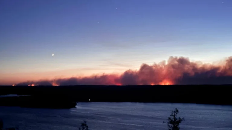
    Wildfires burning in Canada’s Northwest Territories prompted evacuation orders for the communities of Wrigley and Fort Simpson on June 28 and 29, 2026, as two lightning-caused fires remained out of control. The blaze threatening Fort Simpson had expanded to more than 8 900 ha (21 992 acres) by June 29, while more than 62 000 ha (153 209 acres) had burned across the territory.

  • Extreme heat alerts cover portions of 31 U.S. states, heat index up to 46°C (115°F)

    Extreme Heat Warnings, Extreme Heat Watches, and Heat Advisories are in effect across 31 U.S. states after the National Weather Service (NWS) issued a series of heat alerts on June 29, 2026. Peak heat index values are forecast to reach 46°C (115°F), with dangerous heat and humidity expected to persist into early July across parts of the Midwest, Northeast, Southeast, and central United States.