
Severe storms leave at least two dead, spawn at least six tornadoes, and cause flooding across the Midwest and Ohio Valley
At least two people died, 16 incarcerated people were hospitalized following a lightning strike and more than 800 000 electricity customers across Illinois, Indiana, Ohio and Kentucky were without power at 00:00 EDT on August 12 (04:00 UTC on August 12) after severe storms swept the Midwest and Ohio Valley on August 11, 2026. The storms included a preliminarily confirmed derecho associated with three confirmed EF1 tornadoes in Iowa and three preliminarily confirmed tornadoes in the Chicago area. A maximum gust of 160 km/h (99 mph) was measured at Gary, Indiana, while 127-203 mm (5-8 inches) of rain flooded structures, vehicles and roads in parts of southeastern Ohio.
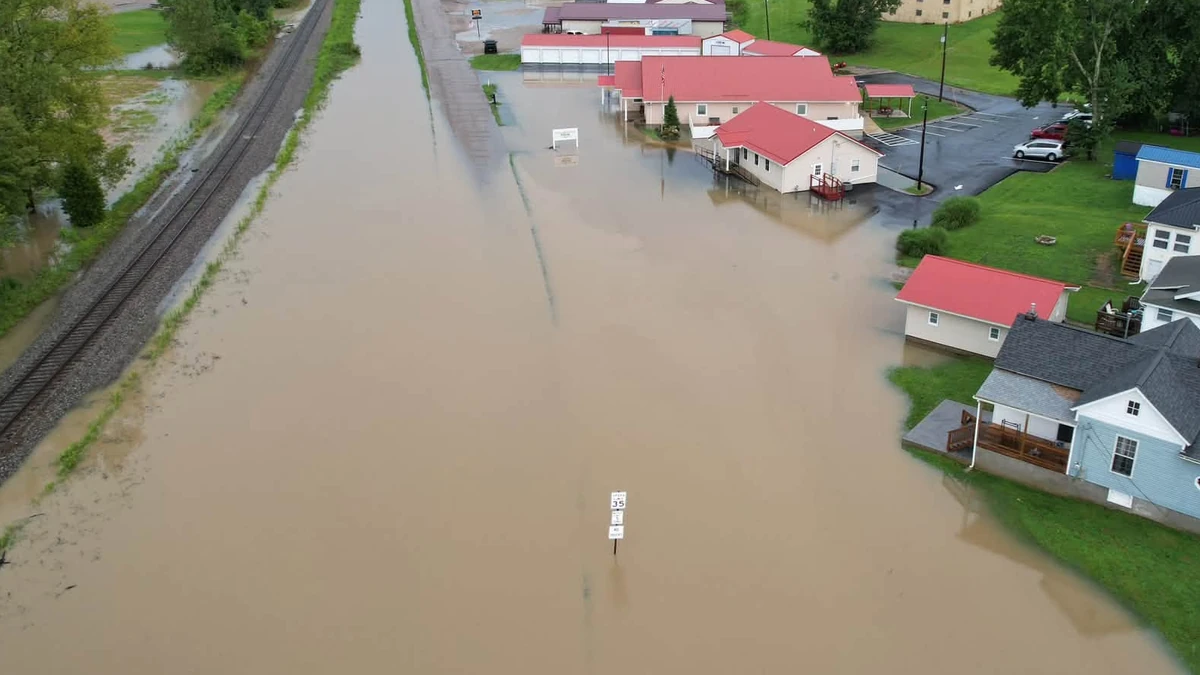
Flooding in Perry County, Ohio on August 11, 2026. Credit: Perry County Ohio/Facebook
The Storm Prediction Center (SPC) preliminarily confirmed the mesoscale convective system that moved from eastern Iowa to northern Indiana as a derecho on August 11.
Preliminary data indicated that it began around 07:00 CDT in Iowa (12:00 UTC) on August 11 and continued through at least 13:25 EDT in Indiana (17:25 UTC), although SPC said it would later assess whether the continuation toward Cincinnati should be included.
The maximum measured gust associated with the derecho was 160 km/h (99 mph) at Gary, Indiana.

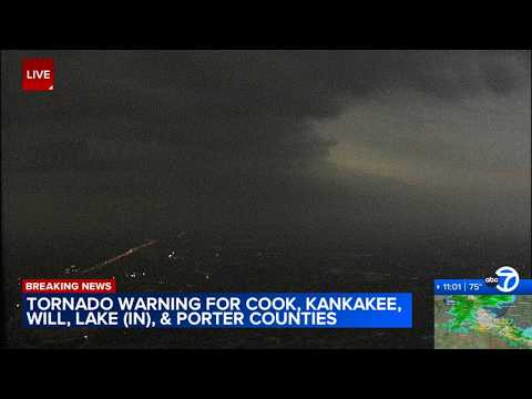
NWS Quad Cities confirmed three EF1 tornadoes in Delaware County, Iowa. NWS Chicago also confirmed three tornadoes with damage consistent with EF1 intensity on August 11.
While no official ratings have been announced, NWS reported that damage along a path from near Monee through Crete was consistent with up to EF1 intensity, while damage from southern Orland Park toward Flossmoor indicated at least EF1 or possibly higher intensity. Damage from a third tornado in the Minooka area was consistent with EF1 intensity.
Two of the Chicago-area tornadoes continued into Lake County, Indiana, with one affecting St. John and the other affecting Munster.

A 4-year-old boy was killed when a tree fell onto the bedroom of a home in Geneva Township, Indiana, Jennings County Sheriff’s Office Chief Deputy Cody Low said.
Ohio Governor Mike DeWine said a person died during a medical emergency in Roseville after flooded roads prevented first responders from reaching the individual.
A third person died in a home explosion and fire in Portage, Indiana, after the storms. Police said the cause remained under investigation, so the death was not included in the storm toll.

Governor DeWine declared a State of Emergency due to the severe flooding in Perry and Muskingum counties and activated the Ohio National Guard High Water Rescue Unit to assist in Roseville and Crooksville.
More than 800 000 utility customers across Illinois, Indiana, Ohio and Kentucky were without power at 00:00 EDT on August 12 (04:00 UTC on August 12), according to PowerOutage.us.
Sixteen incarcerated people were transported to hospitals for treatment after a reported lightning strike at Grafton Correctional Institution in Lorain County on the evening of August 11. One person was airlifted, and no deaths were reported.
Ohio prison officials said the incident occurred as incarcerated people were returning from their evening meal. A thunderstorm producing numerous lightning strikes crossed Lorain County during the 17:00 EDT hour on August 11 (21:00 UTC on August 11).
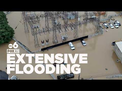
A separate round of severe storms struck Columbus around 10:00 EDT on August 11 (14:00 UTC on August 11). Columbus Mayor Andrew Ginther said a gust of 132 km/h (82 mph) was recorded at John Glenn Columbus International Airport.
The storms brought down trees and power lines, damaged homes and vehicles, and flooded roads, with the city’s South Side among the hardest-hit areas. About 100 000 AEP customers were without power on the afternoon of August 11.
Dayton recorded 53 mm (2.07 inches) of rain on August 11, breaking the previous daily record of 47 mm (1.86 inches) set in 1915.
The confirmed Iowa and Chicago-area tornadoes were associated with the derecho-producing system. The lightning incident, Columbus wind damage, and flooding elsewhere in Ohio occurred during other rounds of thunderstorms and had not all been formally attributed to the derecho.
NWS Northern Indiana reported rainfall totals of 192 mm (7.56 inches) 4.8 km (3 miles) north-northeast of Pulaski, 153 mm (6.03 inches) 4.8 km (3 miles) southeast of Lawton and 129 mm (5.08 inches) 2.1 km (1.3 miles) southwest of Ora.
In a Flood Warning issued at 21:25 EDT on August 11 (01:25 UTC on August 12), NWS Charleston said radar and gauges indicated at 17:16 EDT (21:16 UTC) that 127-203 mm (5-8 inches) of rain had fallen since midnight in central Perry County and northwestern Morgan County.

The rainfall had flooded numerous structures, vehicles, and roads around New Lexington, Somerset, Crooksville, Junction City, and nearby areas.
In another Flood Warning issued at 22:01 EDT on August 11 (02:01 UTC on August 12), NWS Charleston said 102-152 mm (4-6 inches) of rain had fallen in parts of Athens, Morgan, Perry and Washington counties.
At 17:50 EDT on August 11 (21:50 UTC on August 11), the automated gauge on Sunday Creek at Glouster stood at 4.94 m (16.2 feet) in moderate flood. OH Route 13 and several streets were flooded in Glouster, Trimble and Jacksonville.
NWS Charleston reported 76-127 mm (3-5 inches) of rain in other warned parts of southeastern Ohio. Heavy rainfall had ended in some areas by the evening of August 11, but runoff continued to flood larger creeks, rivers, roads and low-lying locations.
At 03:45 EDT on August 12 (07:45 UTC on August 12), the Muskingum River at Beverly stood at 9.02 m (29.6 feet), above its 8.84 m (29 feet) flood stage. Minor flooding was occurring.
NWS forecast the river to crest near 9.08 m (29.8 feet) that morning before falling below flood stage during the afternoon.
At 03:15 EDT on August 12 (07:15 UTC on August 12), the Hocking River at Athens stood at 5.49 m (18 feet). NWS forecast it to rise above its 6.10 m (20 feet) flood stage during the afternoon and crest near 6.31 m (20.7 feet) that evening.
References:
1 Severe Weather (Including a Derecho) on August 11th, 2026 – NWS – August 11, 2026
2 Governor DeWine Updates Ohioans on Severe Weather – Office of Ohio Gov. Mike DeWine – August 11, 2026.
3 At least 2 dead, hundreds of thousands without power after severe US Midwest storms – Reuters – August 12, 2026
4 6 people hospitalized after lightning strikes Ohio prison – FOX Weather – August 11, 2026.
5 Severe weather knocks out power in Illinois, Indiana and Ohio as ‘ring of fire’ strikes Midwest – AP – August 12, 2026

I am an Assistant Editor and Severe Weather & Science Journalist at The Watchers, specializing in real-time severe weather coverage, geophysical event reporting, and research-driven scientific analysis. You can reach me at rishav(at)watchers(.)news.

Just goes to show you do not need a hurricane to see hurricane like damage. Winds and rain, winds and rain. Wonder if homeowners covers this? Vs Hurricane damage? Crazy times. And same places getting hit over and over. And possibly another year probably WITHOUT a hurricane for the USA. Would be year two if it happens. Setting a presidence for sure. Nice coverage.