
Out-of-control Bradley Creek wildfire burns 2 852 ha and destroys more than 200 structures in British Columbia, Canada
The Bradley Creek wildfire remained Out of Control at an estimated 2 852 ha (7 047 acres) west of Vernon, British Columbia, on August 5, 2026. The blaze destroyed more than 200 structures, prompting evacuation orders and a Do Not Consume Water Advisory across affected areas. Meanwhile, firefighters extinguished hotspots and BC Hydro cleared downed lines and impacted infrastructure.
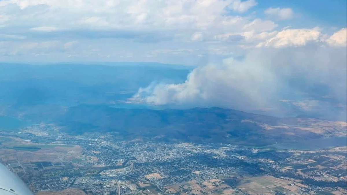
Smoke rising from Bradley Creek fire west of Vernon, British Columbia, Canada on August 5, 2026. Credit: Cariboo Wildfires & BC Information and Safety Page
The Bradley Creek wildfire remained out of control at an estimated 2 852 ha (7 047 acres) west of Vernon, British Columbia, on August 5. The blaze has reportedly destroyed over 200 structures since it was first reported on July 31.
The British Columbia Wildfire Service continued to classify the incident as Out of Control on August 5. The City of Vernon reported no significant growth during the preceding operational period but said increased winds were expected over the following days.
Early growth was mostly supported by fast-burning grass fuels, while crews used roads as control features, extended hose lines, and directed helicopters, airtankers, and skimmers against the flanks.

“The full extent of the damage remains unknown. At this time, more than 30 structures have been confirmed lost. That number is not considered final and is expected to significantly increase as damage assessments continue, and additional areas become safe for emergency crews to access,” the Okanagan Indian Band reported in a community update on August 4. By August 5, the number had increased to over 200.
“For our community, it’s measured in homes, family histories, and places people have spent their lives,” Dan Wilson, the chief of the Okanagan Indian Band, said.

All three evacuation-order zones covering Okanagan Indian Band IR 1 remained active at 18:00 LT on August 5 (01:00 UTC on August 6). The zones covered properties north of Bonneau Road and south of Highway 97, including Head of the Lake Road and Hawhola Road; properties south of Six Mile Creek to Westshore Estates; and all remaining IR 1 properties.
Evacuation orders also covered properties on the west side of Irish Creek Road in the Regional District of North Okanagan’s Electoral Area B.
Evacuation alerts remained in effect for specified properties along Cain, Nashwito, Banks, Beau Park, Siwash Creek, Beatrice and Six Mile Creek roads because the Bradley Creek and Quilpituk Creek fires were affecting available routes from the Westside Road area.

A Do Not Consume Water Advisory remained in effect for the Six Mile, Bradley Creek, Irish Creek and Head of the Lake Community Water System, designated DWS 429, and the 59 Antoine Road Community Water System, designated DWS 2391.
The Okanagan Indian Band said boiling would not make the water safe and directed residents to use bottled water for drinking, food preparation, infant formula, brushing teeth, washing produce, making ice and supplying pets.
Firefighters observed Rank 1 and Rank 2 behavior on August 5, ranging from smoldering ground fire to low-intensity surface fire. Crews extinguished hotspots near homes along Westside Road and constructed guard along the southern and northeastern sections. Aircraft supported suppression along the northern flank.
Crews also carried out small hand ignition operations near Bonneau Road to remove approximately 2 ha (5 acres) of fuel between burned areas and established guards to protect houses and infrastructure.
“A hand ignition event is a controlled burn, planned to remove a small amount of fuel along a fire’s edge,” officials said in a community update on August 5.
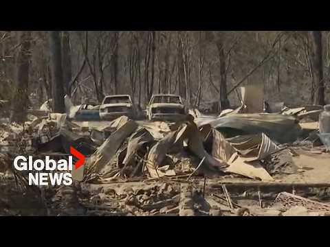
BC Hydro crews cleared downed lines and impacted infrastructure to improve access for suppression teams, while danger-tree and damage assessments continued. Repairs to electrical infrastructure were expected to continue over the following days. Westside Road remained closed to non-emergency personnel.
Highway 97 reopened at 12:40 LT (19:40 UTC) on August 5 with reduced speeds and a no-stopping restriction between Head of the Lake Road and Grandview Flats Road. The Okanagan Indian Band directed motorists to exercise caution through the affected corridor.
Hotter weather and possible dry lightning remain a threat as they can increase fire behavior or produce new starts. Police and federal fisheries personnel patrolled the northern arm of Okanagan Lake to prevent boaters from interfering with aircraft collecting water for suppression operations.
The City of Vernon said its Emergency Support Services operation had assisted 1 088 people from 512 households in person and 1 230 people from 598 households through online and telephone registration by noon on August 5. These figures represent support provided through the Vernon reception system rather than a complete count of people displaced by all evacuation orders.
References:
1 Bradley Creek FSR – BC Wildfire Service – August 6, 2026
2 Community Update: Bradley Creek Fire Update – Okanagan Indian Band – August 5, 2026
3 Community Update: Structure Loss Assessments – Okanagan Indian Band – August 4, 2026

Rishav Kothari is Editor-in-Chief of The Watchers, where he runs the newsroom and covers earthquakes, volcanoes, severe weather and space weather.
Published in the last 24 hours
- Bay of Bengal system to become Cyclone Akvan, landfall forecast between Nellore and Tuni on November 20, India
- El Niño floods kill 2 in Guayaquil as 172.8 mm of rain swamps Milagro, Ecuador's toll rises to 14
- Southern Thailand braces for heavy rain, 15 provinces on flood and landslide alert for November 18-22
- Paraná River floods force 4 547 from homes as water tops evacuation levels in 10 Argentine towns
