
Dust-storm warnings cover sections of I-10 and state routes in southern Arizona
Two walls of dust crossed southern Arizona late on August 5 and early on August 6, 2026, reducing visibility to approximately 400 m (0.25 miles) across parts of Pima and Pinal counties. Winds above 97 km/h (60 mph) accompanied the stronger wall in central Pima County, creating dangerous travel conditions along several state highways and sections of Interstate 10.
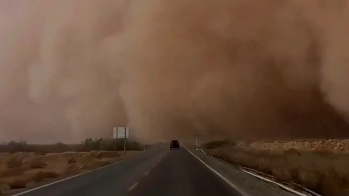
Representative image. Credit: Jim Yang
The first wall extended from north of Arivaca to Marana at 23:02 LT on August 5, moving west at 24 km/h (15 mph). Dust covered parts of central Pima County, including Sells, Three Points, Topawa, San Miguel, San Isidro, Kitt Peak and Picture Rocks.
Visibility fell to approximately 400 m (0.25 miles), while winds exceeded 97 km/h (60 mph). The affected road network included Arizona Route 86 between mile markers 102 and 155 and Route 286 between mile markers 1 and 45.
By 00:25 LT on August 6, the wall had moved west of Topawa toward the Santa Rosa area. Hazardous conditions remained along Route 86 between mile markers 102 and 118 before the dust weakened and left the warned area shortly before 01:00 LT.
A separate dust wall moved north across the Pima–Pinal corridor at 32 km/h (20 mph) shortly before midnight. The affected area included Marana, Eloy, Avra Valley, Picacho, Picacho Peak State Park, Pinal Airpark, Picture Rocks and Red Rock.
Dust reduced visibility to approximately 400 m (0.25 miles) along Interstate 10 between mile markers 206 and 242 and Arizona Route 87 between mile markers 116 and 124. The wall moved out of north-central Pima and southwestern Pinal counties by 00:20 LT on August 6.
The August 5–6 events followed another dust wall in northeastern Cochise County on August 4. That wall extended from northeast of Willcox to north of Portal and moved southwest at 40 km/h (25 mph), affecting Interstate 10 and sections of Routes 181, 186 and 191.
Communities within the Cochise County warning area included Willcox, Bowie, Dragoon, Chiricahua National Monument, Pearce-Sunsites, Cochise, Sunizona, Kansas Settlement and San Simon. The dust weakened by 19:30 LT on August 4, although blowing dust continued to make travel difficult.
No official totals for collisions, injuries, structural damage or prolonged road closures were included in the warning and expiration bulletins reviewed for the event.
The National Weather Service advised motorists not to enter approaching dust. Drivers unable to avoid dense dust were instructed to leave the roadway, place the vehicle in park, engage the parking brake, switch off all lights and remove their foot from the brake pedal.
Additional thunderstorm outflows remained capable of producing gusty winds and blowing dust across south-central Arizona on August 6, particularly in Pinal County. The National Weather Service identified outflow winds and reduced visibility as the main hazards for lower desert areas.
References:
1 Dust Storm Warning for central Pima County – NWS Tucson – August 5, 2026

I’m a science journalist and researcher at The Watchers, contributing to the Epicenter edition, where I cover peer-reviewed scientific research and emerging discoveries across Earth and space sciences. With a background in astronomy and a passion for environmental science, I’ve worked in shark and coral conservation in Fiji, conducting reef and shark-behavior research, contributing to mangrove restoration, and earning PADI Open Water and Coral Reef Certifications. I bring a blend of scientific rigor and storytelling to illuminate the discoveries shaping our planet and beyond.

Commenting rules and guidelines
We value the thoughts and opinions of our readers and welcome healthy discussions on our website. In order to maintain a respectful and positive community, we ask that all commenters follow these rules.