
Strong atmospheric river forecast to bring heavy rain and mountain snow to California this week
A strong atmospheric river is forecast to make landfall along the U.S. West Coast on Wednesday, November 12, 2025, bringing heavy rain and mountain snow across much of California through Friday, November 14.
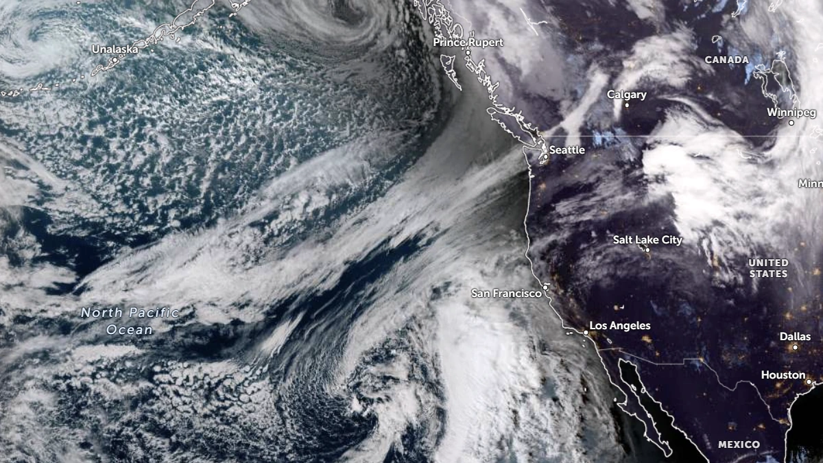
Satellite image of the U.S. West Coast as of 00:00 UTC on November 11, 2025. Credit: NOAA/GOES-19, Zoom Earth, The Watchers
A developing atmospheric river (AR) originating from the subtropical northeast Pacific is forecast to reach the U.S. West Coast late on Wednesday, November 12.
The AR will emerge from an amplifying shortwave trough moving southeastward from south of Alaska, phasing with a cutoff low over the subtropical Pacific. As they interact, southerly low-level flow will transport large amounts of moisture into California, producing a corridor of intense water vapor flux and widespread precipitation.
According to the Center for Western Weather and Water Extremes (CW3E), the system will bring strong AR conditions with integrated vapor transport (IVT) values of over 750 kg m⁻¹ s⁻¹ along coastal California.
Forecast ensemble guidance from GEFS and ECMWF indicates AR2–AR3 conditions along the coast from the Oregon border to the Monterey Peninsula. ECMWF solutions show slightly higher IVT magnitudes and longer duration of AR conditions than GEFS, suggesting enhanced rainfall potential, particularly where orographic uplift favors precipitation along the Transverse Ranges and Sierra Nevada.
The Weather Prediction Center (WPC) forecasts 50–100 mm (2–4 inches) of storm-total precipitation across the Klamath Mountains, southern Cascades, Sierra Nevada, Coast Ranges, and Transverse Ranges, and 25–50 mm (1–2 inches) elsewhere in coastal and valley regions. Marginal Risk Excessive Rainfall Outlooks (level 1 of 4) are in effect for much of northern, central, and southern California, where rainfall rates may exceed 13 mm/h (0.5 inches/h).
Freezing levels are forecast to fall from about 4 270 m (14 000 feet) to below 1 520 m (5 000 feet) by Friday morning, enabling significant snow accumulations in the higher Sierra Nevada.
CW3E’s West-WRF ensemble indicates over 50 % probability of more than 60 cm (24 inches) of snow at Tuolumne Meadows by early Saturday, November 15. The Weather Prediction Center has forecast over 70 % probability of moderate winter-storm impacts across the central and southern Sierra Nevada for the 24-hour period ending 04:00 LT Friday.
For the Upper Yuba watershed, the deterministic GFS forecasts 71 mm (2.8 inches) of mean areal precipitation by 16:00 LT on Friday, while the deterministic ECMWF forecasts 38 mm (1.5 inches).
In the Los Angeles watershed, ECMWF forecasts 38 mm (1.5 inches) versus 13 mm (0.5 inches) from GFS. A majority of ECMWF ensemble members show this event supplying more than 5 % of normal annual precipitation (25 mm or 1 inch).
Model spread remains in the timing and duration of maximum IVT after landfall. However, both CW3E and NOAA forecasts indicate that the system will deliver widespread precipitation beneficial to regions of southern California experiencing moderate-to-severe drought. Since May 2024, much of the region has received less than 70 % of normal rainfall.
References:
1 Atmospheric River Outlook: 10 November 2025 – CW3E -November 10, 2025

I am an Assistant Editor and Severe Weather & Science Journalist at The Watchers, specializing in real-time severe weather coverage, geophysical event reporting, and research-driven scientific analysis. You can reach me at rishav(at)watchers(.)news.
Commenting rules and guidelines
We value the thoughts and opinions of our readers and welcome healthy discussions on our website. In order to maintain a respectful and positive community, we ask that all commenters follow these rules.