
Heavy rain, thunderstorms, and tornadoes threaten Texas as severe storms move through the Southern Plains
Heavy rain and severe thunderstorms are forecast to continue spreading across Texas and the southern Plains late Friday into early Saturday, October 24 into 25, 2025 bringing the threat of flash flooding, damaging winds, large hail, and isolated tornadoes.

Satellite view of the severe weather system located over the southern Plains on October 24, 2025. Credit: NOAA/GOES-19, RAMMB/CIRA, The Watchers
An upper-level low and associated surface frontal system are moving into the southern Plains, triggering widespread thunderstorms and heavy rainfall across Texas.
The storm system had initially tracked through Kansas, Oklahoma, and north Texas on Thursday, October 23, reaching the Dallas-Fort Worth Metro and central Texas by Friday morning, October 24.
The system, interacting with moist air drawn northward from the Gulf of Mexico, is expected to produce intense rainfall rates of up to 50 mm (2 inches) per hour. The heaviest rainfall is forecast from late Friday into early Saturday, October 25.
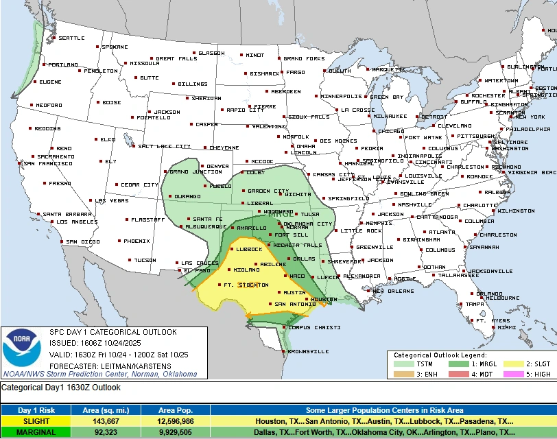
 Image credit: NOAA/SPC
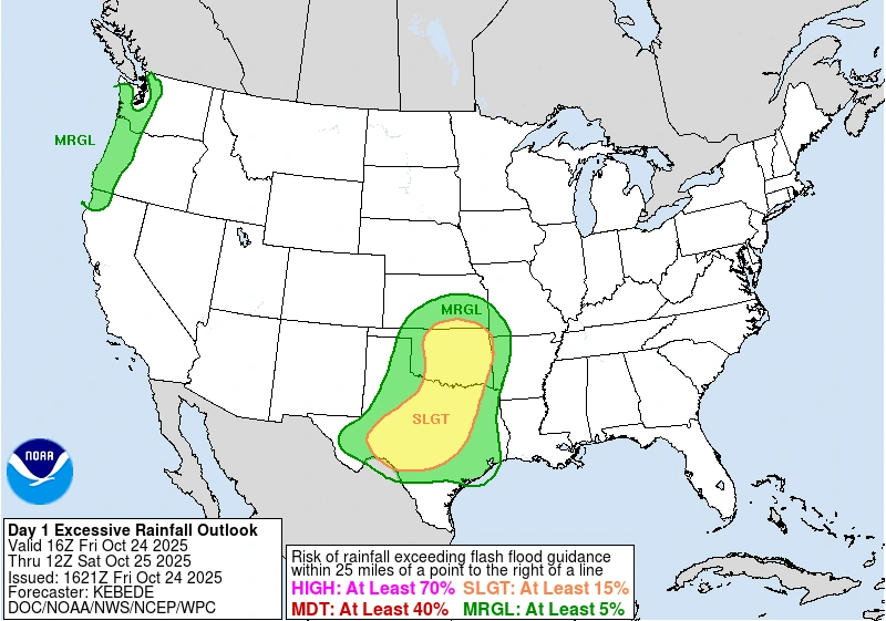
- Image credit: NOAA/WPC
The highest severe-weather potential remains west of I-35, where environmental shear favors rotating thunderstorms capable of producing brief tornadoes.
Urban and low-lying areas could see severe flooding as storms repeatedly track through the affected regions. Meanwhile, flooding will be limited in drier areas due to the dry soil limiting initial run-off.
Local National Weather Service (NWS) offices forecast rainfall totals across central Texas, including the Austin–San Antonio corridor, of 25 to 75 mm (1 to 3 inches), with localized totals up to 100 mm (4 inches). Isolated totals of 100 and 125 mm (4 to 5 inches) are forecast for the Dallas–Fort Worth area through Saturday.
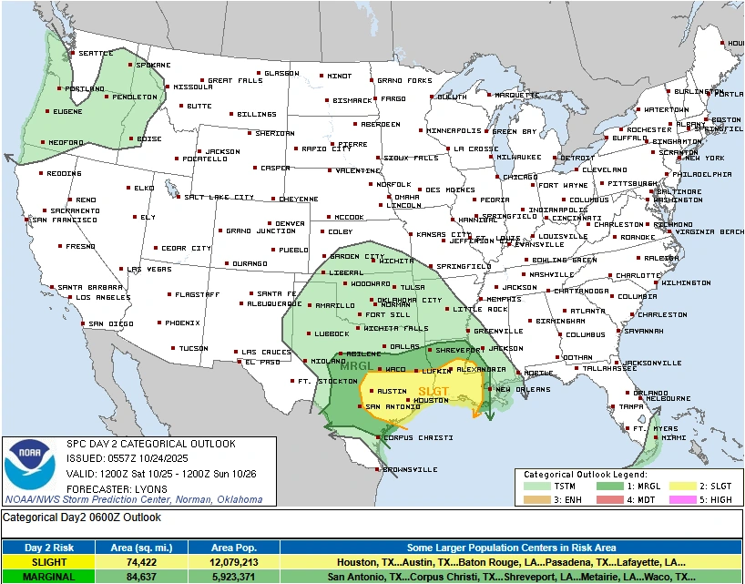
- Image credit: NOAA/SPC
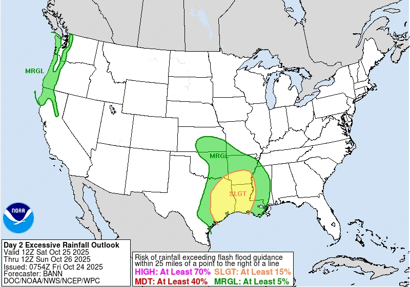
- Image credit: NOAA/WPC
The Weather Prediction Center (WPC) has issued a Slight Risk (level 2 of 4) for excessive rainfall across portions of the southern Plains on Friday, extending eastward from the ArkLaTex and eastern Texas into the Lower Mississippi Valley on Saturday.
At the same time, atmospheric instability and upper-level shear associated with the upper low will support organized severe convection.
The Storm Prediction Center (SPC) has issued a Slight Risk (level 2 of 5) for severe weather across western and central Texas on Friday, shifting toward central Texas and southern Louisiana on Saturday. Primary hazards include large hail, damaging wind gusts, and a few isolated tornadoes.
References:
1 Short Range Forecast Discussion – NWS/WPC – October 24, 2025
2 Area Forecast Discussion – NWS Fort Worth – October 24, 2025
3Area Forecast Discussion – NWS Austin/San Antonio – October 24, 2025

I am an Assistant Editor and Severe Weather & Science Journalist at The Watchers, specializing in real-time severe weather coverage, geophysical event reporting, and research-driven scientific analysis. You can reach me at rishav(at)watchers(.)news.
Commenting rules and guidelines
We value the thoughts and opinions of our readers and welcome healthy discussions on our website. In order to maintain a respectful and positive community, we ask that all commenters follow these rules.