
Back-to-back atmospheric rivers forecast to bring heavy rainfall and mountain snow to the Pacific Northwest and northern California
The Pacific Northwest will see back-to-back atmospheric rivers (ARs) beginning late Thursday, October 23, 2025, bringing significant precipitation and unsettled weather conditions through the end of October. The Weather Prediction Center (WPC) has issued a Marginal Risk of excessive rainfall for coastal areas of Washington, Oregon, and northern California as the first AR approaches.
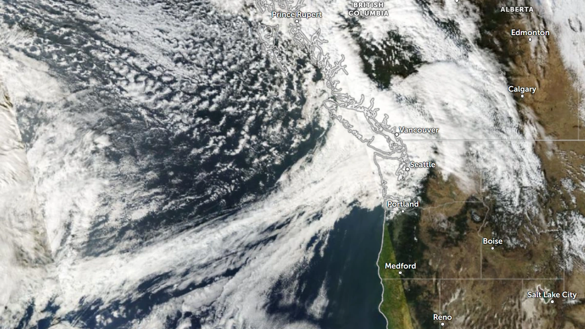
Daytime satellite image of the Pacific Northwest on October 20, 2025. Credit NOAA/GOES-19, Zoom Earth, The Watchers
A strong atmospheric river (AR) is forecast to make landfall over the PNW late Thursday, October 23, and move southward into northern California through Friday, October 24. A second, weaker AR is expected to follow, making landfall over southern Oregon and northern California during the weekend.
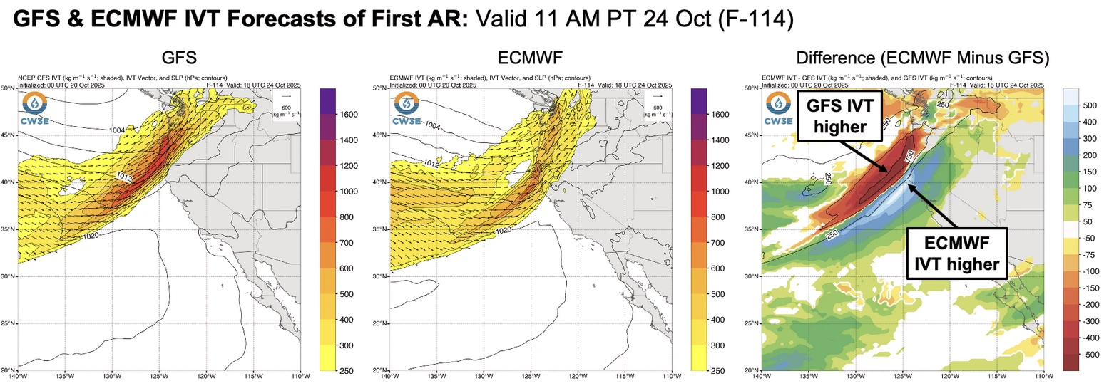
The strength and timing of landfall remain uncertain, with the ECMWF model forecasting an earlier landfall and stronger integrated vapor transport (IVT) compared to the GFS model.
The landfalling ARs are expected to bring unsettled weather conditions that will persist through the end of October.

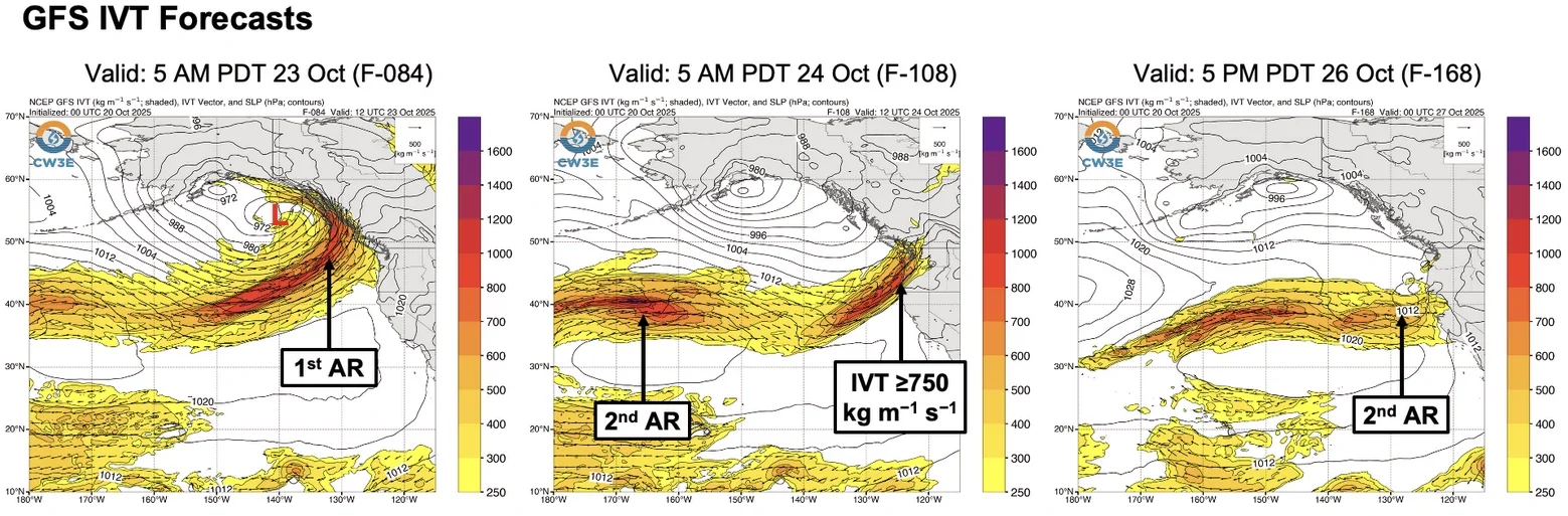
About 80% of GEFS and ECMWF ensemble members forecast at least AR 3 conditions over northern coastal Oregon in association with the first AR.
At least 51–152 mm (2–6 inches) of rainfall is forecast across western Washington, western Oregon, and northern California over the next 7 days, with higher totals expected over the Olympic Peninsula and North Cascades.
The Weather Prediction Center has issued a Marginal Risk of excessive rainfall for coastal Washington, Oregon, northern California, and the Washington Cascades due to the heavy precipitation associated with the first AR.
While most of the precipitation from the first AR is expected to fall as rain, lower freezing levels during the second AR may support significant snowfall accumulations in the higher terrain of the Oregon Cascades.
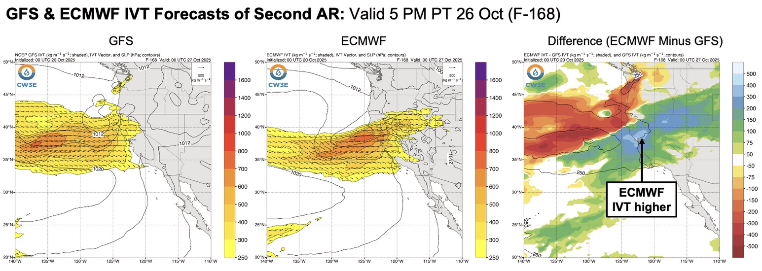
Model differences in the forecasts of the second AR are driving differences in forecast precipitation over the next 10 days. Overall, the ECMWF ensemble is forecasting higher precipitation totals in western Washington, western Oregon, and northern California compared to the GEFS ensemble.
References:
1 Multiple Atmospheric Rivers Forecast to Impact US West Coast Later This Week into This Weekend – CW3E – October 20, 2025

I am an Assistant Editor and Severe Weather & Science Journalist at The Watchers, specializing in real-time severe weather coverage, geophysical event reporting, and research-driven scientific analysis. You can reach me at rishav(at)watchers(.)news.
Commenting rules and guidelines
We value the thoughts and opinions of our readers and welcome healthy discussions on our website. In order to maintain a respectful and positive community, we ask that all commenters follow these rules.