
Unusually strong summer atmospheric river brings heavy rainfall to Washington
An unusually strong summer atmospheric river made landfall over the Pacific Northwest late on August 14, 2025, reaching AR 3 along the Washington coast and producing 75–200 mm (3–8 inches) of rain across parts of western Washington.
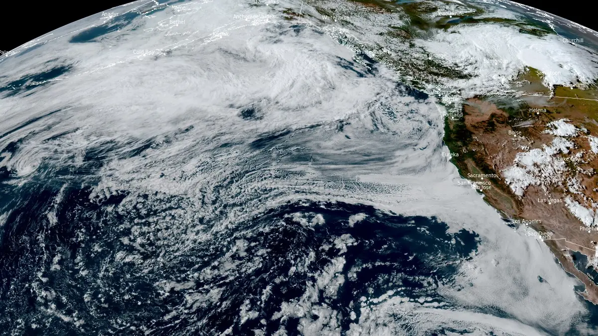
Satellite image of atmospheric river impacting Pacific Northwest on August 14, 2025. Credit: NOAA/GOES-West, RAMMB/CIRA, The Watchers
An unusually potent summer atmospheric river (AR) made landfall over the Pacific Northwest late on August 14, bringing widespread rainfall to western Washington.
Analyses from the Global Ensemble Forecast System (GEFS) indicated AR 3 (on a scale of 1–5) conditions along much of the Washington coast and AR 2 in portions of the Cascades foothills, including the Green River Basin.
The event developed within a plume of very moist air extending eastward from the Western Pacific. On August 15, Salem, Oregon, recorded precipitable water of 45 mm (1.79 inches), the city’s third highest on record and the highest for summer.
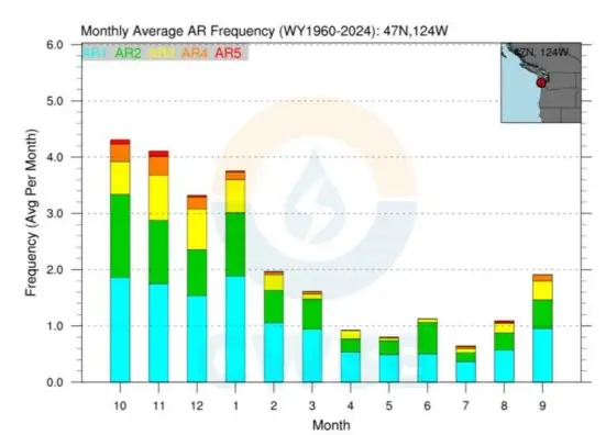
Integrated vapor transport (IVT) peaked at 851 kg m−1 s−1. At Grays Harbor County, Washington, this ranked as the fifth-strongest August AR observed since 1960, with only 14 August ARs reaching AR 3 or greater at that location in that period, according to the Center for Western Weather and Water Extremes.
Estimated precipitation totals reached 75–200 mm (3–8 inches) across parts of the Olympic Peninsula and Washington Cascades, with 25–75 mm (1–3 inches) in the Green River Basin. Despite the heavy rainfall, hydrologic impacts were limited due to dry antecedent soil conditions and low antecedent streamflow.
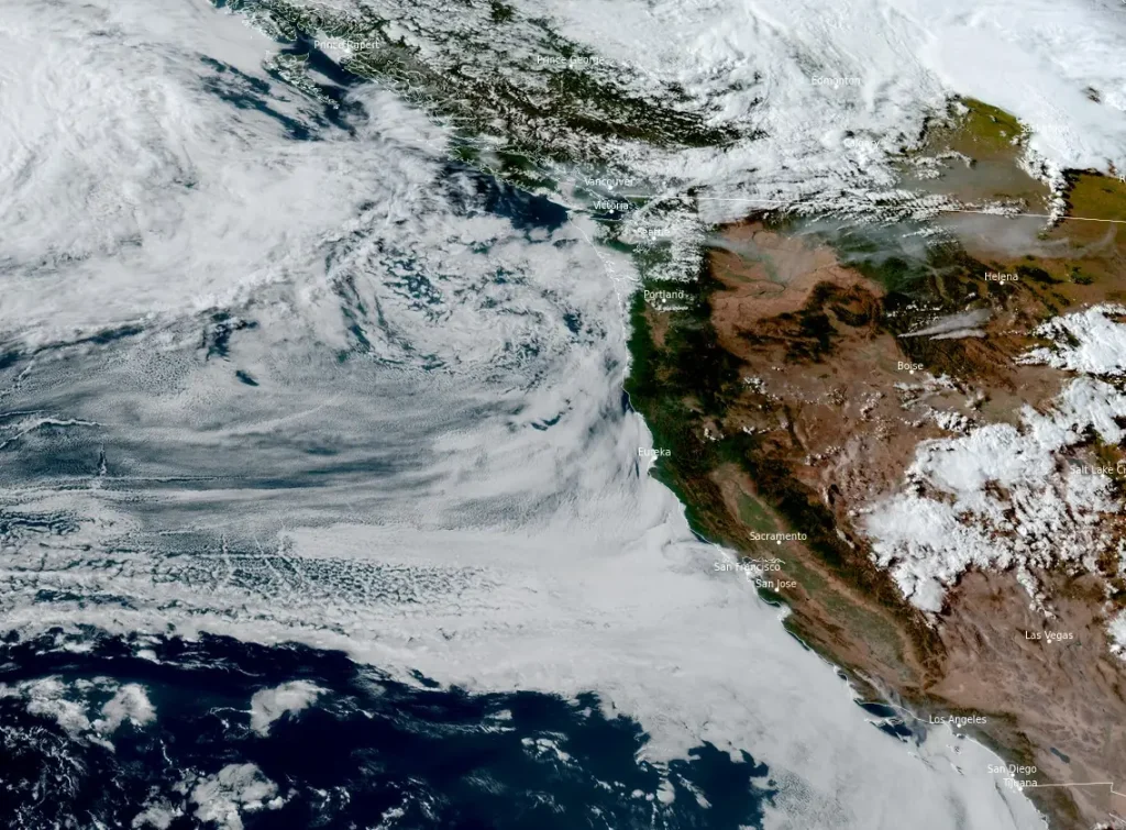
Atmospheric rivers of this intensity are uncommon in the Pacific Northwest during summer. While winter ARs more often produce significant flooding, the combination of event timing and pre-event dryness limited runoff efficiency during this episode.
I'm a dedicated researcher, journalist, and editor at The Watchers. With over 20 years of experience in the media industry, I specialize in hard science news, focusing on extreme weather, seismic and volcanic activity, space weather, and astronomy, including near-Earth objects and planetary defense strategies. You can reach me at teo /at/ watchers.news.
Commenting rules and guidelines
We value the thoughts and opinions of our readers and welcome healthy discussions on our website. In order to maintain a respectful and positive community, we ask that all commenters follow these rules.