
Nine killed as Tropical Storm Erin floods São Vicente, Cape Verde
An extreme 192.3 mm (7.57 inches) of rain fell in just 5 hours on August 11, 2025, causing destructive floods in São Vicente, Cape Verde, that killed at least nine people, including four children, and prompted a disaster declaration for two islands.

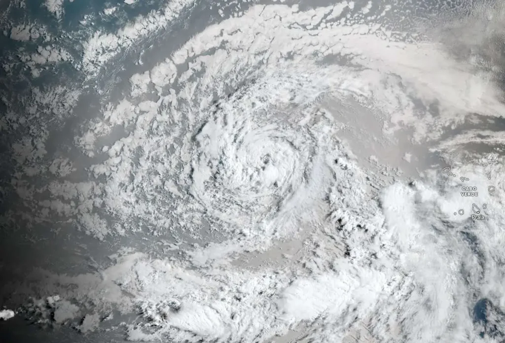
Satellite image of Tropical Storm Erin at 09:40 UTC on August 12, 2025. Credit: NOAA/GOES-East, Zoom Earth, The Watchers
Tropical Storm Erin (Invest 97L) brought extreme rainfall to Cape Verde on August 11, with the island of São Vicente recording 192.3 mm (7.57 inches) in just 5 hours between midnight and 05:00 local time, according to the National Institute of Meteorology and Geophysics (INMG).
The resulting flash floods killed at least nine people, including four children, and caused significant damage to property and infrastructure. According to government officials, five people are still missing, 1 500 have been displaced and a total of 3 000 affected in São Vicente Island.
Floodwaters inundated residential areas, damaged commercial buildings, and blocked roads by debris and fallen trees, stranding vehicles, while power outages affected large parts of the island.
As a result, the government declared a state of disaster for São Vicente and the neighboring island of Santo Antão.
Cape Verde’s meteorological service warned that additional showers and thunderstorms could trigger localized flooding in already saturated areas.
The flooding began during the early hours of August 11 as outer rainbands from Tropical Storm Erin, at the time still designated Invest 97L, swept across the northern islands. Erin formed later that day at 15:00 UTC about 450 km (280 miles) west-northwest of the Cabo Verde, with maximum sustained winds near 75 km/h (45 mph).
At 09:00 UTC on August 12, the center of Tropical Storm Erin was located about 1 105 km (690 miles) W of Cabo Verde and about 3 045 km (1 890 miles) E of the Northern Leeward Islands.
The system had maximum sustained winds of 75 km/h (45 mph) and was moving W at 35 km/h (22 mph). It had minimum central pressure of 1 004 hPa.
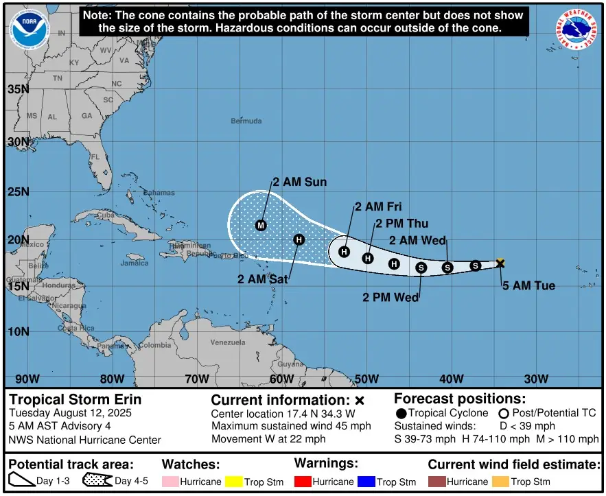
Westward motion is expected to continue for the next several days with a decrease in forward speed and gradual turn toward the WNW.
Gradual strengthening is forecast over the next several days, and Erin is expected to become a hurricane in the next couple of days.
I'm a dedicated researcher, journalist, and editor at The Watchers. With over 20 years of experience in the media industry, I specialize in hard science news, focusing on extreme weather, seismic and volcanic activity, space weather, and astronomy, including near-Earth objects and planetary defense strategies. You can reach me at teo /at/ watchers.news.
Thank you for writing about Cape Verde. We are in mourning for the loss of lives.
So sorry for your loss.