
Flash floods kill one in Maryland, trigger states of emergency in New York and New Jersey
Flash floods struck parts of the northeastern United States on July 31, 2025, killing one person in Maryland and prompting state emergencies in New York and New Jersey.
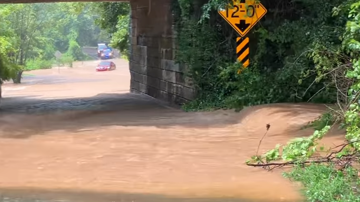
Flooding in Joppatowne, Maryland on July 31, 2025. Credit: Joppatowne Volunteer Fire Department
Flash floods along the I-95 corridor between Washington, D.C., and northern New Jersey claimed at least one life in Maryland and prompted a state of emergency in New York City on Thursday, July 31.
Flash floods struck Maryland on Thursday afternoon after 50–100 mm (2–4 inches) of rainfall was reported by 14:15 local time (LT) in areas near Baltimore, including Perry Hall, Honeygo, Joppatowne, Kingsville, and Edgewood.
By 16:25 LT, Bethesda, Rockville, and Potomac had also recorded 50–100 mm (2–4 inches) of rain, with localized totals reaching 100–150 mm (4–6 inches).
“Monitor low areas and drainages for rapid rises. Seek high ground if needed. Parts of NE/NW DC, too,” warned the National Weather Service (NWS), which issued multiple flash flood warnings for areas along the I-95 corridor. The warnings came as numerous streams and creeks flooded in response to intense rainfall throughout Thursday.
According to the Mount Airy Volunteer Fire Company in Maryland, a boy was playing with other children when he was swept into a drainage pipe. He was later pronounced dead at the scene.
New York Governor Kathy Hochul declared a state of emergency for New York City and surrounding counties, advising employers to release workers early.
Major flooding was reported along I-295 in Queens, disrupting transportation across the New York metro region. New York Police closed all northbound lanes of FDR Drive at East Houston Street due to flooding.
The Metropolitan Transportation Authority (MTA) reported delays on multiple subway lines, with water pouring onto platforms and tracks on the Long Island Rail Road at Great Neck in Queens.
Long Island Rail Road service was suspended on some routes due to high water. Officials have not confirmed when full service will resume or whether there was damage to the tracks.
Train delays were also reported between Philadelphia and Wilmington, where floodwaters were reported over the tracks.
In New Jersey, flooding submerged sections of I-280 in Orange and stranded vehicles in Elizabeth and Summit. U.S. Highway 22 was also flooded in Plainfield.
With showers forecast to continue into early Saturday, August 1, rainfall totals in parts of New Jersey are expected to reach up to 180 mm (7 inches). Acting Governor Tahesha Way declared a state of emergency for all of New Jersey.
This event comes two weeks after flooding claimed two lives in New Jersey when a vehicle was swept into a brook. During that storm, New York City recorded its second-wettest hour on record with 52.6 mm (2.07 inches), breaking a 117-year-old daily record.
Read more:

I am an Assistant Editor and Severe Weather & Science Journalist at The Watchers, specializing in real-time severe weather coverage, geophysical event reporting, and research-driven scientific analysis. You can reach me at rishav(at)watchers(.)news.
Commenting rules and guidelines
We value the thoughts and opinions of our readers and welcome healthy discussions on our website. In order to maintain a respectful and positive community, we ask that all commenters follow these rules.