
Downburst damages multiple aircraft at North Perry Airport, Florida
A severe thunderstorm produced a damaging downburst in Pembroke Pines, Florida, on Friday, May 23, 2025, severely damaging multiple aircraft at North Perry Airport and prompting an emergency airport closure. Straight-line winds also caused widespread damage across Broward County, with hail reported along the Treasure Coast.

Plane tossed by damaging winds in southern Florida on Friday, May 23, 2025. Pembroke PD
Severe thunderstorms swept across southern Florida on Friday, May 23, leading to widespread wind damage, hail, and localized flooding.
Strong winds damaged multiple aircraft at North Perry Airport in Pembroke Pines, including at least one plane flipped onto a fueling truck, prompting an emergency closure of the facility.
“At approximately 18:00 local time (LT), the area surrounding North Perry Airport (HWO) experienced a severe thunderstorm, which brought strong, damaging winds,” said Fort Lauderdale-Hollywood International Airport spokesperson Arlene Satchell.
“Several aircraft were severely damaged. As a result, HWO is closed until 07:00 LT on Saturday, May 24, to allow the Broward County Aviation Department to continue an initial damage assessment at our general aviation airport.”
Meanwhile, trees and power lines were downed across Broward County, and lime-sized hail was reported along the Treasure Coast.
 Plane tossed by damaging winds in southern Florida on Friday, May 23, 2025. Pembroke PD
Tree damage caused by a downburst in Pembroke Pines, Florida on Friday, May 23, 2025. Credit: Pembroke PD

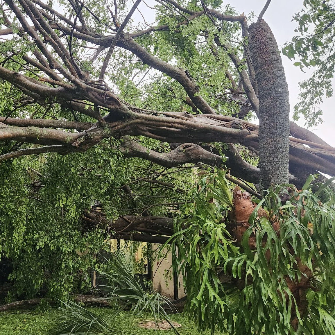
The straight-line wind damage led many to initially believe a tornado had touched down in East Pembroke Pines, where power lines and trees were downed. Authorities advised residents to exercise caution while traveling through the affected areas.
“It appears as if a small tornado touched down in East Pembroke Pines, between Palm Avenue and NW 72nd Avenue near Pines Boulevard,” the Pembroke Pines Police Department initially stated, describing the observed damage.
The National Weather Service (NWS) later confirmed that the damaging winds were the result of a severe thunderstorm downburst, resulting in straight-line wind damage.
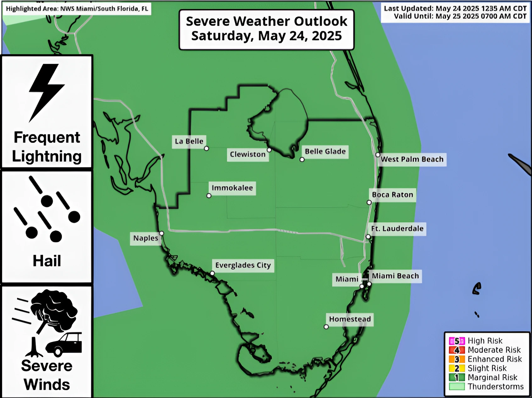
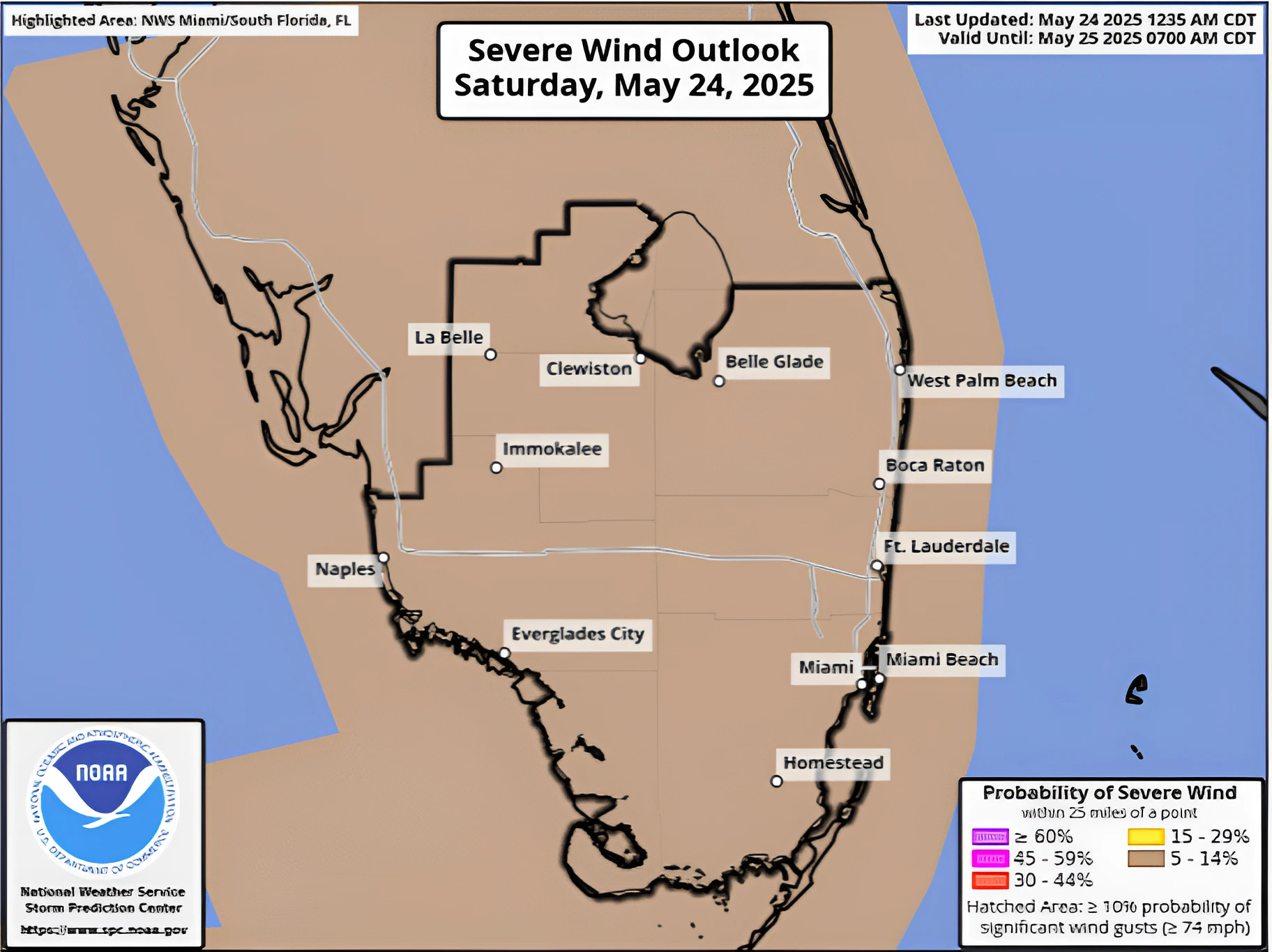
The threat of thunderstorms will continue over the region on Saturday, with a Marginal Risk (level 1 of 5) for isolated storms, with the highest risk lying over inland areas including Clewiston, Belle Glade, and La Belle.
The storms will begin impacting the region during Saturday afternoon and are forecast to last through the evening. Damaging winds and large hail, along with the possibility of waterspouts, are forecast for the risk zone.

I am an Assistant Editor and Severe Weather & Science Journalist at The Watchers, specializing in real-time severe weather coverage, geophysical event reporting, and research-driven scientific analysis. You can reach me at rishav(at)watchers(.)news.
Commenting rules and guidelines
We value the thoughts and opinions of our readers and welcome healthy discussions on our website. In order to maintain a respectful and positive community, we ask that all commenters follow these rules.