
Enhanced Risk issued for May 16 as tornadoes and severe storms threaten Ohio and Mississippi valleys, U.S.
A widespread severe weather threat is expected on Friday, May 16, 2025, as a strong low-pressure system moves from the Upper Midwest into the Ohio and Mississippi valleys, affecting Kentucky, Tennessee, Arkansas, Missouri, Illinois, and Ohio.

WPC excessive rainfall outlook for Friday, May 16, 2025. Credit: WPC
A strong low-pressure system tracking into the Upper Midwest and bringing a severe weather threat on Thursday, May 15, will shift southeastward into the Ohio and Mississippi valleys on Friday, May 16.
The system will bring severe thunderstorms, large hail, damaging wind gusts, and the potential for a few tornadoes across the Ohio and Mississippi valleys on Friday. Flash flooding will also be a threat in some areas due to rainfall associated with slow-moving storms.
Isolated flash flooding will be possible over parts of the Northern Plains, where persistent showers on the western side of the strong low-pressure system are forecast to produce 25 to 76 mm (1–3 inches) of rainfall on Thursday.
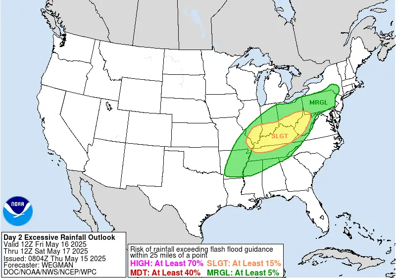
The Weather Prediction Center (WPC) has issued a Slight Risk (level 2/4) for excessive rainfall, covering all of Kentucky and parts of southern Indiana, Ohio, Illinois, and northern Tennessee.
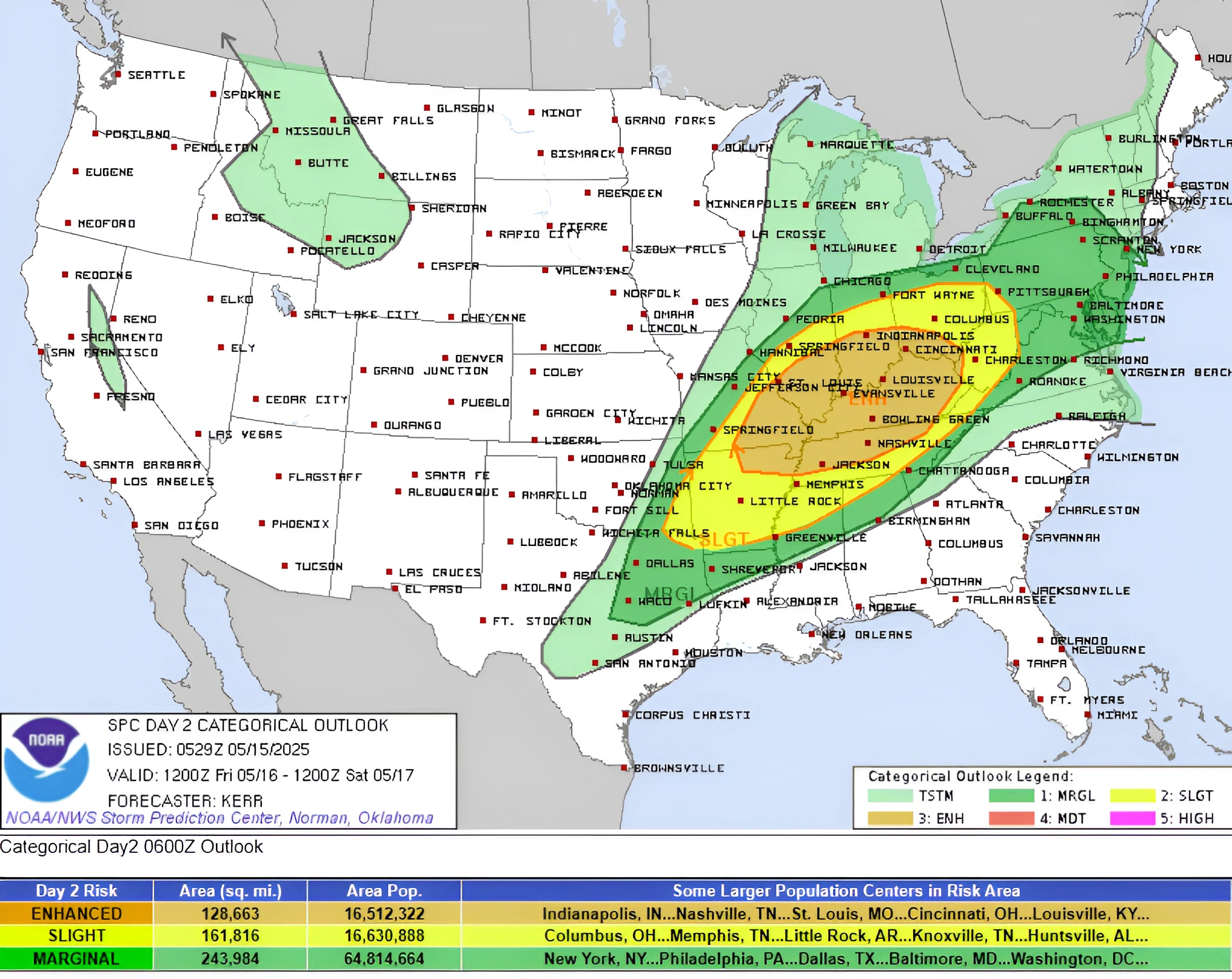
The Storm Prediction Center (SPC) has issued an Enhanced Risk (level 3/5) for severe thunderstorms on Friday, covering nearly all of Kentucky and parts of northern Tennessee, northeastern Arkansas, southern Missouri, Illinois, Indiana, and Ohio.
The Enhanced Risk area is surrounded by a broader Slight Risk (level 2/5) area, extending from parts of Oklahoma through Ohio and into West Virginia.
Persistent severe weather this week has saturated soils across the affected areas, increasing the risk of flooding. Flooding has already impacted parts of the Mid-Atlantic, with one fatality reported in Virginia on Wednesday, May 14.
By Saturday, May 17, the strong low pressure system will pick up some eastward momentum, pushing a cold front into the eastern U.S. while a warm front lifts into the Northeast.
Showers and thunderstorms are expected across much of the eastern U.S., extending into the Southern Plains, where the trailing cold front may briefly stall before lifting northward again as a warm front.
Precipitation chances will also increase across the Northwest on Saturday as a strong Pacific frontal system moves inland. Widespread showers are forecast, with mixed precipitation expected at higher elevations and snow possible in the Cascades and Northern Rockies.
Read more:

I am an Assistant Editor and Severe Weather & Science Journalist at The Watchers, specializing in real-time severe weather coverage, geophysical event reporting, and research-driven scientific analysis. You can reach me at rishav(at)watchers(.)news.
Commenting rules and guidelines
We value the thoughts and opinions of our readers and welcome healthy discussions on our website. In order to maintain a respectful and positive community, we ask that all commenters follow these rules.