
Severe winter storm leaves 10 dead, triggers widespread flooding across Kentucky and southeastern U.S.
At least 10 people have died and over 700 00 customers across multiple states were left without power after a severe winter storm swept through the southeastern United States from February 15 to 17, 2025, bringing strong winds, heavy rainfall, and widespread flooding.
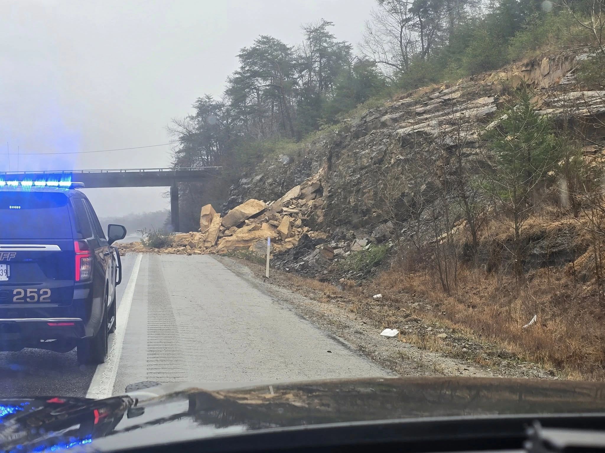
Rockslide at 1-69 in Dawson Springs Kentucky on Saturday, February 15, 2025. Image credit: Dawson Spring Police
At least 10 people have died as a result of a severe winter storm that affected much of the southeastern United States over the weekend, bringing strong winds, heavy rainfall, and severe flooding. The storm also caused power outages for at least 700 000 customers from New York to Alabama.
According to Kentucky Governor Andy Beshear, nine fatalities were reported in Kentucky alone, with emergency responders conducting over 1 000 rescues across the state.
One fatality was reported in Atlanta, Georgia, after a tree fell on a house, killing a man while he was lying in his bed, according to fire crews who arrived at the scene at around 05:00 local time (LT) on Sunday, February 16.
According to the National Weather Service (NWS) office in Louisville, the region received 76 – 178 mm (3 – 7 inches) of rainfall, leading to widespread flooding.
The Louisville Metro Police Department (LMPD) assisted fire departments with water rescues throughout the city during the storm. First responders completed 30 water rescues across the region, with LMPD warning residents not to drive through flooded areas.


In Coal Run City, Kentucky, floods damaged 79 residences and 33 businesses, damaging 112 structures in total on Sunday although the floods haven’t washed out any culverts.
Residents in Rives, Tennessee, were urged to evacuate and seek higher ground immediately after a levee failure along the Obion River led to sudden flooding in the town and surrounding areas.
Four tornadoes were also reported in northeastern Mississippi on Saturday, February 15. EF-1 tornadoes were reported in Shannon and Bounds Crossroad. EF-0 tornadoes were reported in southwest Itawamba, South Fairview.
Hundreds of roads were blocked due to flooding. Downtown Pikeville was inaccessible from the US 23 to US 119 intersection. “The river has now covered all lanes of travel in that area and is too deep for vehicles,” the Pikeville Police Department stated. “Do not be on the roadways unless it’s an emergency or you’ve been evacuated and are heading to shelter. Please use caution if you have to be out,” they added.
The heavy rains have also caused mudslides in some areas. In Dawson Springs a rockslide was reported on northbound I-69, approximately 3 miles from the Hopkins county line on Saturday.
Although the storm ended and rainfall subsided, flooding continued across the region.
Black ice has also been reported in central Kentucky and southern Indiana, creating hazardous driving conditions on Monday, February 17.
The storm is moving away from New England after bringing in locally heavy snow and widespread freezing rain through Sunday. The wintry precipitation will start dwindling on Monday, and the huge circulation of the deep cyclone will continue to funnel strong and gusty winds across the entire Northeast and the Great Lakes for a few days.
Lake-effect snow will be observed along the Snow Belt downwind from the Great Lakes. In addition, blizzard warnings remain in effect into this afternoon along the western slopes of the central Appalachians due to snow falling under very gusty upslope flow forced by the slowly departing storm.
The enhanced snowfall is expected to taper off later on Monday as an arctic high-pressure system begins to usher colder and drier air into the region.
References:
1 Short Range Forecast Discussion – NWS – February 17, 2025

Rishav Kothari is Editor-in-Chief of The Watchers, where he runs the newsroom and covers earthquakes, volcanoes, severe weather and space weather.
Published in the last 24 hours
- In September 1859, a solar storm lit up the night sky so brightly that gold miners in the Rocky Mountains woke up after midnight and started cooking breakfast, convinced the aurora glowing over their camp was the sunrise Epicenter
- A patch of warm Pacific water that could become the strongest El Niño in more than 70 years sits thousands of miles from any American town, yet it is already the main reason NOAA expects a wetter winter across the South and a milder one across the North
- A 19-year-old Nebraska teacher reportedly tied her pupils together with twine and led them to safety through a blizzard in January 1888 Epicenter
