
Freeze warnings and frost advisories issued for Bay Area as new atmospheric river approaches California
A strong atmospheric river (AR) is forecast to bring heavy rainfall and colder temperatures across California this week starting Tuesday night, February 11, 2025, with the heaviest precipitation expected in southwestern parts of the state through Thursday, February 13.
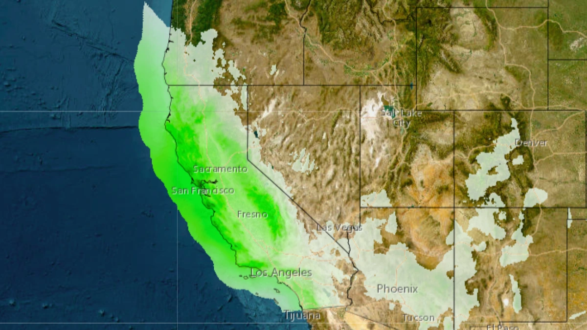
Precipitation forecast map for California until Thursday night, February 13, 2025. Image credit: NWS
California is bracing for another atmospheric river, with forecasts predicting heavy rain and potential flooding. Meteorologists warn that the incoming weather system could exacerbate existing flood risks in the region, particularly in areas already saturated from previous storms.
Residents are advised to stay informed and prepare for possible evacuations as the storm progresses.
The system is forecast to bring heavy rainfall across the state starting Tuesday night, February 11, and continuing through Friday, February 14. The heaviest rain is expected in southwestern California through Thursday, February 13.
San Luis Obispo and Santa Barbara counties have a 60% chance of receiving 50 – 100 mm (2 – 4 inches) of rain, with 100 – 200 mm (4 – 8 inches) expected in the mountains and foothills. Meanwhile, there is a 40% chance of 25 – 50 mm (1 – 2 inches) of rain and 50 – 100 mm (2 – 4 inches) in the mountains and foothills.
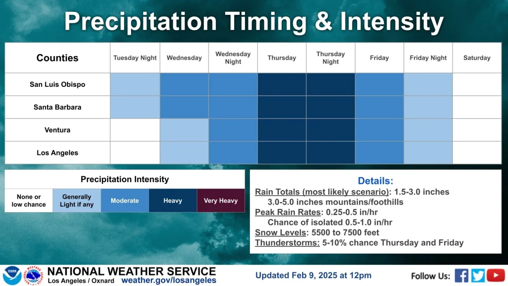
Ventura and Los Angeles counties have a 60% chance of receiving 25 – 50 mm (1 – 2 inches) of rain, with 50 – 100 mm (2 – 4 inches) expected in the mountains and foothills. There is also a 40% chance of 50 – 100 mm (2 – 4 inches) of rain, with 100 – 200 mm (4 – 8 inches) in the mountains and foothills.
The storm will bring colder temperatures to the region, prompting Freeze Warnings and a Frost Advisory for the Bay Area until 09:00 local time (LT). Areas under the Freeze Warning could experience temperatures below 0 °C (32 °F), while temperatures in other areas will range from 0.5 – 2.2 °C (33 – 36 °F).
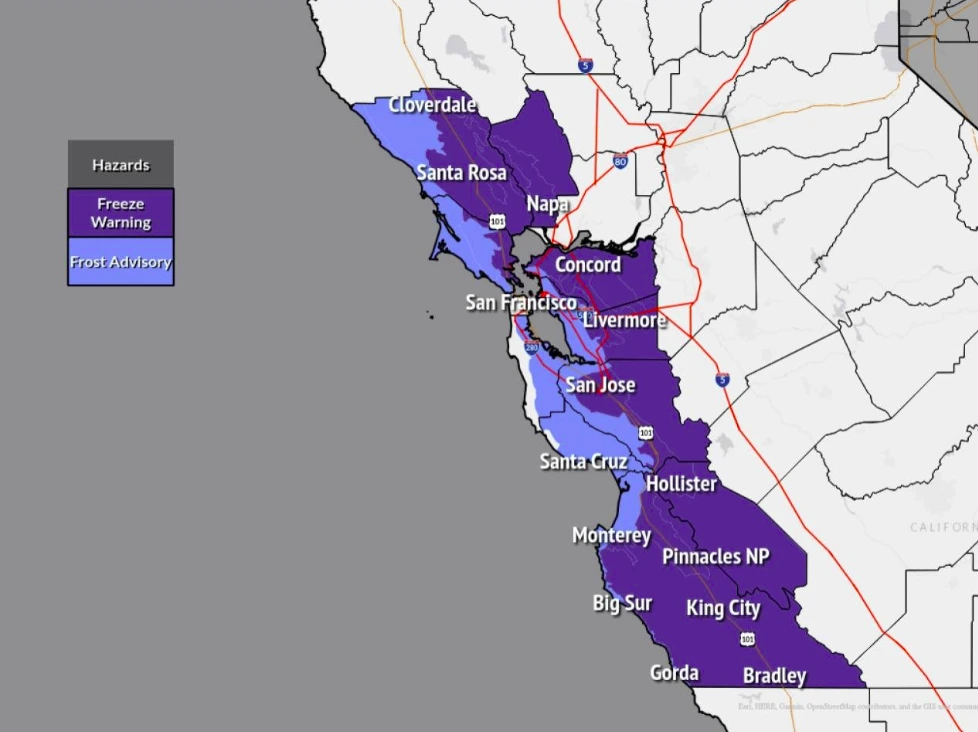
The cold is expected to affect most of the inland Bay Area and Central Coast, with similar conditions continuing each morning through Wednesday, February 12. The low temperatures may have significant impacts on people, pets, and plants. Residents are advised to protect pets and plants and cover outdoor pipes to prevent freezing.
1 Short Range Forecast Discussion – NWS – February 10, 2025

Rishav Kothari is Editor-in-Chief of The Watchers, where he runs the newsroom and covers earthquakes, volcanoes, severe weather and space weather.
Published in the last 24 hours
- High Risk of excessive rainfall covers Florida’s Space Coast as St. Johns River near Cocoa reaches 5.67 m
- People who stayed put through the 2017 hurricanes were more often the ones with flood insurance, a survey of 2,557 Gulf Coast residents found, and the authors suggest the policy may have made the storm feel less dangerous Epicenter
- Four small asteroids will pass close to Earth from November 21 to 23
- Cyclone Akvan weakens after landfall near Gopalpur; more than 300 000 evacuated in Odisha, India
