
Rare winter storm to impact Gulf Coast with heavy snow and disruptive ice
A rare winter storm is forecasted to bring heavy snow and disruptive ice accumulations as it moves from Texas eastward across the Gulf Coast states this week. The storm is expected to cause significant travel disruptions and potential power outages due to ice accumulation. Residents in the affected areas are advised to prepare for severe winter weather conditions.
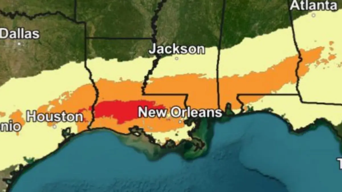
Image credit: NWS/SPC
A bitterly cold arctic airmass has overspread the interior western, central, and eastern U.S. following a strong cold front passage over the weekend.
In addition to the frigid temperatures, the combination of such cold air reaching the Gulf Coast and a developing low pressure system will lead to a rare, significant winter storm for the Gulf Coast States and Southeast, the National Weather Service (NWS) forecaster Putnam noted.
Impacts are expected to begin Monday evening, January 20, across eastern and southern Texas, spreading eastward along the Gulf Coast and through the Southeast through Tuesday and Wednesday, January 21 and 22.
Heavy snow is expected along and north of the Interstate 10 corridor with swaths of sleet and freezing rain over portions of southern Texas and southeast Georgia/northern Florida.
Major travel disruptions are likely and flight delays/cancellations are expected given that these areas are not accustomed to impactful Winter weather. Flight cancellations and delays are also expected.
Power outages in areas of significant snow and ice are possible, and will exacerbate impacts from the frigidly cold temperatures that will also be in place.
Widespread sub-freezing overnight lows are forecast along the Gulf Coast starting tonight and continuing through the rest of the week.
Several factors for the potential winter storm remain uncertain, and forecast changes are anticipated as the potential winter storm draws closer, NWS said.

References:
1 Short Range Forecast Discussion – NWS/WPC – Issued at 07:16 UTC on January 20, 2025

Teo Blašković founded The Watchers in 2011 and edited it until 2026, covering seismic and volcanic activity, extreme weather, space weather and near-Earth objects. Articles on this page are his archive.
Published in the last 24 hours
- High Risk of excessive rainfall covers Florida’s Space Coast as St. Johns River near Cocoa reaches 5.67 m
- Four small asteroids will pass close to Earth from November 21 to 23
- Cyclone Akvan weakens after landfall near Gopalpur; more than 300 000 evacuated in Odisha, India
- A broad low over southeastern Florida and the northwestern Bahamas has a 30 percent chance of subtropical or tropical development within 48 hours and a 50 percent chance within 7 days, the National Hurricane Center says
