
UK issues fresh Amber warning for snow, 2 fatalities reported
The UK Met Office has issued fresh Amber and Yellow National Severe Weather Warnings for snow and ice on January 8, 2025, as cold weather that already claimed 2 lives persists.
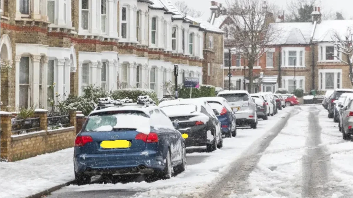
Image credit: Met Office
Amber and Yellow National Severe Weather Warnings have been issued for snow and ice across parts of the UK as cold weather continues to affect the region. An Amber warning for snow is in effect for southwestern England until 21:00 on January 8, 2025, while Yellow warnings cover parts of Scotland, Northern Ireland, and southern England.
The Amber warning predicts significant snowfall in parts of Devon, Cornwall, Dorset, and Somerset. According to the Met Office, areas above 150 m (490 feet) are expected to accumulate 2 – 5 cm (0.8 – 2 inches) of snow, while higher ground such as Dartmoor and Exmoor could receive up to 10 cm (4 inches). Lower elevations may experience only a light dusting. Disruptions to transportation networks, particularly during the evening rush hours, are anticipated.
Yellow warnings for snow and ice are in effect across parts of Scotland and Northern Ireland, potentially affecting travel. Southern England is also under a Yellow warning for snow, with lighter snowfall expected, though minor disruptions may still occur.
Low temperatures are forecast to continue through January 9 and 10, with additional snow and ice warnings expected. A northerly airflow will maintain freezing conditions, and temperatures could drop as low as -15 °C (5 °F) to -16 °C (3 °F) in areas with lying snow, particularly in Scotland and northern England.
Deputy Chief Forecaster Christoph Almond stated that a weather front arriving early Friday may bring additional snowfall to southern and western regions, with a risk of ice as it moves northeast. The extent of the snowfall, however, remains uncertain.
By Sunday, milder air is expected to spread across much of the UK. Rain will become more frequent, especially in Northern Ireland and western Scotland. Drier and more settled conditions are anticipated in the south and east. Overnight frost and fog may persist in some areas.
The Met Office advises the public to stay vigilant, monitor updates, and prepare for potential disruptions, especially in areas under Amber warnings.
The severe weather began with the UK Met Office first issuing Amber warnings for snow and ice on January 3 affecting large parts of England and Wales including East Midlands, North West England, West Midlands, Yorkshire, and Humber.
The warnings predicted heavy snow accumulations of 30 to 40 cm (12 to 16 inches) over high ground in the Pennines and Wales accompanied by freezing rain and severe ice hazards.
Freezing rain developed across Wales and parts of England causing treacherous travel conditions as the cold air collided with milder weather systems. Over the weekend, snow turned to rain in southern regions and led to widespread flooding as the snow began to thaw.
Over 15 weather warnings have been issued since the start of the month in total including 4 Amber alerts for snow and ice.
Unfortunately, at least 2 people died in the storm.
In North Yorkshire, a man’s body was recovered from floodwaters near Beal on January 6 with authorities believing he entered the water during the weekend.
In Lincolnshire, a 7-month-old baby was killed in a car crash on an icy stretch of the A1 near Grantham on January 5 with police suspecting that icy conditions contributed to the incident.
The Environment Agency has issued over 200 flood warnings and 300 flood alerts because of heavy rain and snowmelt inundating already saturated catchments.
The severe weather has caused disruptions to transport and infrastructure affecting airports and railways.
Manchester Airport temporarily closed its runways because of heavy snow on January 6 but operations resumed later the same day. Liverpool John Lennon Airport and Aberdeen International Airport faced similar closures because of icy conditions.
Railways experienced widespread disruptions with flooding and fallen trees blocking lines between Peterborough and Leicester Derby and Nottingham and various routes in Wales and northern England.
Major roads including the A1 in Lincolnshire and A66 in Cumbria have been closed because of flooding and stranded vehicles. The M25 in Surrey was shut after a lorry struck the central reservation and caused delays.
Emergency services across the country have been stretched thin as Leicestershire Fire and Rescue rescued 59 people from floodwaters and over 62 properties in Lincolnshire were flooded leading to evacuations in Stamford.
The coldest night of the winter was recorded on January 6 with temperatures dropping to -13.3 °C (8 °F) in Loch Glascarnoch Scotland while the Isles of Scilly experienced a milder 13.2 °C (55.8 °F).
The temperature extremes have worsened ice formation and localized flooding. Snow accumulation has also been notable with Bingley West Yorkshire recording 17 cm (6.7 inches) by January 5 and Shap Cumbria measuring 10 cm (4 inches).
Flood risks remain critical as heavy rain combines with snowmelt. The Environment Agency has warned of “danger to life” flood conditions in Leicestershire affecting the River Soar near Barrow upon Soar.
Over 300 properties have been inundated since New Year’s Eve while 41 000 properties were protected by measures.
“The recent heavy rain combined with melting snow means it is probable significant river flooding will continue in Leicestershire today, with minor river flooding probable in some other parts of the country, continuing through to Thursday for some larger rivers,” Stefan Laeger, Flood Duty Manager explained.

Amber cold weather alerts from the UK Health Security Agency are still active across England showing increased health risks for vulnerable populations.
Public health officials recommend keeping homes heated to 18°C and avoiding travel during icy conditions. Authorities have advised people to avoid flooded roads and paths and to carry winter kits with blankets, food, and water when traveling.
“Temperatures will remain below average, with widespread frost and the threat of ice at times. Some areas, especially in the north, may struggle to get above freezing for several days,” Mike Silverstone, Deputy Chief Forecaster stated.
Further snow and ice warnings are likely for southern and central England with up to 30 cm (12 inches) of snowfall possible in upland areas by midweek.
References:
1 Amber warning for snow issued – Met Office – January 8, 2025
2 Snow and ice warnings for a cold week ahead – Met Office – January 7, 2025
3 Man’s body found in floods as major incidents declared – The Times – January 6, 2025
4 UK braces for blizzards with amber warnings in place as mercury plunges to -5C after baby killed in crash on icy road – THE IRISH SUN – January 4, 2025

Rishika holds a Master’s in International Studies from Stella Maris College, Chennai, India, where she earned a gold medal, and an MCA from the University of Mysore, Karnataka, India. Previously, she served as a Research Assistant at the National Institute of Advanced Studies, Indian Institute of Science, Bengaluru, India. During her tenure, she contributed as a Junior Writer for Europe Monitor on the Global Politics website and as an Assistant Editor for The World This Week. Her work has also been published in The Hindu newspaper, showing her expertise in global affairs. Rishika is also a recipient of the Women Empowerment Award at the district level in Haryana, India, in 2022.
Commenting rules and guidelines
We value the thoughts and opinions of our readers and welcome healthy discussions on our website. In order to maintain a respectful and positive community, we ask that all commenters follow these rules.