
Multiday lake-effect snow to blanket parts of New York and Pennsylvania with heavy snow
A powerful multiday lake-effect snow event is set to blanket parts of New York and Pennsylvania, with areas downwind of Lake Ontario and Lake Erie expected to receive up to 90 cm (3 feet) of snow by Sunday, January 5, 2025 creating hazardous conditions across several regions.
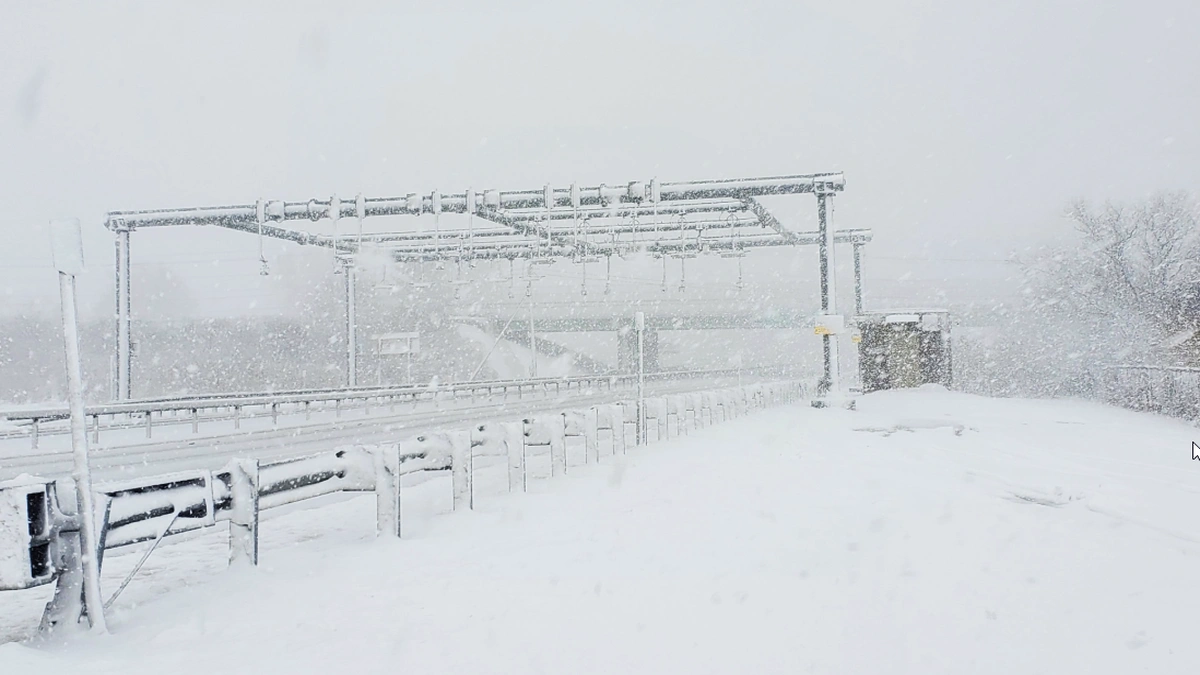
Image credit: New York State Thruway Authority
A multiday lake-effect snowstorm is expected to bring significant snowfall across New York. Areas downwind of Lake Ontario and Lake Erie in Upstate New York and northwestern Pennsylvania could receive several feet of snow due to the event, lasting through Sunday, January 5.
Syracuse and Utica, along with northern and eastern portions of New York, has already experienced snowfall starting Thursday, January 2.
Arctic air moving in from Canada could bring 7.5 to 90 cm (3 inches to 3 feet) of snow to parts of central and western New York through the weekend. Communities on the Tug Hill Plateau, east of Lake Ontario, are expected to see 60 – 90 cm (2 – 3 feet) of snow by Sunday.
“The most intense portion of this event is expected to occur between Thursday night and Friday morning, January 3, off Lake Ontario into central Oswego and southern Lewis counties. Intensity will vary off Lake Erie before increasing again on Friday,” said the National Weather Service (NWS) Buffalo office.
Several Winter Storm Warnings, Winter Weather Advisories, and Lake-Effect Snow Warnings have been issued for areas along Lake Ontario and Lake Erie.
The Lake-Effect Snow Warnings extend from Ohio to New York, including Cleveland in Ohio, Erie in Pennsylvania, as well as Syracuse and Watertown in New York. Warnings have also been issued for Oneida, Madison, and Onondaga counties through Sunday.
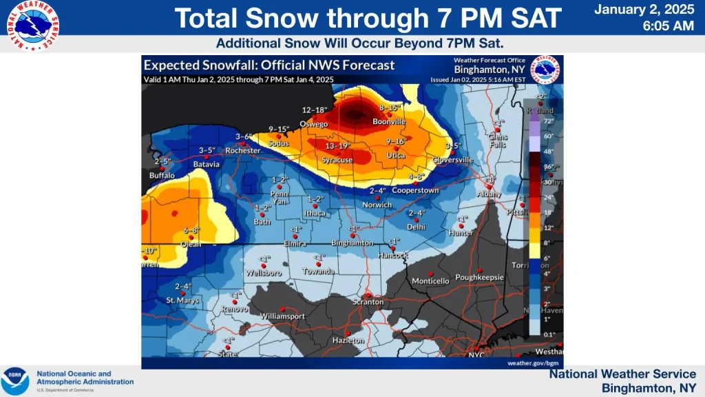
Significant snowfall totals are expected from Thursday through Friday, with areas such as Syracuse, Oswego, and Boonville likely receiving 30 – 48 cm (12 – 19 inches) of snow. Localized totals may exceed 90 cm (36 inches) in areas such as Florence.
Bands of snow could lead to reduced visibility and slippery conditions, creating dangerous travel conditions in many areas.
References:
1 Multiday lake-effect snow event could bury parts of New York in up to 3 feet through weekend – Fox Weather – January 2, 2024
2 Hazardous Weather Outlook – NWS – January 2, 2024

I am an Assistant Editor and Severe Weather & Science Journalist at The Watchers, specializing in real-time severe weather coverage, geophysical event reporting, and research-driven scientific analysis. You can reach me at rishav(at)watchers(.)news.
Sounds about right for Central NY. Shovel the driveway, and one hour later, shovel it again, and again, and again. Been there, done that.. don’t miss it at all. Its a blast after the Town snow plow dumps 2 feet at the end of your driveway. I bet many heart attacks the next few days unfortunetly.