
Multiple atmospheric rivers set to impact U.S. West Coast this week
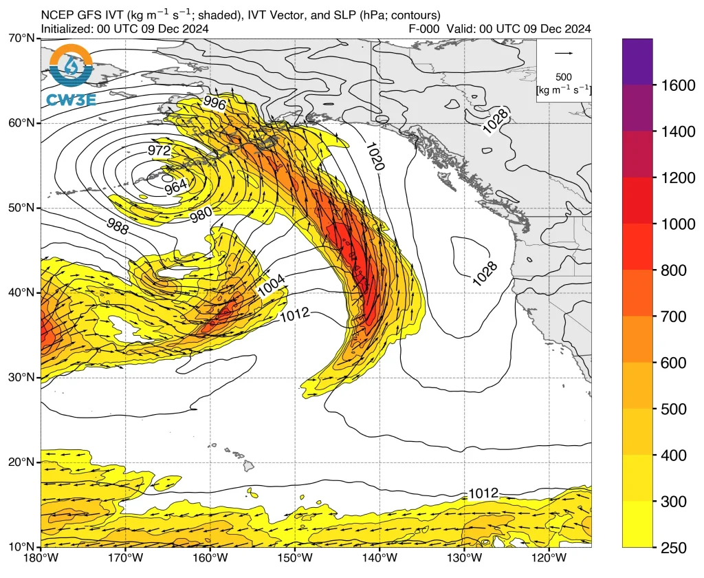
A series of atmospheric rivers (ARs) and mid-level shortwave troughs are forecast to deliver significant precipitation to the United States West Coast starting mid-week, potentially extending into next week. Forecasts indicate that California, Oregon, and Washington will experience varying levels of rainfall intensity, with Northern California likely at the epicenter of the heaviest activity. The first AR in the series is expected to reach California on Wednesday, December 11, 2024.
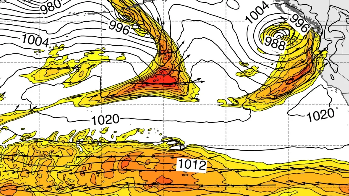
Image credit: CW3E
- A series of atmospheric rivers (ARs) are forecast to impact the U.S. West Coast, beginning mid-week and potentially continuing into next week. These events will vary in intensity and precipitation, with Northern California, Oregon, and Washington likely to experience significant rainfall.
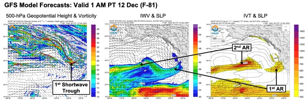
- The first AR is expected to reach California late Wednesday, December 11, into Thursday, December 12. This system will produce weak AR conditions, with limited rainfall and integrated water vapor transport (IVT) values below 500 kg/m-1/s-1.
- A second, more impactful AR is forecast to make landfall in Northern California between Friday, December 13, and Saturday, December 14. This event could bring moderate to strong AR conditions, although there is uncertainty surrounding its exact timing, location, and intensity.
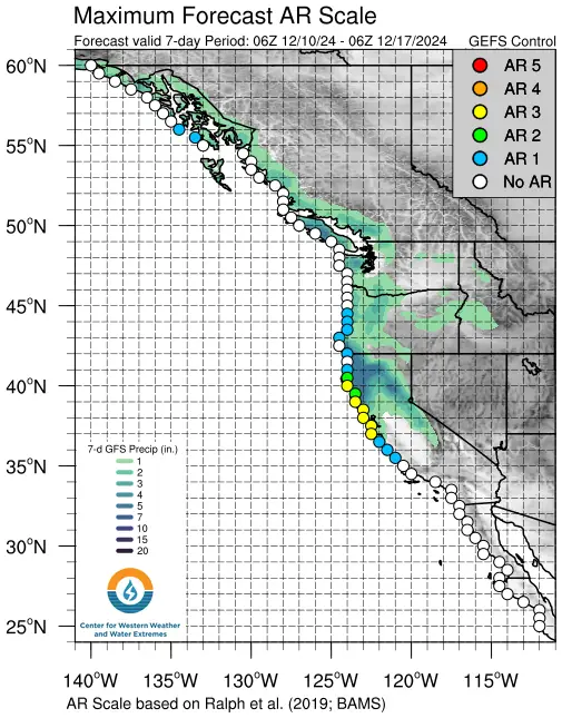
- The National Blend of Models (NBM) predicts 50 – 125 mm (2 – 5 inches) of total precipitation in parts of Northern California, western Oregon, and western Washington over the next seven days. Some models suggest even higher rainfall totals over the next 10 days.
A dynamic weather pattern is forming over the United States West Coast, characterized by a series of atmospheric rivers (ARs) and mid-level shortwave troughs. Significant precipitation is expected to begin mid-week and could extend into the following week, potentially impacting California, Oregon, and Washington with varying intensities.
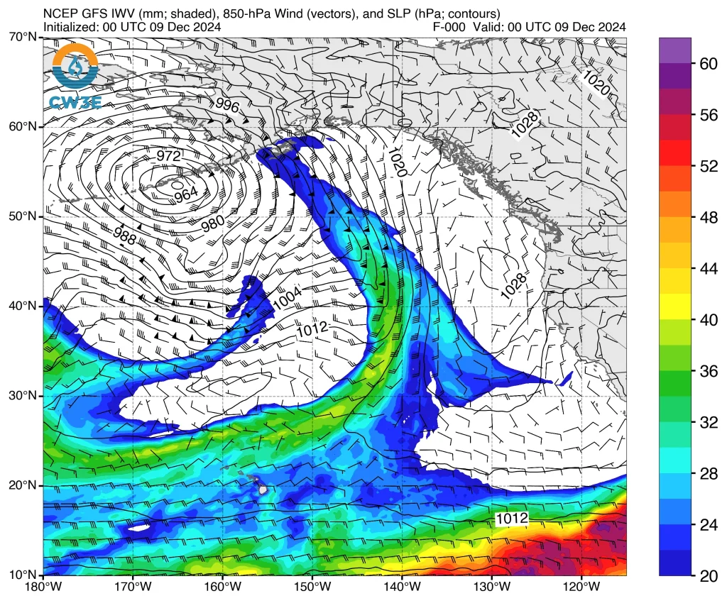
The first AR in this series is projected to reach California late on Wednesday and continue into Thursday, December 12. Forecasts predict weak AR conditions, with integrated water vapor transport (IVT) values below 500 kg/m-1/s-1. Rainfall from this event is expected to be limited in both scope and intensity.
A second, stronger AR is expected to make landfall in Northern California between Friday, December 13, and Saturday, December 14.
Forecasts indicate this system may bring more significant weather impacts, though the exact timing, location, and intensity of AR conditions remain uncertain. Models suggest the possibility of moderate to strong AR conditions in some areas.
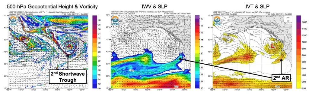
Deterministic and ensemble models, including the 00Z GEFS and EPS control members, indicate that this AR might be classified as an AR 2 on the Ralph et al. 2019 AR Scale. Coastal Northern California is expected to be the focal point of this forecast activity.
A third AR is expected to develop behind the second AR, potentially making landfall over the Pacific Northwest early next week downstream of a shortwave trough.
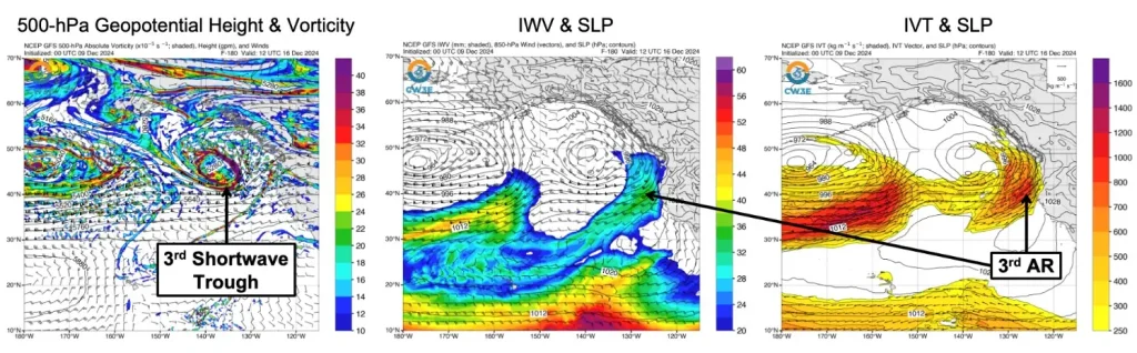
Models suggest continued AR activity along the West Coast into the following week. The evolving dynamics of these systems and their interactions with mid-level troughs contribute to forecast uncertainty, requiring close monitoring as further details emerge.
The 12Z National Blend of Models (NBM) forecasts 50 – 125 mm (2 – 5 inches) of total precipitation in parts of Northern California, western Oregon, and western Washington over the next seven days. GEFS models suggest higher precipitation totals for the region over the next 10 days compared to EPS.
References:
1 CW3E AR Update: 9 December 2024 Outlook – CW3E – December 9, 2024

I am an Assistant Editor and Severe Weather & Science Journalist at The Watchers, specializing in real-time severe weather coverage, geophysical event reporting, and research-driven scientific analysis. You can reach me at rishav(at)watchers(.)news.
Normal winter weather.