
Long duration heavy snow in Southern Rockies and High Plains as winter storm intensifies, U.S.
The National Weather Service (NWS) has issued warnings for a prolonged snowfall event impacting the southern Rockies starting on Wednesday, November 6, 2024, as an upper-level low brings cold air and snow to high elevations in northern New Mexico and southern Colorado. Areas along the Colorado-New Mexico border could see several feet of snow.
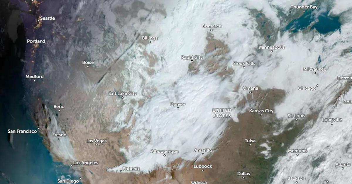
Satellite image of the winter storm over the southern Rockies. NOAA/GOES-East, Zoom Earth, The Watchers. Acquired at 15:50 UTC on November 6, 2024
A winter storm is developing across the southern Rockies. A vigorous upper-level low has deepened and is moving south toward the Four Corners region as of Wednesday morning.
The upper-level low is drawing in a surge of polar air into the region and developing a band of snow over the central Rockies and into the central High Plains. Snowfall is expected to intensify and expand in coverage through Wednesday.
Snow is expected to persist from the central to southern Rockies and into the nearby High Plains, primarily across New Mexico and Colorado, due to the compact and vigorous upper-level low.
“There is increasing potential for a long-duration heavy snowfall event to impact the high elevations of northern New Mexico and southern Colorado this week. Additionally, heavy snow is possible in the adjacent High Plains. Be sure to plan ahead and prepare for winter driving conditions,” said the National Weather Service (NWS).
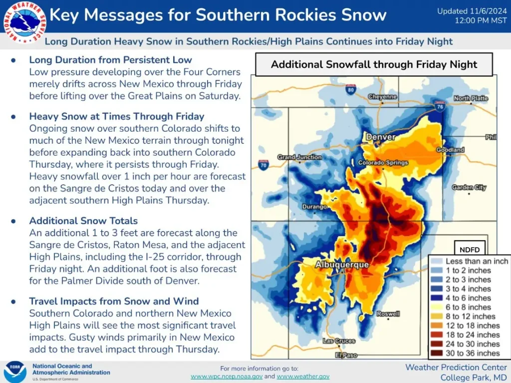
Low pressure developing over the Four Corners will merely drift across New Mexico through Friday before lifting over the Great Plains on Saturday, November 9, the NWS Weather Prediction Center (WPC) said on Wednesday.
Ongoing snow over southern Colorado will shift to much of the New Mexico terrain through tonight before expanding back into southern Colorado Thursday, where it is forecast to persist through Friday. Heavy snowfall over 2.5 cm (1 inch) per hour is forecast on the Sangre de Cristos today and over the adjacent southern High Plains Thursday.
An additional 30 to 60 cm (1 to 3 feet) are forecast along the Sangre de Cristos, Raton Mesa, and the adjacent High Plains, including the 1-25 corridor, through Friday night. An additional 30 cm (1 foot) is also forecast for the Palmer Divide south of Denver.
Southern Colorado and northern New Mexico High Plains will see the most significant travel impacts. Gusty winds primarily in New Mexico add to the travel impact through Thursday.
References:
1 Short Range Forecast Discussion – NWS – Issued at 08:00 UTC on November 6, 2024

I am an Assistant Editor and Severe Weather & Science Journalist at The Watchers, specializing in real-time severe weather coverage, geophysical event reporting, and research-driven scientific analysis. You can reach me at rishav(at)watchers(.)news.
Commenting rules and guidelines
We value the thoughts and opinions of our readers and welcome healthy discussions on our website. In order to maintain a respectful and positive community, we ask that all commenters follow these rules.