
Shallow M6.2 earthquake hits northern Sumatra, Indonesia

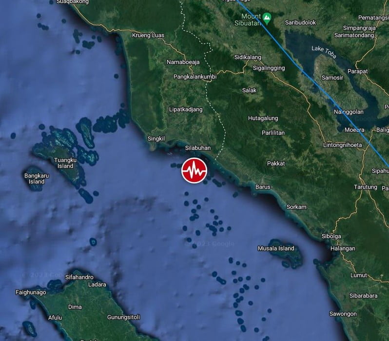
Image credit: TW/SAM, Google
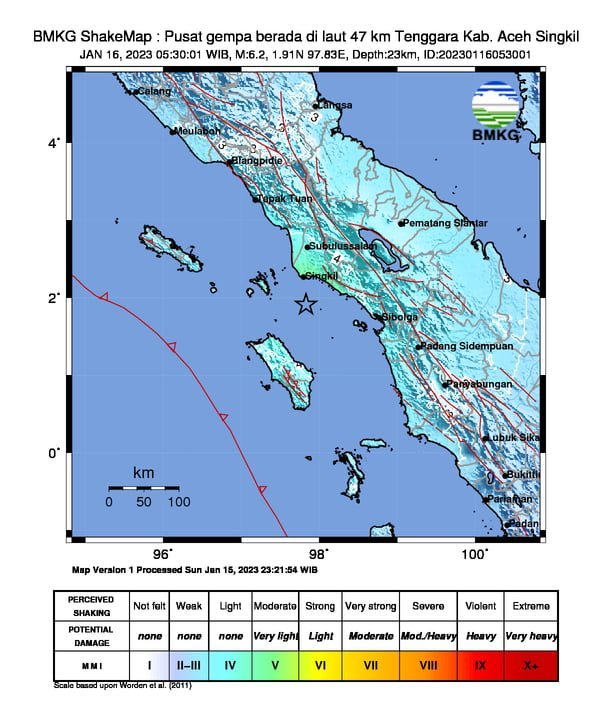
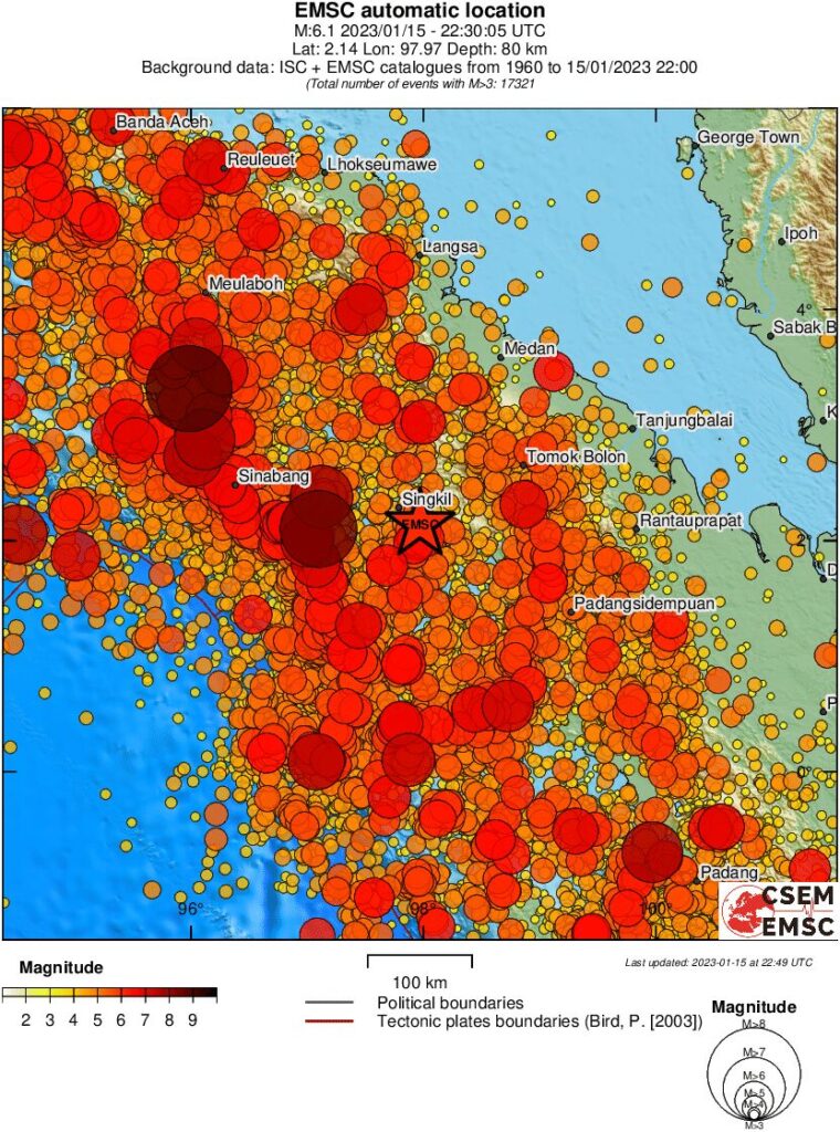
A strong and shallow earthquake registered by the BMKG and USGS as M6.2 hit northern Sumatra, Indonesia at 22:29 UTC on January 15, 2023 (05:30 LT, January 16). BMKG is reporting a depth of 23 km (14.3 miles) and USGS 37 km (23 miles).
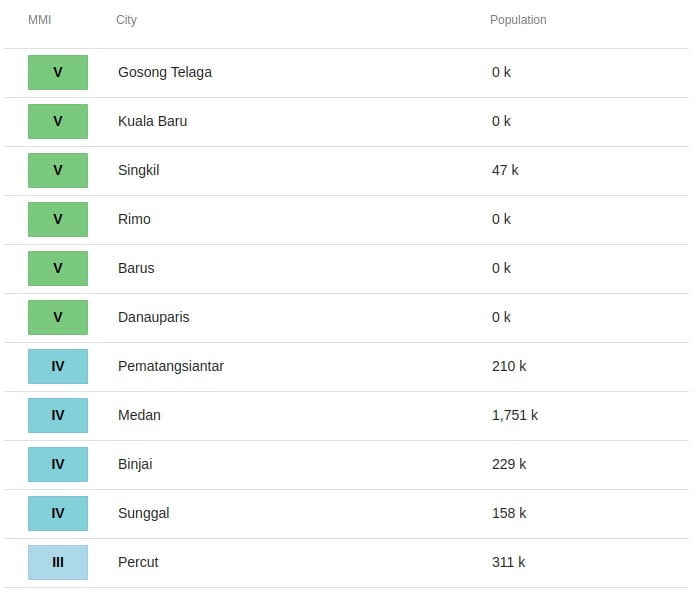
The epicenter was located 40.3 km (25 miles) SE of Singkil, Aceh (population 46 800) and 90.3 km (56.1 miles) WNW of Sibolga (population 79 714), North Sumatra, Indonesia.
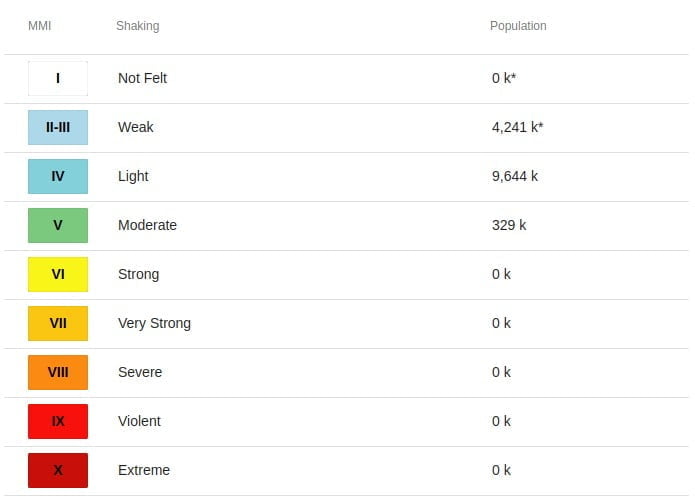
329 000 people are estimated to have felt moderate shaking and 9 644 000 light.
Taking into account the location of the epicenter and the depth of the hypocenter, the earthquake that occurred was a type of shallow earthquake due to the subduction activity of the Indo-Australian plate which dived under the Eurasian plate. The results of the analysis of the source mechanism indicate that the earthquake has an oblique thrust mechanism, BMKG said.
This earthquake had an impact and was felt in the Aceh Singkil and Gunung Sitoli areas with an intensity scale of IV MMI (if it was felt by many people in the house), Subulussalam area, South Aceh with an intensity scale of III – IV MMI (if it was felt by people during the day many in the house), and the Padang Sidempuan area with an intensity scale of II – III MMI (Vibration felt by several people, light objects that were hung swayed).
The modeling results show that it does not have the potential for a tsunami.
The USGS issued a Green alert for shaking-related fatalities and economic losses. There is a low likelihood of casualties and damage.
Overall, the population in this region resides in structures that are vulnerable to earthquake shaking, though resistant structures exist. The predominant vulnerable building types are unreinforced brick with concrete floor and precast concrete frame with wall construction.
Recent earthquakes in this area have caused secondary hazards such as landslides that might have contributed to losses.
Estimated population exposure to earthquake shaking
Selected cities exposed
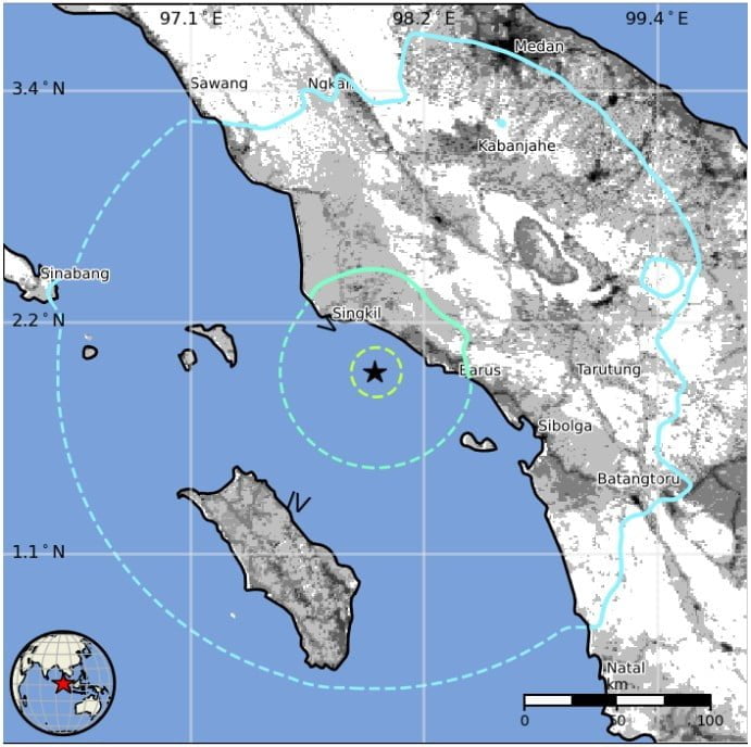
Regional seismicity
I'm a dedicated researcher, journalist, and editor at The Watchers. With over 20 years of experience in the media industry, I specialize in hard science news, focusing on extreme weather, seismic and volcanic activity, space weather, and astronomy, including near-Earth objects and planetary defense strategies. You can reach me at teo /at/ watchers.news.
Commenting rules and guidelines
We value the thoughts and opinions of our readers and welcome healthy discussions on our website. In order to maintain a respectful and positive community, we ask that all commenters follow these rules.