
Paralyzing lake effect snow to impact Great Lakes late this week, U.S.
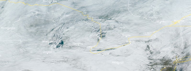
Image credit: NOAA/GOES-East, RAMMB/CIRA, The Watchers. Acquired at 17:20 UTC on November 16, 2022
Periods of heavy lake effect snow will impact the Great Lakes through Sunday, November 20, 2022. Snowfall rates of 50+ mm (2 inches) per hour are expected, creating nearly impossible travel. Between 30 and 60 cm (1 and 2 feet) of snow, with local amounts in excess of 120 cm (4 feet), are likely.
- As a result of the potentially paralyzing event, Lake Effect Snow Warnings are in effect downwind of Lakes Erie and Ontario, as areas within these snow bands will experience visibility dropping to near zero at times and covered roadways that will make travel extremely hazardous, if not impossible
- A Canadian cold front will usher in unseasonably cool temperatures across much of the U.S. later this week and weekend
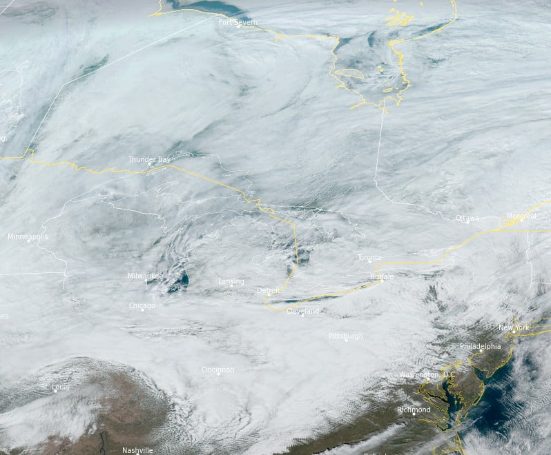
On the heels of a potent coastal low that produced widespread precipitation across the Mid-Atlantic and Northeast, a significant lake effect snow event is taking shape downwind of Lakes Erie and Ontario.1
Late Thursday evening, November 17, more organized and near-stationary bands of snow will develop downwind of the lakes, persisting through the weekend and dumping several feet of snow in areas where the band lingers the longest.
Due to the localized nature of this event, total snowfall accumulations will be highly dependent on where snow bands develop and could shift significantly with changes in wind direction.
East of Lakes Erie and Ontario, snowfall will at times be accompanied by lightning, thunder, gusty winds, and rates of 75 mm (3 inches) per hour. This will produce near-zero visibility, snow-covered roadways, scattered damage to infrastructure, and potentially paralyze the hardest-hit communities.2
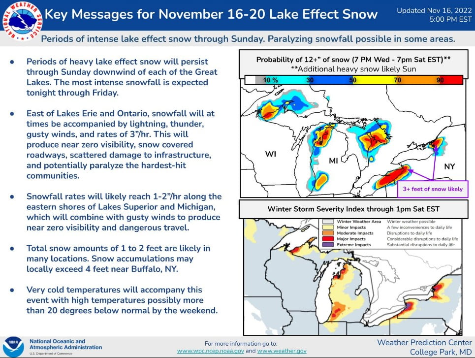
Snowfall rates will likely reach 25 – 50 mm (1 – 2 inches) per hour along the eastern shores of Lakes Superior and Michigan, which will combine with gusty winds to produce near-zero visibility and dangerous travel.
Total snow amounts to 30 – 60 cm (1 – 2 feet) are likely in many locations.
While the heaviest accumulations will remain highly localized, current forecasts suggest the Buffalo, NY metropolitan area will receive the most intense and prolonged snowfall, while a more broad area of 150 to 300 mm (6 – 12 inches) will encompass locations east and southeast of the Lakes Erie and Ontario.
Very cold temperatures will accompany this event with high temperatures possibly more than 20 °F (11 °C) below normal by the weekend.
References:
1 Short Range Forecast Discussion – NWS Weather Prediction Center College Park MD – 238 AM EST Thu Nov 17 2022
2 Paralyzing Lake Effect Snow possible late this week – NOAA NWS Weather Prediction Center – November 17, 2022
I'm a dedicated researcher, journalist, and editor at The Watchers. With over 20 years of experience in the media industry, I specialize in hard science news, focusing on extreme weather, seismic and volcanic activity, space weather, and astronomy, including near-Earth objects and planetary defense strategies. You can reach me at teo /at/ watchers.news.
Commenting rules and guidelines
We value the thoughts and opinions of our readers and welcome healthy discussions on our website. In order to maintain a respectful and positive community, we ask that all commenters follow these rules.